Pinch yourself, Houston. It’s July. It’s the beginning of the very hottest time of the year. And remarkably, it’s going to feel somewhat dry outside.
A bonafide front pushed through the region during the overnight hours, and into the Gulf of Mexico. Now we aren’t going to see significant cooling during the daytime with this front—the ground is just too warm, the sun is too high in the sky for too long, and there just isn’t that cool of an air mass over the southern United States during the middle of summer. But what we will see is a northerly flow and significantly drier air. You’ll begin to feel this tonight, and it will be pretty amazing for this time of year.
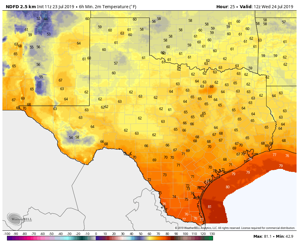
Low temperatures on Wednesday morning for Texas will be something else for July. (Weather Bell)
Tuesday
The front blew through with only scattered showers. The high-resolution models had been trending drier, and the bulk of the storm activity remained offshore. The same models are indicating we may see some brief redevelopment this morning between Interstate 10 and the coast, but after that the atmosphere should really begin to dry out. Highs today will be around 90 degrees with partly to mostly cloudy skies. Skies will clear later today or this evening, and lows should get down to around 70 for most of Houston.
Houston’s weather pattern will turn more interesting this week, and not in a bad way as a bonafide cold front moves into the region. This won’t be a prototypical fall front, there’s just not enough cold air available to work with, but it will be noticeable as some significantly drier air moves in. Areas on the inland side of Interstate 69, especially, may see dewpoints in the low- to mid-50s later this week. This will offer a rare, if short-lived reprieve from the kind of humidity we’re normally accustomed to during the summer months in Houston.
If dewpoints are an unfamiliar concept, they offer an indicator of total moisture in the air. The past several mornings, when you’ve walked outside and been smacked in the face by high humidity, the dewpoint has generally been in the mid-70s for Houston. That’s typical for July. Anything from 60 or lower will be completely noticeable, especially during the evening and morning hours. Roughly, for Houston, here’s what various dewpoints mean:
70s means uncomfortable, or typical summer
60s means humid, but not terrible
50s means mostly comfortable
40s or less means very comfortable or dry
Monday
Today will be a lot like Sunday, with partly to mostly cloudy skies, and highs in the mid-90s. There’s enough moisture that we should again see the development of showers and thunderstorms along the sea breeze that moves inland late this morning and the afternoon hours. Rain chances are probably in the 40 percent range, meaning showers will be very much hit or miss.
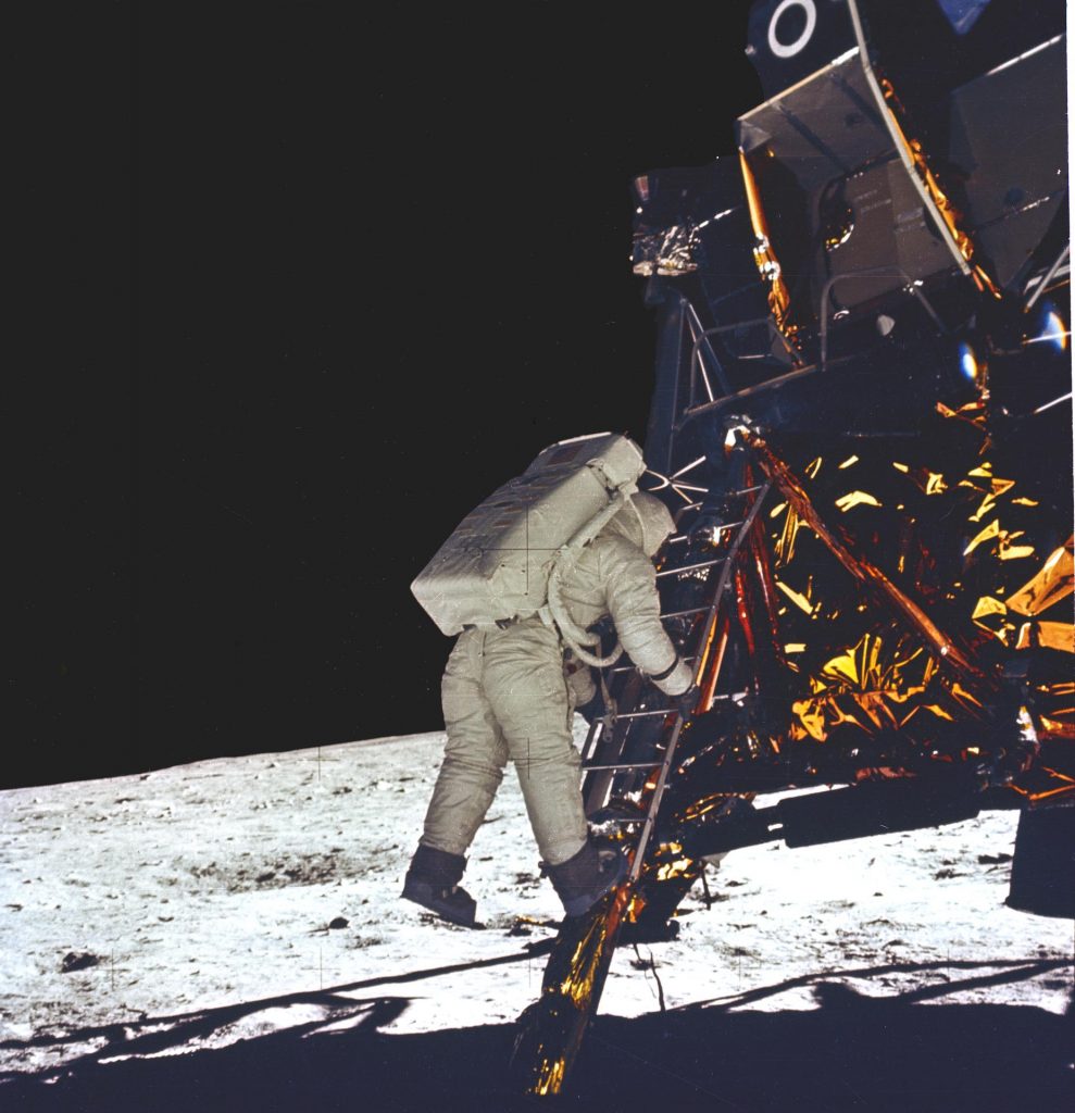
I thought it might be interesting to look back at Houston’s weather during the Moon landing, in 1969. This was a Sunday, so a lot of people would have been off from work, with not a whole lot going on during the afternoon or evening hours. The Eagle’s touchdown—”Houston, the Eagle has landed”—came at 3:17pm local time. After checkouts, preparations, and getting suited up, Neil Armstrong stepped on to the lunar surface at 9:56pm. Buzz Aldrin soon followed.
Weather conditions in Houston that day were rather blah compared to what was happening in space. For the most part, for much of the region, it was a gray day, with fog in the morning, and some scattered, light drizzle. Highs for most of Houston only reached into the upper 80s, with clouds keeping more typical summertime heat at bay. The humidity, of course, was typically Houston high. If you have memories of that day’s weather, please share them in the comments below.
The weather would have been rather unremarkable, and not particularly memorable, because most people experienced the Moon landings in their homes, in front of a television set or listening to the radio. If one had stepped outside to check the sky after Neil and Buzz walked on lunar surface, the Moon would have been visible near the western horizon, if skies were clear enough. Which for most of Houston, they weren’t.
In this photograph, Buzz Aldrin takes his first step onto the surface of the Moon.
Among the many things I find so intriguing about the Apollo Program is that it produced one of the rare moments in history when everyone can recall where he or she was when it happened—and it wasn’t a tragedy. Think about most of the other “Where were you when?” moments. JFK’s assassination. The Twin Towers falling during the Sept. 11 attacks. The space shuttle Challenger and Columbia accidents. For most of the country these were tragic moments. The Moon landing, rather, united this country and the world to celebrate what humans can achieve when we set aside our differences and work together.
By the way, if you’re heading out to the big Apollo 50th event at Space Center Houston today or this evening, it will be partly sunny and hot, with high temperatures in the mid-90s. We may see a very few scattered showers pop up this afternoon, but those should be long gone by the time the concerts begin at the lunar celebration.
Speaking of that event, Reliant is also a sponsor of that celebration. Here’s a quick message from them:
What a great time to be from Houston as we celebrate the innovation, teamwork and drive that made the first steps on the moon possible. We are proud to be the Official Countdown sponsor at the “Apollo 11 50th Live” festival where we will mark the exact moment Neil Armstrong set foot on the moon. The event will feature fun family activities, food and live music from the band Walk the Moon. If you attend, stop by the Reliant booth for some fun giveaways, including LED bracelets for the first 15,000 through the gate that synchronize to different exhibits, the concert and the countdown.
We are firmly entrenched in a July or even August-type weather pattern with strong heat, high humidity. For those of us who wear glasses, this week has been a bit challenging in the morning when walking outside, as it’s like walking into a fog machine. We are going to start to see some changes, however, and they should begin slowly this weekend.
Today
We expect that Friday will be similar to Thursday. Watch for perhaps a couple showers along the sea breeze in the afternoon. Otherwise, today will be just sunny and hot today, with high temperatures back into the mid-90s. For once though, it might actually feel “nicer” in Houston than in much of the Northeast and Midwest the next few days.
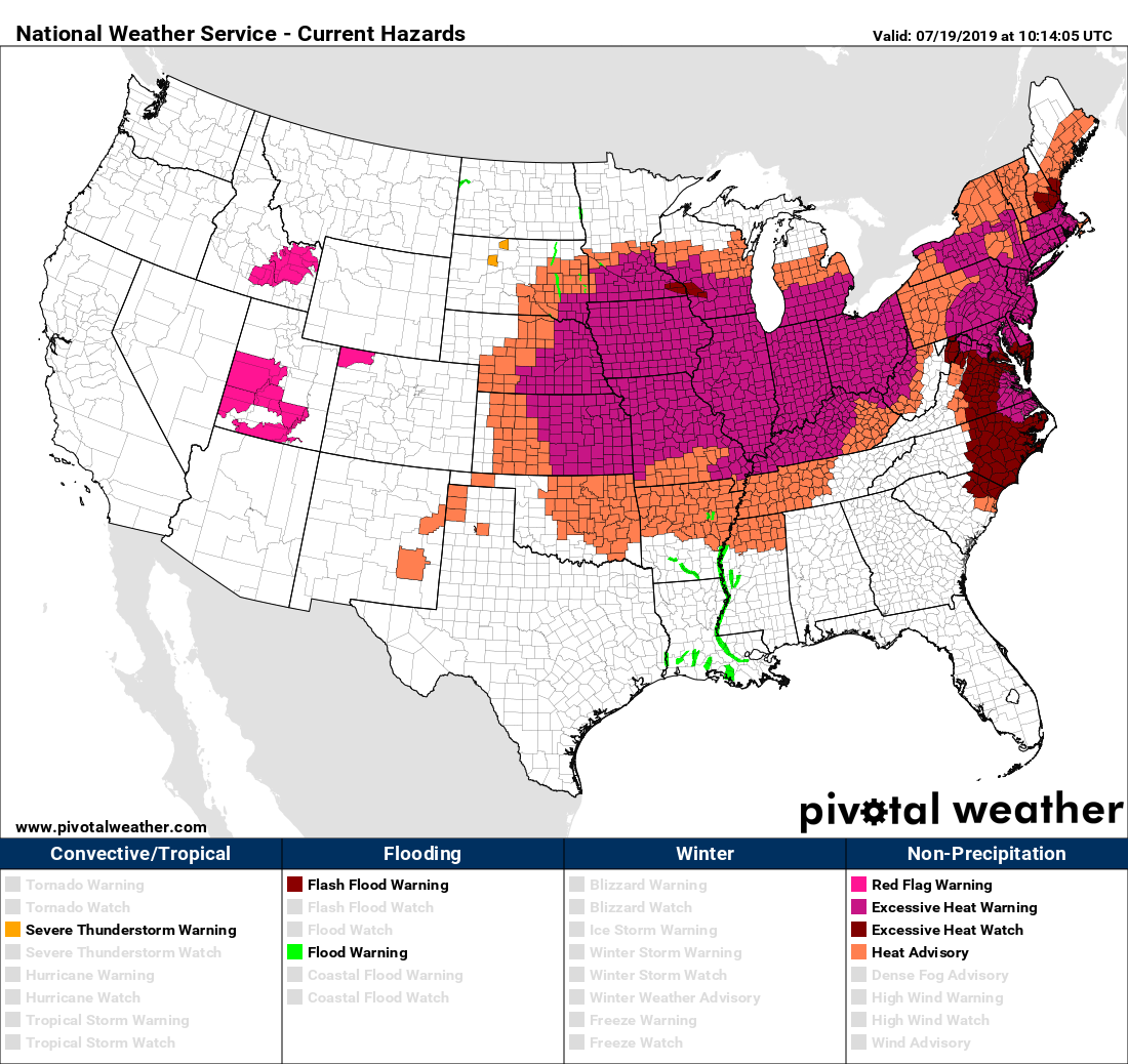
A rather large swath of the country is under Excessive Heat Warnings or Heat Advisories today and for parts of this weekend. Houston sees standard summer heat. (Pivotal Weather)
So we’ve got that going for us, which is nice.
Saturday & Sunday
While tomorrow and Sunday should be fairly similar to recent days, I do think we will have a very slightly better chance at seeing a few showers in parts of the area on both afternoons along the sea breeze. The slightly higher chance is probably on Sunday. After starting both days in the upper-70s, we will head into the low- or mid-90s during the afternoons. Have an umbrella handy to be safe, but your outdoor plans should be mostly fine I think this weekend.
Monday
A weak disturbance riding along the northern Gulf Coast from east to west will arrive in Houston Monday, likely boosting our odds for a few showers and storms just a little more to start next week. The best way I can characterize rain chances on Monday would be that if the weekend has about 20 percent chance, then Monday is probably about a 30 percent chance. We will warm from upper 70s to lower or middle 90s Monday afternoon again.