Good morning. Our weather remains one of a battle between cool fronts and the onshore flow, and as a result we’ll see intermittent periods of nice weather broken by the possibility of storms.
Thursday
It’s a bit chilly across the Houston area this morning, with most of the region having fallen into the 50s. However, winds are swinging back around to the southeast, and this will allow moisture levels to creep back up today. Although skies should remain partly sunny, some light, scattered showers may move into Houston from the southwest later this afternoon. Highs should remain pleasant, in the low 70s. Overnight temperatures tonight should be about 10 degrees warmer with the renewed onshore flow.
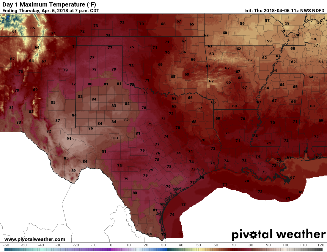
Highs Thursday will be seasonal for much of the southern United States. (Pivotal Weather)
Friday and Saturday
A warmer, muggier day with high temperatures probably reaching about 80 degrees. Rain chances, and later thunderstorm chances, will be on the rise during the afternoon and evening hours as a cold front approaches the area. However, a fairly strong capping inversion should set up over the area, and this may limit any precipitation until after the front moves into the region.
Some severe thunderstorms rumbled through Houston during the overnight hours, bringing some scattered reports of hail and damaging winds (a private airplane hangar was damaged at Hobby Airport). While the light show was impressive, rain totals were modest, with most of the region getting 0.25 to 1.0 inch of rainfall. In the wake of Tuesday night’s front we’re left with gusty winds, reaching the low 30mph in some locations this morning.
Wednesday
Skies today will be clearing out, leaving us with lots of sunshine later today. Temperatures will hold steady at about 70 degrees, however, and winds will remain brisk out of the north. Skies tonight will be mostly clear, with temperatures generally in the 50s—cooler to the north of the city and warmer to the south.
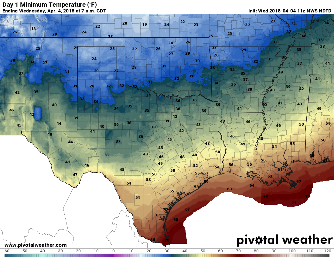
Expect moderately chilly temperatures on Thursday morning. (Pivotal Weather)
Thursday
A nice day, with partly to mostly sunny skies, and highs in the 70s. As winds shift around to come out of the southeast, moisture levels will rise some, and we can’t entirely rule out of a few brief, scattered showers later in the day. For the most part, however, this should be a pretty nice day.
We’re definitely in the midst of spring storm season. After an active night last week, we have the potential for more storms this evening, and perhaps again this weekend. So it goes in spring, along the warming Gulf of Mexico coast.
Tuesday
We’ll see another warm, mostly cloudy day with highs reaching into the low 80s. Although there is the potential for some scattered showers across the region, the heavier storms are probably going to hold off until the late afternoon or evening hours. A cold front, and an associated area of disturbed weather should move into the Brazos Valley during the afternoon hours, and probably will move into Houston sometime after 7pm. The entire system should move off the coast by around midnight.
Rain accumulations for most of the city should average between 0.5 and 1.5 inches. The primary concern, therefore, is that some of these storms could be severe, with damaging winds or hail. If you’re out and about this evening, such as coming home from the Astros baseball game, this storm could catch you out. Take care.
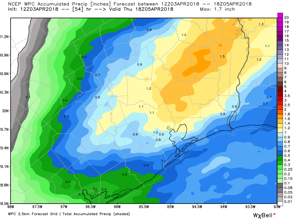
Rainfall accumulations on Tuesday evening shouldn’t cause any significant problems. (NOAA)
Wednesday
Sunny and significantly cooler and drier in the wake of Tuesday night’s cold front. Highs in the low 70s, with a noticeable wind out of the north. Temperatures on Wednesday night should fall into the upper 40s for the northern half of Houston, while remaining in the 50s for areas closer to the coast.
Houston has had some nice, chilly nights in March, but I think we all realize that summer is coming. Long, hot days. Shorter, humid nights. As y’all know, Reliant has sponsored our site for this year, and for their electricity customers they’re offering a free energy assessment ahead of the dog days of summer.
As part of this online “Home Energy Snapshot,” you’ll get personalized advice on how to make your home more efficient. Benefit from energy savings that you may not be aware are possible prior to an energy checkup. With your home energy snapshot, you’ll receive the following information:
A report of your home’s average electricity usage over the last year
A Home Efficiency Rating, based on comparisons with similar homes
Tips to improve your home’s energy efficiency
A baseline to measure your home’s efficiency progress
A Reliant Home Energy consultant discusses the Home Energy Snapshot. (Reliant)
In-Home Consultation
If your Home Efficiency Rating indicates inefficiencies in electricity use, Reliant may recommend scheduling an In-Home Consultation. At your request, a Reliant Home Energy Consultant will visit your home for free, review your Home Energy Snapshot with you and thoroughly examine your home. The goal is to identify any issues that need to be addressed and provide vital statistics on your home’s major systems. Before the consultant leaves, he or she will provide you with recommendations tailored to improving your home’s efficiency and exclusive discounts on home services from Reliant and its affiliates.
During this visit, the following factors are evaluated:
Home characteristics: Age, size, type and number of stories
Heating and cooling system: Fuel source, system size an SEER rating
Appliances: Energy Efficiency and 5 Star Rating
Thermostat(s): Type(s) and automation
Air Return System: Location, flow, etc.
Insulation type: Location, depth and R-value
Ductwork: Design, connections, sizes, performance, seals, type and R-value
Attic Ventilation: Types and amounts
Windows: Seals and caulking
Lighting : Interior and exterior lighting
Within 48 hours of your In-Home Consultation, your Home Energy Consultant will send you the “Big Picture,” a detailed report that includes all the factors assessed during your consultation, plus specific actions you can take.
Reliant will inspect your home for energy efficiency. And ghosts! (Kidding. I think.)
Virtual Consultation
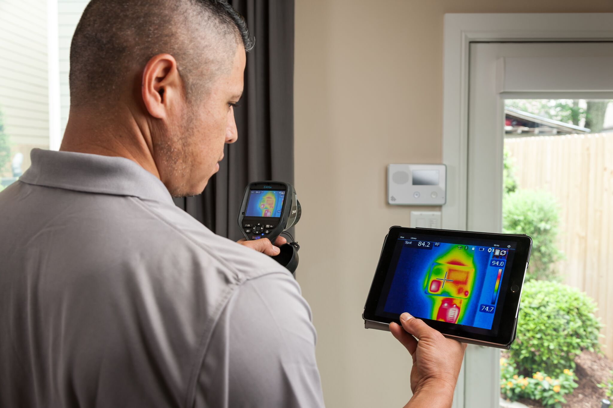
Reliant can even help customers in rural areas with the new Reliant Virtual In-home Consultation. Customers receive an infrared thermometer in the mail, and then at a scheduled time, Reliant’s energy consultant will Skype or FaceTime with you to take a virtual tour of your home. Using the thermometer, customers can take temperatures to give an idea of how well their A/C system is working and receive a full report with results.
To schedule a consultation, call 1-855-887-2190. With Reliant, you can request a free In-Home Consultation once per year.