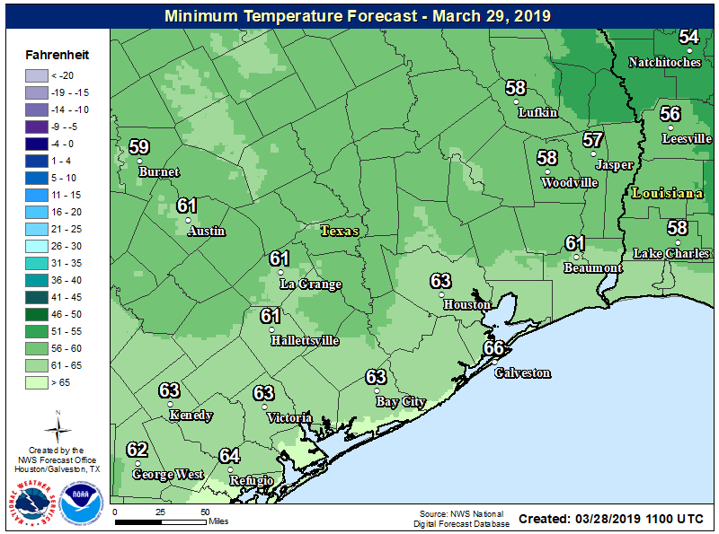
Temperatures have reached the mid- to upper-30s across the northern reaches of the Houston metro area this morning, offering the region a final, fleeting taste of winter. As of 6:20 a.m. CT, the mark of 39 degrees at Bush Intercontinental Airport ties the record low for today, set in 1989. It is, indeed, quite chilly out with a light northerly wind, so dress accordingly this morning.
Monday
Skies will be clearing today, but with a bit of unsteady air aloft, we can’t entirely rule out a few stray showers this afternoon. However, most of us will not see rain, but rather partly to mostly sunny skies, and highs of around 60 degrees. This is nearly in line for normal low temperatures this time of year. Lows Monday night will be cold again (see map below), but temperatures probably should be a couple of degrees warmer than Sunday night.
Tuesday
An absolutely splendid day: Highs around 70 degrees, mostly sunny skies, light winds. Overnight lows in the 50s. Play hooky.
Wednesday
Moisture will be returning inland later on Tuesday, and that will allow for the development of clouds on Wednesday. Rain chances are low (about 20 percent) but not non-existent, as highs push into the mid-70s (it will be even warmer if the sun can break through the clouds for a bit).