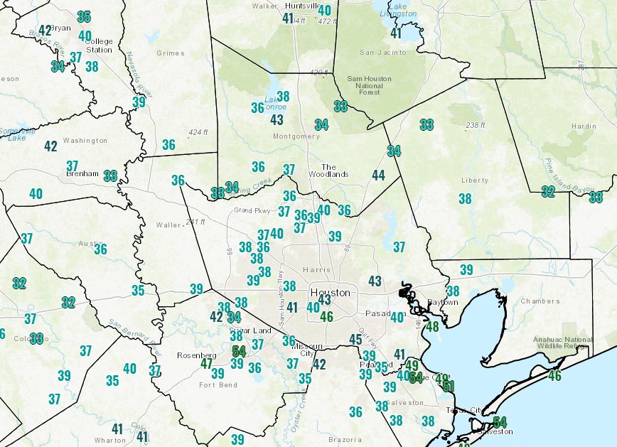
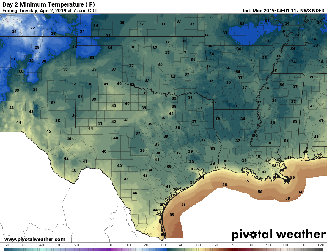
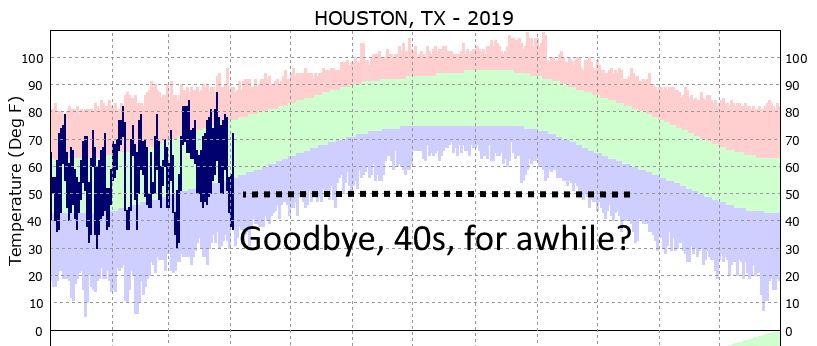
Storms possible tonight and Monday morning in Houston

Happy New Year! As expected, New Year’s Eve brought a lot of moisture into the Houston region, but the rain moved out before the beginning of evening festivities during the evening, leaving behind a foggy, humid, and misty day to start 2017. More rainfall is on the way, however, with the potential for some severe weather late tonight and Monday morning.

Dewpoint temperatures this morning are in the 50s, and although conditions are calm at the surface, about a mile up into the atmosphere south-southwesterly winds will be increasing today, rising to about 50 mph in the lower levels of the atmosphere by Monday morning. This will both bring lots of moisture and shear into the area late tonight and on Monday—setting the stage for some severe weather. The most likely time for storms will occur from after shortly after midnight tonight through noon Monday, with storms moving fairly rapidly from west-to-east.

Storm outlook for Texas on Sunday and Monday morning. (NOAA)

The primary threat will come from severe thunderstorms, damaging winds, hail and potentially a few tornadoes. Better chances for storms and higher rain accumulations will come north of I-10, where some areas may see 1 inch or more of precipitation.

As storms move out of the area by late Monday morning, skies will clear out and highs should rise to nearly 80 degrees. Cooler, drier air will arrive by Monday night, with a reinforcing shot of colder air later this week. How cold temperatures get by Friday or Saturday morning is not entirely clear, but forecast models have backed off the idea of an Arctic surge driving lows into the 20s.

We’ll update tomorrow morning with a comprehensive look at the week ahead, and out first forecast for the 2017 Houston Marathon.

Posted at 9 am CT on Sunday by Eric

Unsettled weekend, but real winter lurking

Unsettled weather is going to be the story of the next several days. We have a lot to discuss, so let’s break it down.

Today & Weekend

No big issues for Friday, as we’ll see clouds thicken and seasonably cool temperatures. There could be a sprinkle later today, but steadier light rain won’t begin to break out until probably after Midnight. Rain may become steady to heavy at times on Saturday morning. Here’s the good news though: Rain will likely end early to mid afternoon Saturday, and the bulk of New Year’s Eve night will be dry. If you have outdoor plans, don’t cancel them, but I encourage you to follow the forecast just to be safe.

We’ll ring in 2017 the same way we spent much of 2016: Milder than usual and a bit damp.

While there will continue to be a slight chance of showers Sunday, I think the majority of the day will be dry. It will continue to be mild, with temps in the 70s.

For Monday, the weather gets a little more interesting. A vigorous upper level disturbance will arrive, bringing renewed showers and thunderstorms. There are a lot of details that are TBD with this one, but it could potentially produce some strong to severe thunderstorms, especially north of I-10. We’ll keep you posted if this becomes more than just a “potential.”

See full post

Taking stock of how cold it’s been in Houston this winter

As of 7 am CT a cold front has swept through most of the Houston area, bringing an end to the warmest late December streak of weather in the city’s history, an unprecedented five days of 80-degree weather during the Christmas to New Year’s period. As we swing back toward colder weather here’s a look back at the coldest temperatures across the region this season, so far.

Map of the lowest temperatures so far this winter. (Brian Brettschneider)


Notably a few parts of Texas, Louisiana and the southwestern United States have yet to experience a freeze this year. Now let’s zoom in on southeast Texas, where you can really see the effect of warmer waters in the Gulf of Mexico and Galveston Bay on land temperatures. A small slice of the coast has yet to freeze, and that’s unlikely to change in the next week or 10 days.

Lowest temperature of the season for the greater Houston area. (Brian Brettschneider)

See full post

Houston going for a record fifth consecutive 80-degree day in December

The heat continues. Tuesday marked the fourth straight day of high temperatures of 80 degrees or greater in Houston, and the third record high in three of the last four days. According to data from Matt, That has happened five times before in the city in December (1933, 1956, 1995, 1998 and 2012), but all of the previous streaks came before Dec. 20. Today we’re likely to get our fifth—which has never happened in more than 120 years of records—before some cold weather sneaks into the region.

Today

You know the drill. Foggy morning, partly to mostly cloudy skies, and warm with highs around 80 degrees. Houston will experience one more very un-winter-like day before change finally arrives on Thursday. Looking outside, it dawns on me that for Houston, a White Christmas means fog rather than snow.

Dewpoint temperatures at 6am CT on Thursday morning. The front finally arrives. (Weather Bell)

See full post