After this morning, the cold front is gone. It was nice while it lasted—and more is on the way. But first, some disturbed weather.
Wednesday and Thursday
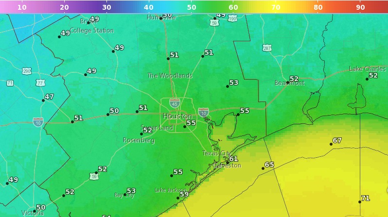
It’s pleasantly cool this morning, with most of the region falling into the 50s except for areas immediately along the coast. Sunny skies will allow for warmer temperatures today, in the mid-80s, and the real change will come later this afternoon as winds shift to the southeast. This will allow for humidity levels to rise, and overnight temperatures to jump into the upper 60s. Thursday should be another mostly sunny day, with highs in the mid-80s.
Friday
Moisture levels will be rising with the onshore flow, and by Friday an upper-level disturbance will bring a healthy chance of rain to the forecast. We could see some intermittent downpours during the afternoon, but we expect the storms to move rather than stall, so we’re not too concerned about the potential for localized flooding. Some parts of town may see 1 inch of rain, or so, while others get only very light showers, or no rain at all. Highs in the low 80s.
Saturday
Rain chances will remain, but there doesn’t appear to be quite as strong of a trigger for showers and thunderstorms on Saturday. Look for partly to mostly cloudy skies, with scattered showers, but right now accumulations do not look too significant. If you’re planning outdoor activities this weekend, the chance of pulling them off on Saturday is higher than Sunday. Highs in the mid-80s.