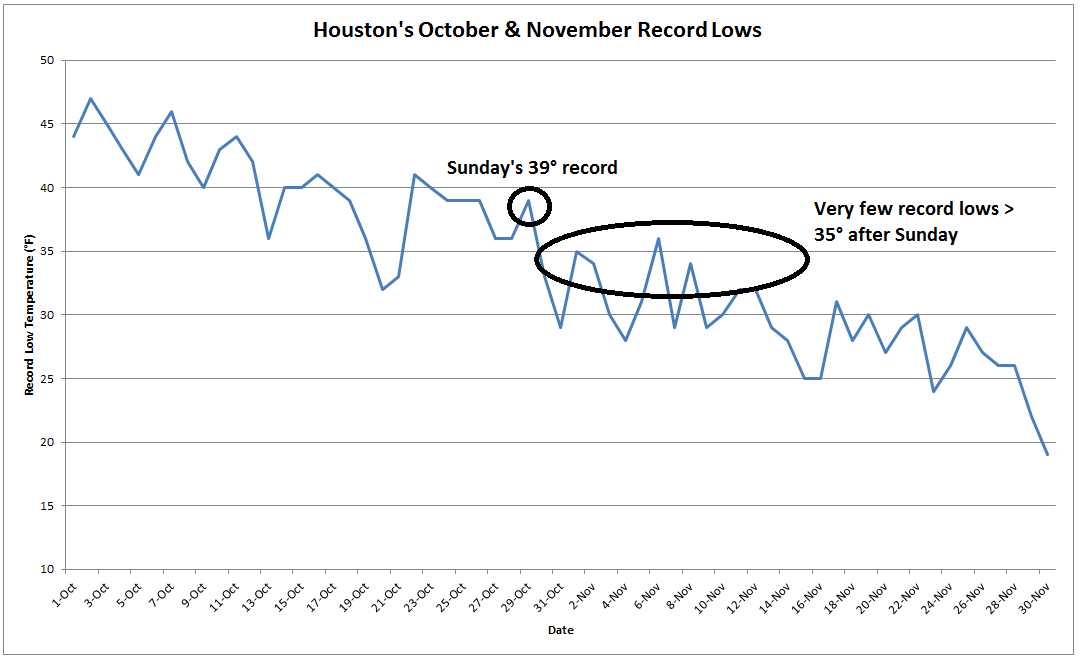
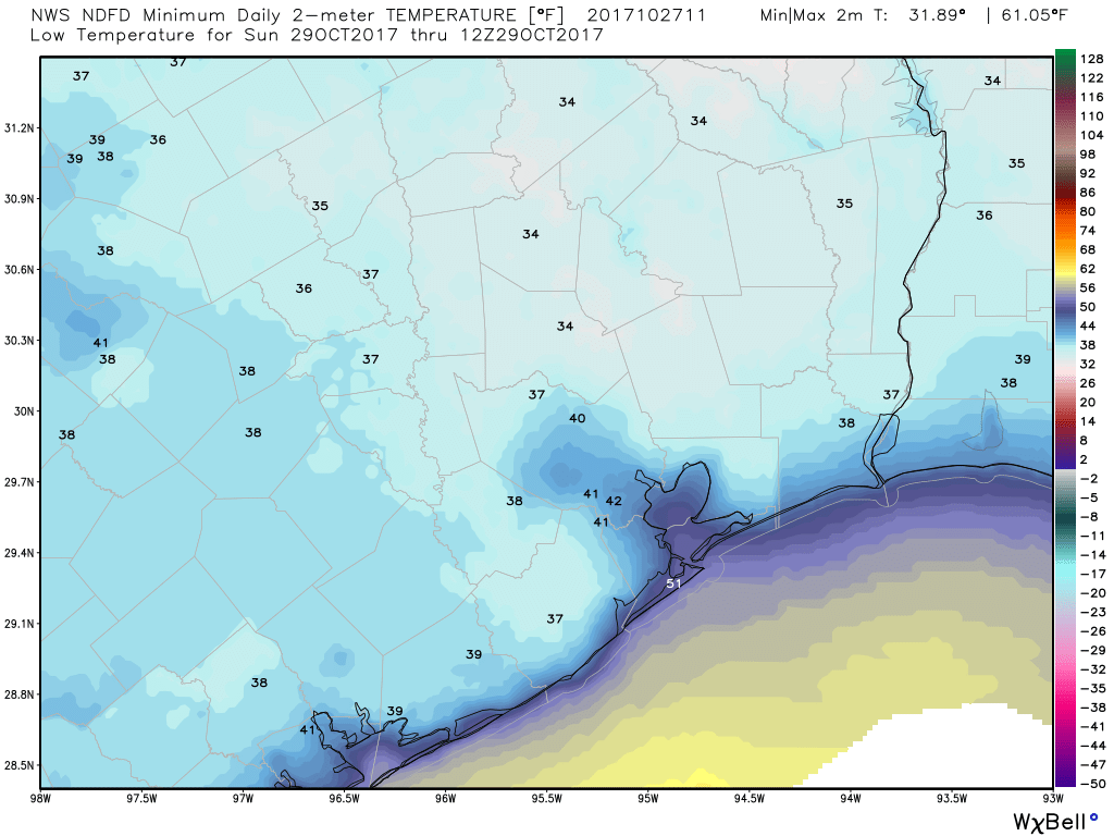
Did you enjoy our brief romp with winter? Houston smashed some records with a low temperature of 35 degrees on Sunday at Bush Intercontinental Airport (breaking a mark of 39 degrees), and a low of 39 degrees at Hobby Airport (breaking a mark of 42 degrees). Perhaps hell is freezing over because the Houston Astros are about to win the World Series? Anyway, this cold spell offered a taste of winter, but after another pleasant day Monday we’re going to settle back into a warmer pattern for awhile.
Today
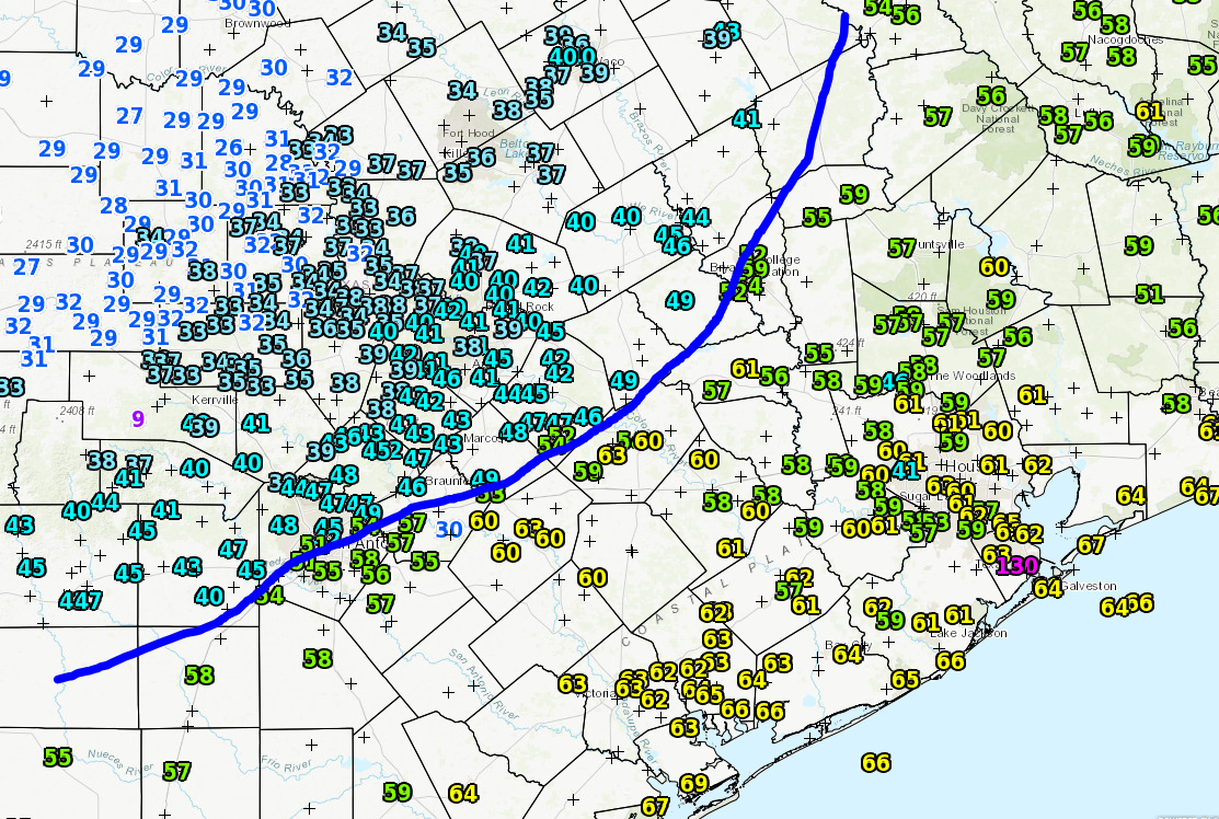
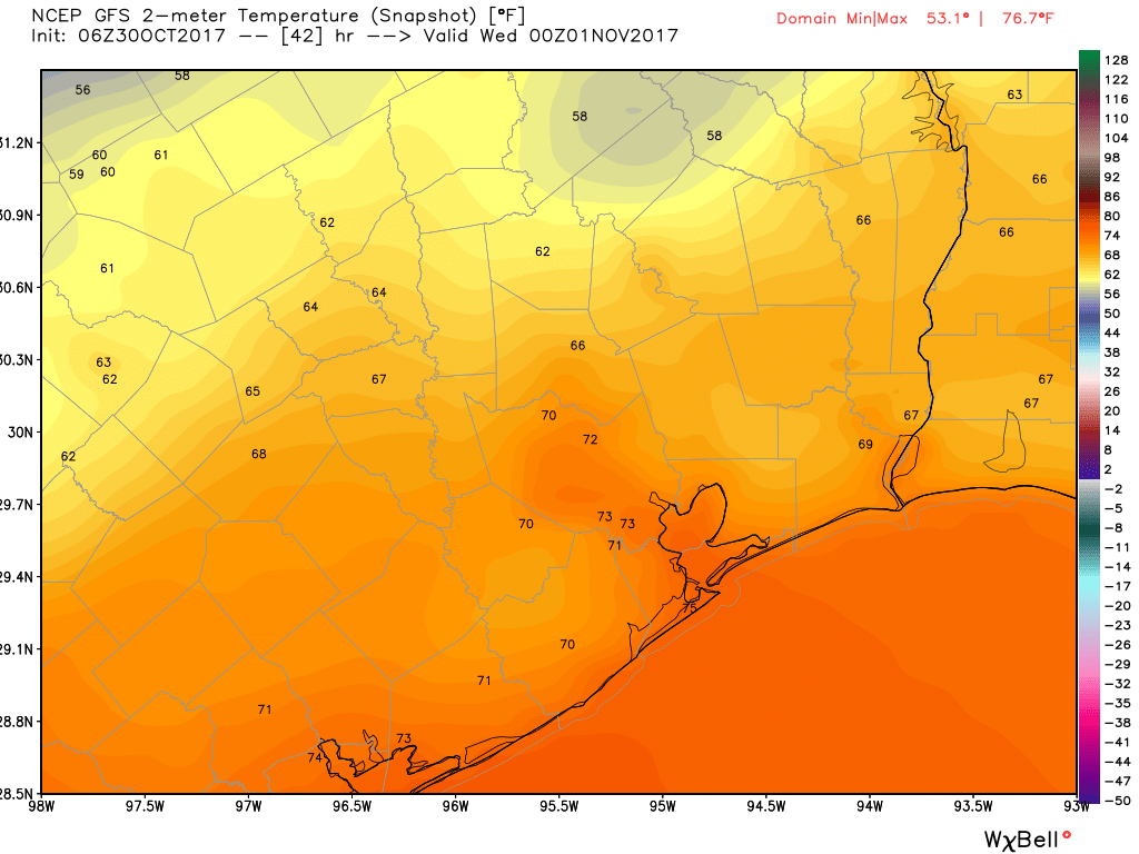
Southerly winds have already returned, and while this morning saw clear and cool conditions in the low 50s, we’ll warm quickly into the upper 70s under mostly sunny skies.
Halloween
Tuesday will offer mostly treats in terms of weather—but potentially a few tricks as well. We’re going to see a weak cool front move into the Houston area and then essentially stall at or near the coast. Effectively, this means we are going to see some increasing rain chances later on Tuesday, especially to the west and southwest of the Houston metro area.
While some light rain is possible in Houston during the afternoon and evening hours, I’m hopeful that some or most of the region will remain dry. However, rain chances will improve significantly during the overnight hours. Temperatures during trick-or-treating will likely be in the upper 60s to lower 70 degrees.