Houston had an all-too-brief taste of drier air this weekend, but already humidity levels are rising, and we’re going to see a fairly warm week for early October. Some (perhaps significantly) cooler weather should finally arrive next week.
Monday
As moisture levels rise, we’ll see a chance for scattered showers—with some isolated, heavy rains possible later today, this evening, and during the overnight hours. Most of Houston may just see clouds, but after a sunny, dry weekend the difference in moisture levels will nonetheless be noticeable. Clouds should limit highs to the upper 80s.
Tuesday and Wednesday
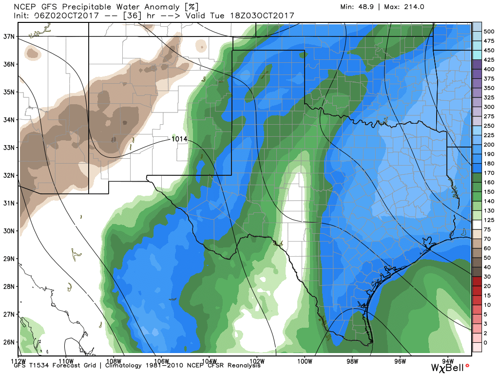
Moisture levels will spike on Tuesday, as an easterly flow brings in tropical moisture. Precipitable water levels will rise above 2.0 inches, and this should allow for fairly widespread showers and some thunderstorms. Some of these storms could be pretty heavy, bringing some localized heavy rains. For the most part, I expect people to see 0.5 to 1.5 inch of rainfall, but some areas will see more than this. We are not too concerned about flooding at this time, but will be watching this closely.
Rain chances will continue from Tuesday night into Wednesday morning, but then should begin to ebb as moisture levels fall, and high pressure builds. Both days should see highs in the mid- to upper-80s.