The winter solstice began early this morning, as the Sun reached its lowest point in the sky. Paradoxically, instead of seeing cooler weather over the next week or 10 days, Houston will instead warm back up over the Christmas Holiday, and perhaps most of the following week.
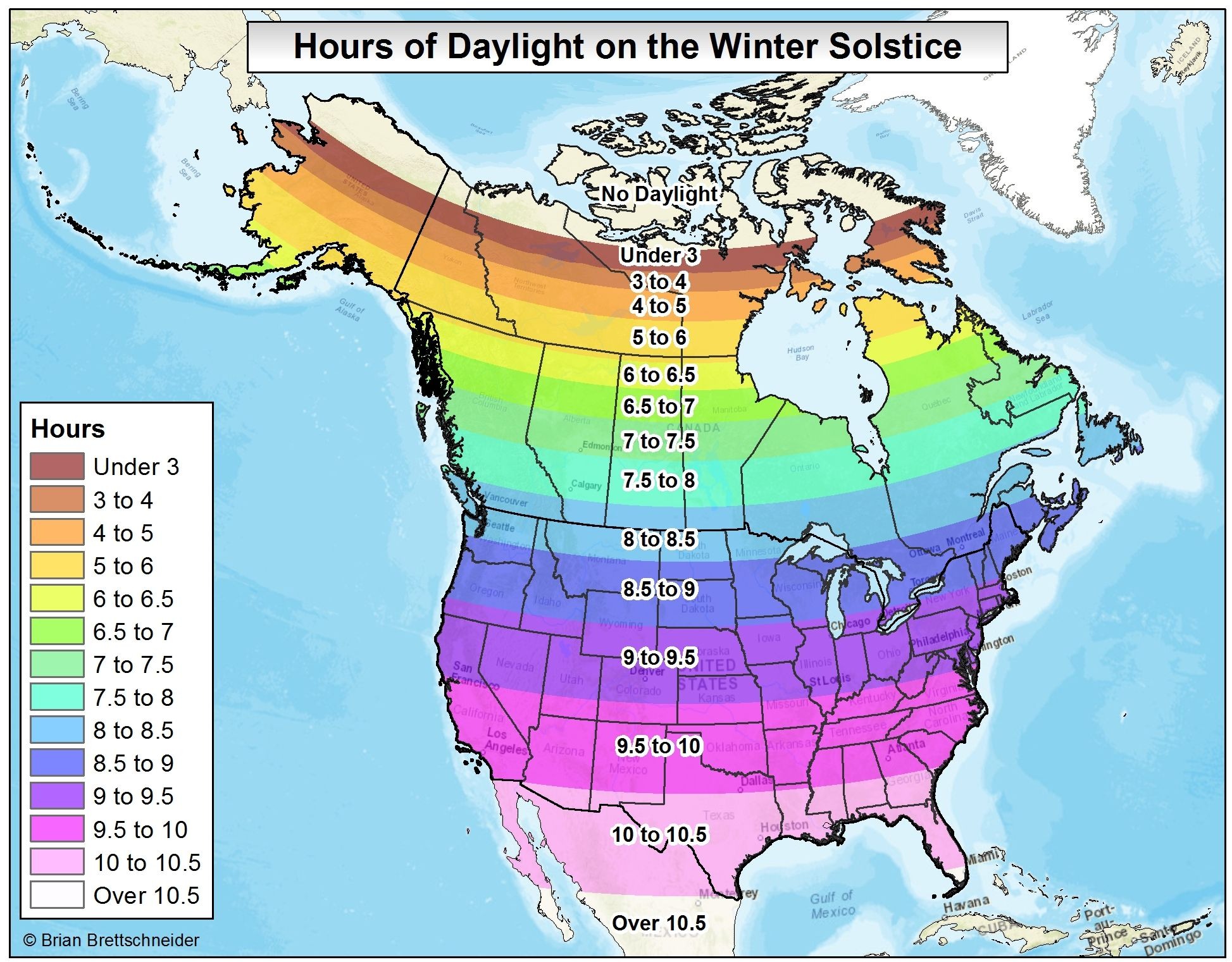
For the northern hemisphere today is the “shortest” day of the year, in terms of daylight. With a sunrise at 7:12am CT and sunset at 5:26pm, there is just 10 hours and 14 minutes of daylight. (At mid-summer the day is 14 hours, 3 minutes long). Here’s how that compares with the rest of the northern hemisphere on the winter solstice.