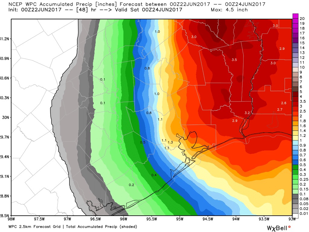
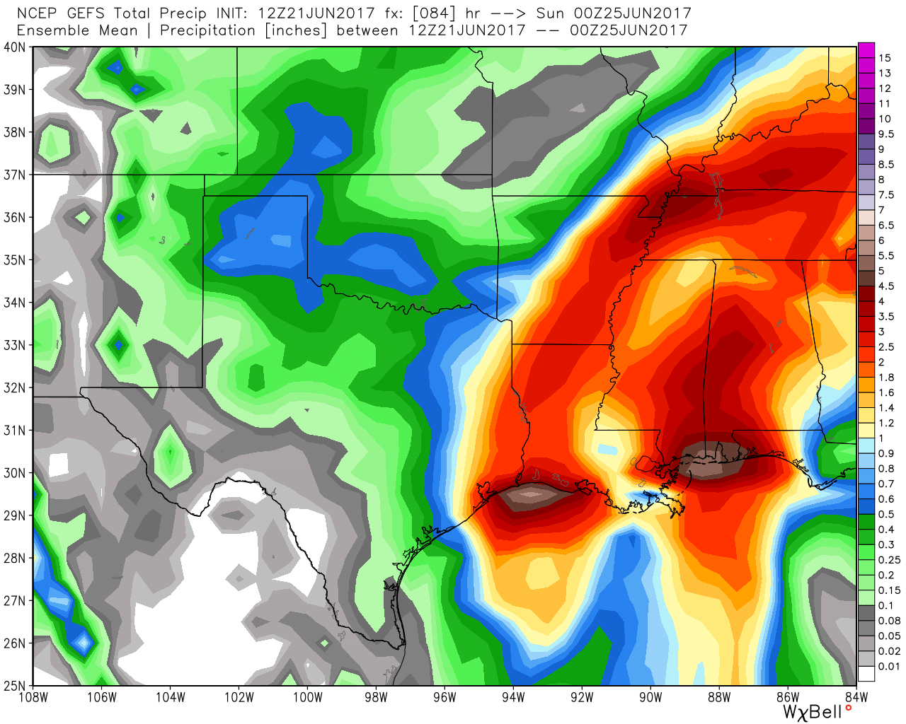
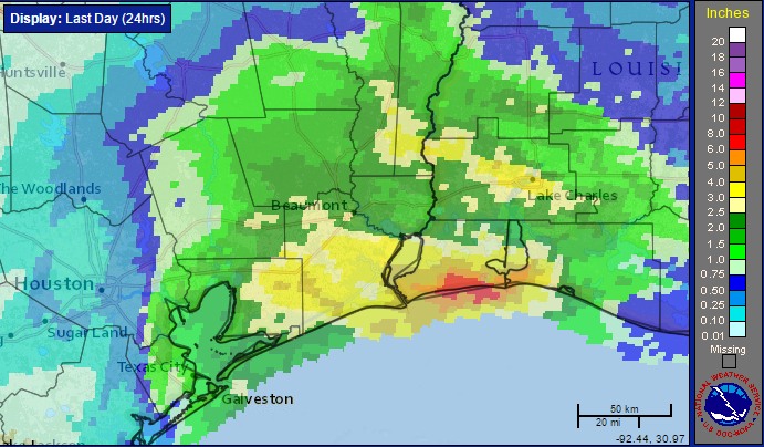
As Tropical Storm Cindy turned to the north on Wednesday evening, the system’s rain bands went with it. The storm clearly demonstrated how miles matter when it comes to tropical weather, bringing about 6 inches of rainfall to an area between Beaumont and Lake Charles along the Gulf coast, and far less just 100 miles to the west in Galveston. For Houston, as we suggested here on Wednesday, Cindy turned out to be a non-event, with 0.5 to 2.0 inches of rain across the eastern half of the region, and very little rain to the west.
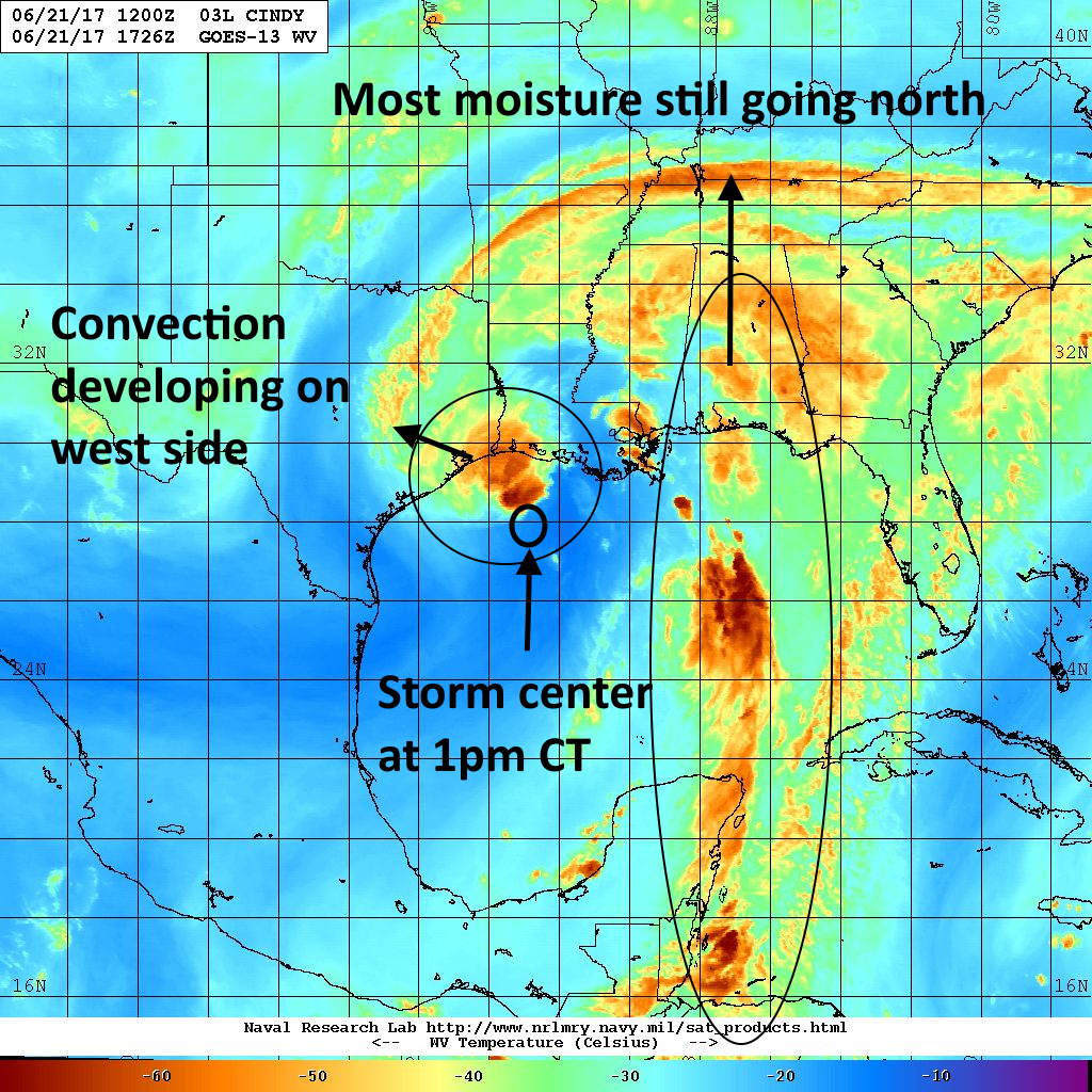
Cindy also showed why it’s best to be on the west, or left, side of a tropical system—where there’s generally less rain, wind, and the northerly flow on the back side of a tropical system can sometimes bring drier air as we saw on Wednesday with the lower humidity. My concern is that when a more serious tropical system threatens, residents will remember Cindy and think, “Oh, it’s no big deal.” That’s why Matt and I started this site, to not hype storms like Cindy, so when the real deal comes you’ll take us at our word.
Today
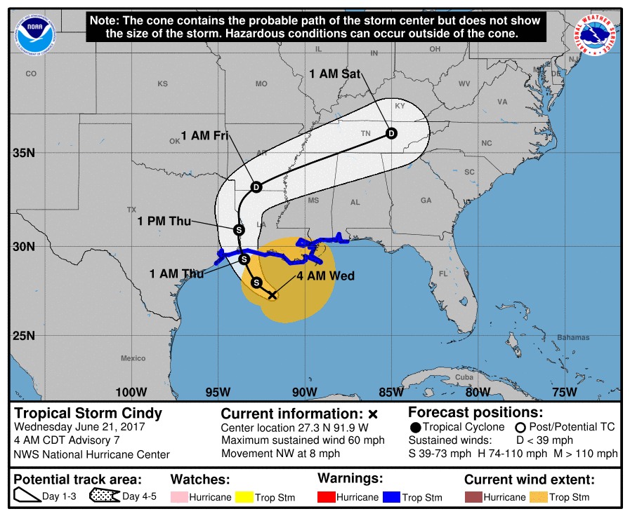
After making landfall near the Texas-Louisiana border before sunrise, Cindy has continued moving north. Additional showers and thunderstorms from the back side of the tropical system may rotate through Houston today, but I don’t think they’ll bring more than 1 to 2 additional inches of rain even for the hardest hit areas. Highs should again be limited to about 90 degrees.
Friday
Muggy weather returns on Friday, and with partly sunny skies we can expect temperatures to likely warm into the mid-90s. It’s going to feel hot after the cooler mid-week weather Houston experienced due to Cindy.
Saturday and Sunday
This weekend should be fairly wet, especially for the southern half of the Houston area. The combination of an approaching front—not really cold front, sorry—and the region’s moist and warm environment should allow for the development of widespread showers and thunderstorms. Some areas could see an additional 1 to 2 inches of rain, but right now I’m not anticipating any flooding problems. Mainly, the rains may be a hassle for those with outdoor plans. Highs will reach the lower 90s.
Next week
Rain chances won’t be quite as robust next week, but I’d still expect at least scattered showers and thunderstorms, with partly sunny skies, to start next week. This weather isn’t all bad for late June, a month which some times can be a scorcher, as it should help to keep highs around 90 degrees.
Posted at 7:20am CT on Thursday by Eric