Continuing our theme of giving you the latest forecast information, here’s an early afternoon update.
Now
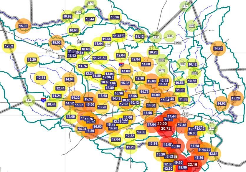
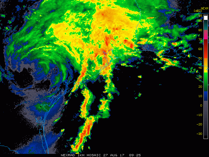
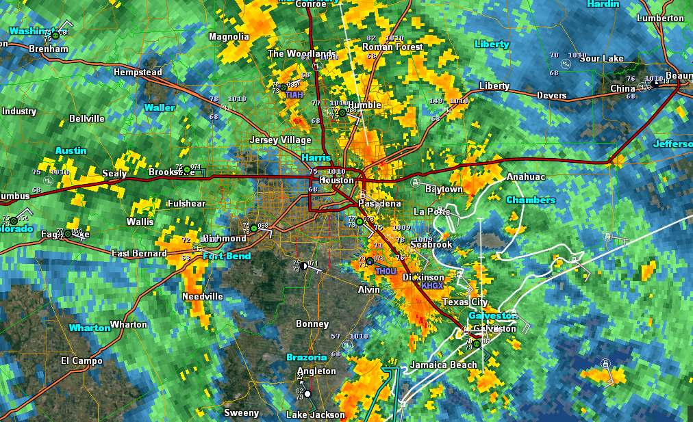
Some good news for some folks. Dry air has punched in west of I-45 as of 12:30, and in some areas, we’re getting a nice dry period. Other areas are still seeing rains, but they’re falling at manageable rates. We continue to see isolated tornado warnings pop up all over the area.
Rest of Today
Looking at high-resolution weather models, I think we’re going to see this pattern continue. Occasional drying moves around the area, with pockets of heavier rain at times. Some places may see 1-3″ in an hour. This will limit improvement, but outside of areas where runoff from last night is still flowing through the system, it shouldn’t make things terribly worse. Not ideal, but manageable for the most part. Tornado Warnings will continue to pop up across the region, so if you can safely find shelter if a warnings is issued, do so.
Tonight
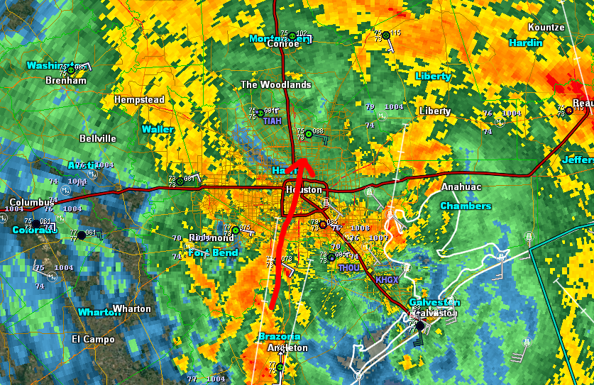
A couple points. The setup is not identical to last night, but there are a number of similarities. And obviously that concerns us. Yesterday, we could say with high confidence that Houston was going to have a rough night. Tonight, we can only say that someone in the Houston area is going to have a rough night. Our highest resolution, shortest term model, the HRRR, has the heaviest rain tonight between Baytown and Beaumont. The Texas Tech WRF model develops another period of heavy rain west of Houston and progresses it eastward across the city (not as intense or permanent as last night, but still bad). The NAM models tend to like the heaviest rain over the Inner Loop, and the GFS has the heaviest west of Houston. Last night, they all had Houston getting hammered. So tonight’s forecast is a shrug forecast. I’m hoping we’ll gain more clarity with our mid to late afternoon update in a few hours.
Tomorrow
Right now, despite the model disagreements, I would expect a repeat of today’s weather after sunrise on Monday: Rain, heavy at times, with occasional breaks. And a continued isolated tornado threat. More on this later.
Posted at 12:45 PM Sunday by Matt