After mostly dry weather for the last six weeks, Houston’s weather will turn more dynamic later today and Monday. Three factors will help drive the potential for heavy rain during the next 36 hours: high atmospheric moisture content, a stalled front, and an upper-level system moving into the region from the southwest.
We don’t have too many concerns about weather today—as any showers and thunderstorms that develop probably won’t be too organized, and any strong storms should move through the region for the most part. Expect partly to mostly cloudy skies and highs in the upper 80s with a decent chance of rain. Accumulations will likely be less than 1 inch for most areas.
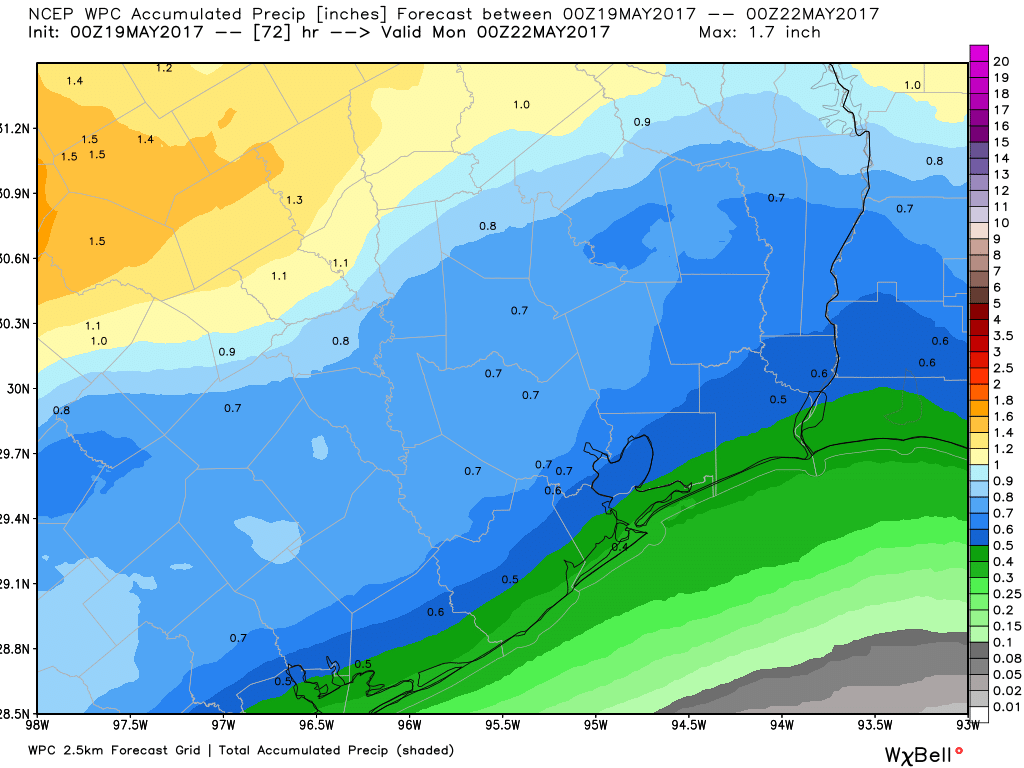
The bigger potential for storms will come later tonight and Monday, as an upper-level disturbance moves into the region. For now it appears the best rain chances will be closer to the coast, but I think most of the area has a good chance of seeing 2 to 4 inches of rain through Monday night. Because the atmosphere is so moist, we’re likely going to see higher localized amounts where the heaviest storms develop on Monday, but it’s just not possible to predict where those bullseyes will occur. Some flash flooding is therefore possible.
The bottom line is we’ll need to pay close attention to weather conditions tonight and on Monday. Lesser rain chances remain Tuesday, whereas from Wednesday on the weather looks great. We’ll stay on top of things for you.
Posted at 10:15am CT on Sunday by Eric