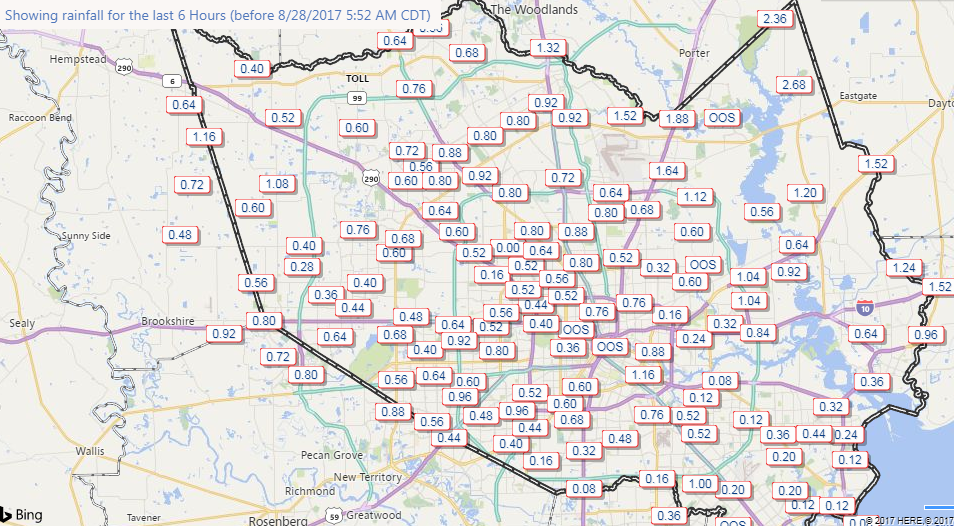
Monday, 10:30am CT—There is no way to escape the reality of the situation on the ground this morning: Houston bayous are flooding, and even after the region has received 30 inches of rain during the last two days, more is now falling over the central Houston area. It is a catastrophic situation. Finally, however, the end is in sight. Another day or two of this …
Harvey
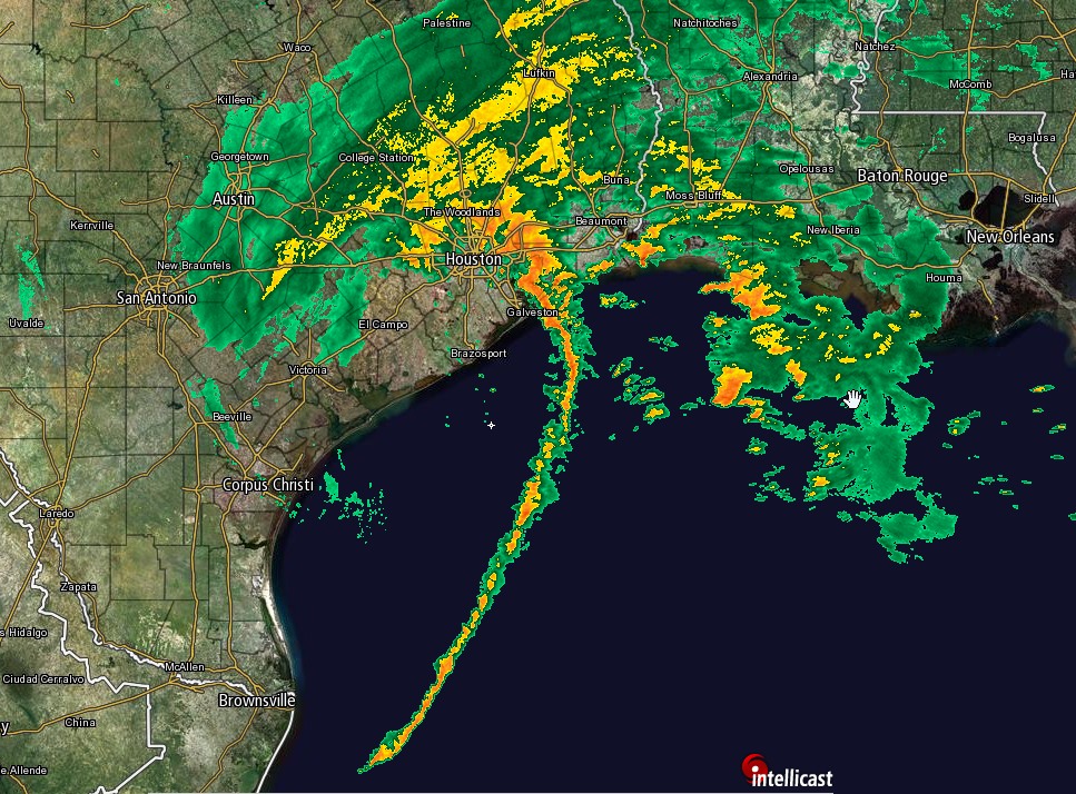
Harvey remains barely a tropical storm, but its center moved into the Gulf of Mexico near Matagorda Bay this morning. Presently moving to the southeast at about 5 mph, some slight strengthening is possible over the next day or two as Harvey turns east, then northeast, but as discussed yesterday we are not too concerned about this possibility due to the lack of an organized core, and additionally some drier air is working into the storm. (See official track forecast).
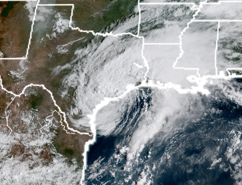
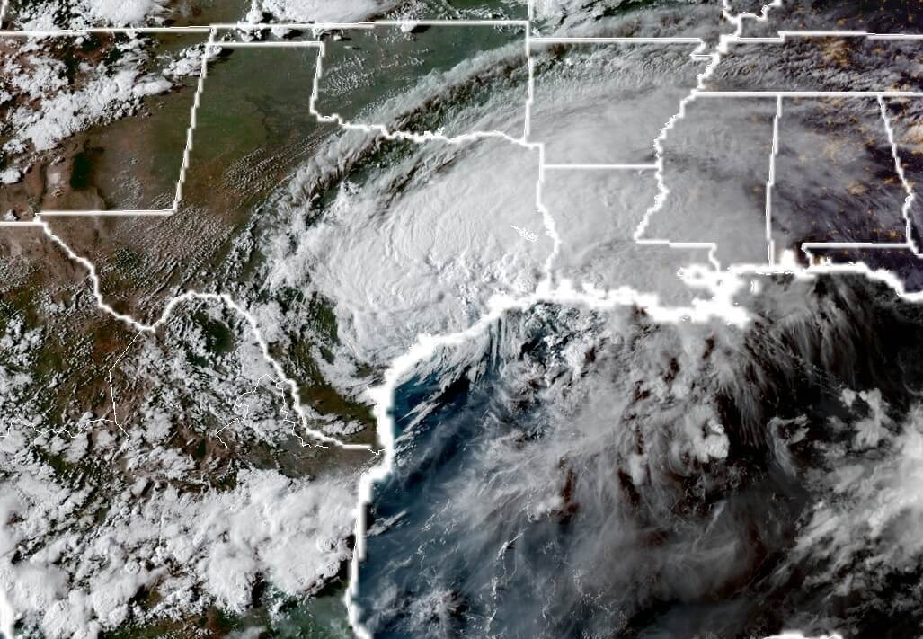
Overall, Harvey’s movement into the Gulf may be a positive development, because the storm is getting closer to being picked up by lower pressure in the Midwestern United States, which should lift it north. By later Tuesday, or Wednesday, we should hopefully be on the back side of the storm, with northerly winds helping to push water from inland bayous out to the Gulf of Mexico. Heavy rains should end, hopefully, by Wednesday or Wednesday night.