It’s cool this morning, and generally in the low 40s across the Houston metro area. Also, the winds have finally calmed down.
TODAY and FRIDAY
Houston will see mostly sunny days, with highs in the upper 60s to 70 degrees, and lows in the 40s. Conditions will be near perfect for late February.
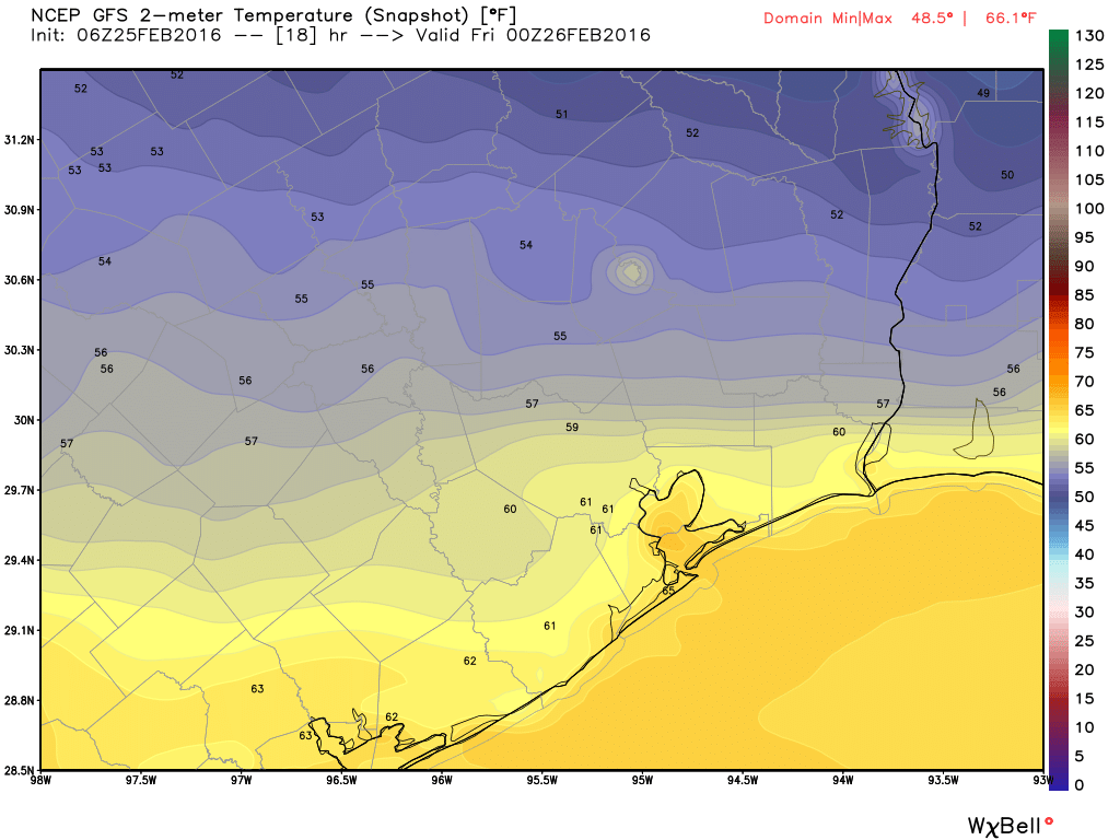
Temperatures at the beginning of tonight’s Republican Debate will be about 60 degrees, falling to about 50 by its end. Hotter inside, I am sure! (Weather Bell)
SATURDAY
We’ll see more of the same to start the weekend, as additional cool air moves into the region on Friday. After a cool start in the low 40s, expect sunny skies and highs near 70 degrees.
Good morning. The rain is over. The wind is coming to an end. Welcome to several days of splendid late winter weather.
TODAY-FRIDAY
Under the influence of high pressure, expect three similar days to end the work week, with highs in the mid- to upper-60s, ample sunshine, and cool nights with lows in the upper 30s for areas far inland, and in the low 40s closer to the coast. These will be great days.
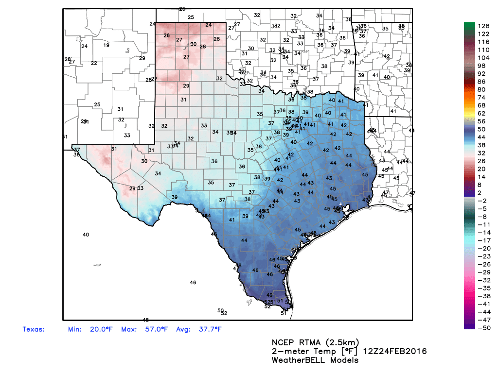
It’s cold across Texas this morning, but we’ll warm up when the Sun comes out. (Weather Bell)
Good morning. A series of steady, but not too threatening rain showers and thunderstorms are moving through Houston this morning.
TODAY
Showers and storms will continue to develop and move from west to east across Houston for a little while longer. The rains should end for the most part by the mid-morning hours. Much of the region should receive about 1 to 1.5 inches of rain through this morning, which is just what we needed after a very dry start to 2016.
Highs today will reach about 70 degrees. By early this afternoon a cold front will move through the area, and we’re going to see some really strong winds as the front moves in this evening and tonight. A gale warning is in effect for the metro Houston area, with gusts as high as 40 mph possible. Low temperatures tonight will fall into the mid-40s, and with the wind it will feel quite a bit cooler once the Sun goes down.
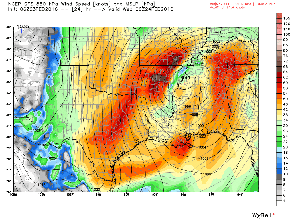
A strong low-pressure system will bring storms into Louisiana and Mississippi later today, and on its backside Texas will see very strong northerly winds. (Weather Bell)
Good morning. We’re starting to see light to moderate rain showers move into the Houston area from the northwest, which is being driven by a weak cool front. More dynamic weather is ahead after that.
TODAY
As the cool front nears the coast it should stall, and we’ll see this rain end during the late morning or early afternoon hours. Highs today should be in the mid-70s as this first front won’t pack much of a punch. Lows tonight will be around 60 degrees.
TUESDAY
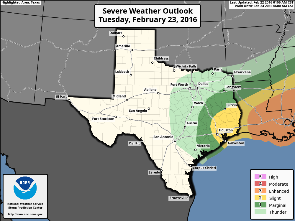
Another, considerably stronger cold front will reach Houston sometime during the middle of the day on Tuesday, and this will bring much windier, and cooler conditions. This current of fast moving air in the lower levels of the atmosphere, also known as a “jet,” will also bring the possibility of storms before and during its arrival. While the most favorable conditions will be over coastal Louisiana and further east, Houston may also see a few scattered tornadoes and hail. Rain showers and storms are most likely from Tuesday morning through the early afternoon hours, before ending after the front’s passage. Accumulations of 1 to 3 inches are possible north of Houston, with one-half inch of rain or less closer to the coast.
Severe weather outlook for Tuesday and Tuesday night. (NOAA)