In brief: In today’s post we go a little deeper into the possibility of a cold front arriving by next weekend. Also, we discuss rain chances over the next several days, which remain healthy for most of the region.
Cold front or nah?
Houston’s first fall front typically arrives during the second half of September—not always, but often. Said front is almost always weak in the sense that it only brings very modest temperature relief and a relatively short period of modestly drier air. But psychologically it’s a huge deal, because it is a promise of what is to come, namely fall.
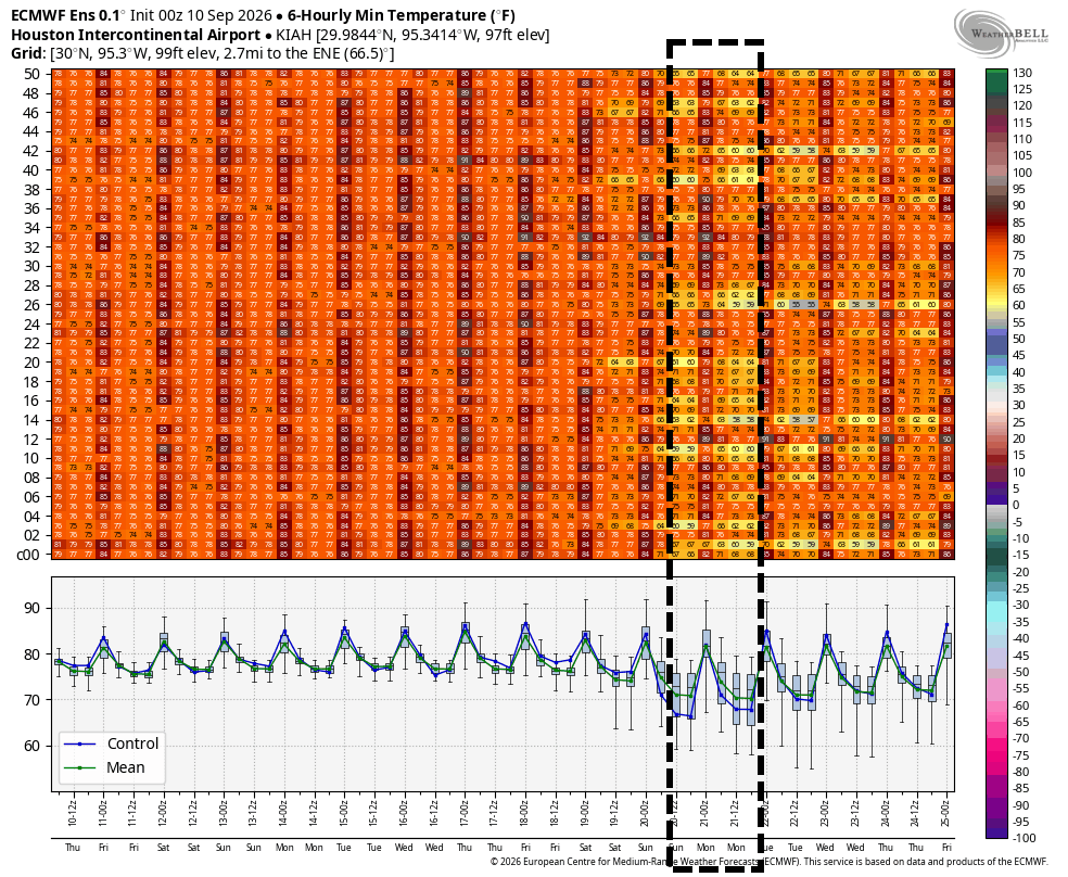
Because the first fronts are usually weak, they are difficult to predict. We end up in a will it, or won’t it make it scenario up until a couple of days before the front’s arrival. Some of our better models are continuing to indicate the possibility of the season’s first front arriving in about nine or 10 days time. That’s more or less at the edge of what is reliably predictable, so there is some double uncertainty about this front, both in the sense of it is difficult to forecast accurately, and it remains relatively far into the future from a forecast standpoint.
So, real talk, I think there’s a pretty decent chance a front makes it in by around September 19 or 20. I would not swear to anything like that, and realistically the chance is probably somewhere in the vicinity of 40 or 50 percent. We are unlikely to really have high confidence in this forecast until at least next Monday or so.
Thursday and Friday
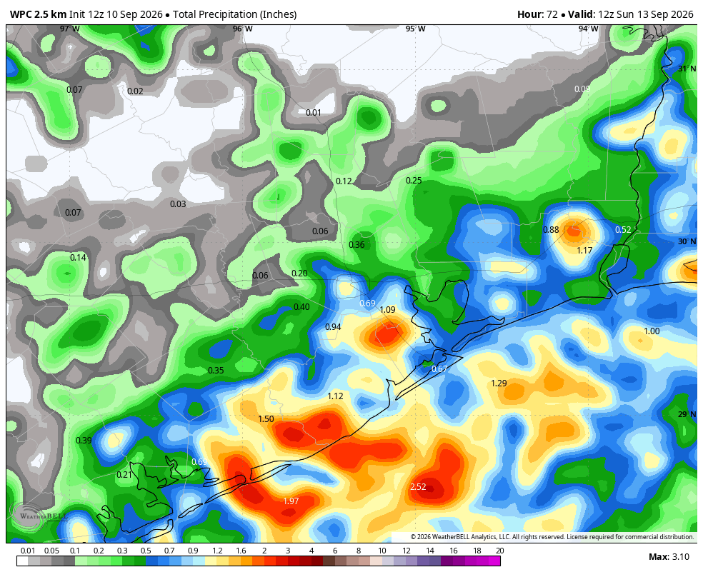
Both of these days will see similar conditions, which is to say high temperatures in the vicinity of 90 degrees and partly sunny skies. Along with daytime heating we will scattered to widespread showers and thunderstorms during the afternoon hours. While most of these should move through fairly quickly, some of the stronger cells could produce 1 to 2 inches over smaller areas. Overall chances are probably higher closer to the coast than further inland. Winds will generally be light, from the south. Nighttime lows will be in the upper 70s.
Saturday and Sunday
I’m not sure a whole lot changes over the weekend. Temperatures will be similar. If I squint, it’s possible that Sunday has a little more sunshine and lower rain chances, but some showers are definitely still possible. So if you’re tailgating at Reliant Stadium—which is a great name for a football stadium by the way, glad it’s back—you can expect mostly sunny conditions but we unfortunately cannot rule out the possibility of some showers moving through, even if overall chances are fairly low.
Next week
Temperatures don’t change much next week as I expect the region to be in the vicinity of the lower 90s. Rain chances may drop back to 20 or 30 percent daily, but I don’t think they’re going away entirely. The big question, toward the end of next week, is whether a weak front does make it. This would probably bring a brief bump in shower chances. Obviously we’ll be keeping a close eye on this to see what happens and when we know, you’ll know.
