In brief: A surge of tropical moisture is headed toward the upper Texas coast today, and we explain what that really means. After shower chances today we will have a hot and sunny weekend, with zero risk of inclement weather.
Tropical moisture, but in a good way
When it comes to weather, living near a huge body of tropical water such as the Gulf has its upsides and downsides. Among its benefits are a moderating impact on colder temperatures during the winter, and a ready source of moisture when we otherwise might plunge into drought. On the downside is that sometimes that “ready source of moisture” provides a little too much tropical moisture.
When we speak of tropical moisture it simply refers to moisture that originates over very warm tropical or subtropical bodies of water, and what differentiates it is that this warmer air is capable of holding more water vapor. This creates deep layers of more humid air and very high levels of “precipitable water,” the amount of liquid water if one were to condense all of that vapor in the atmosphere from the surface to space.
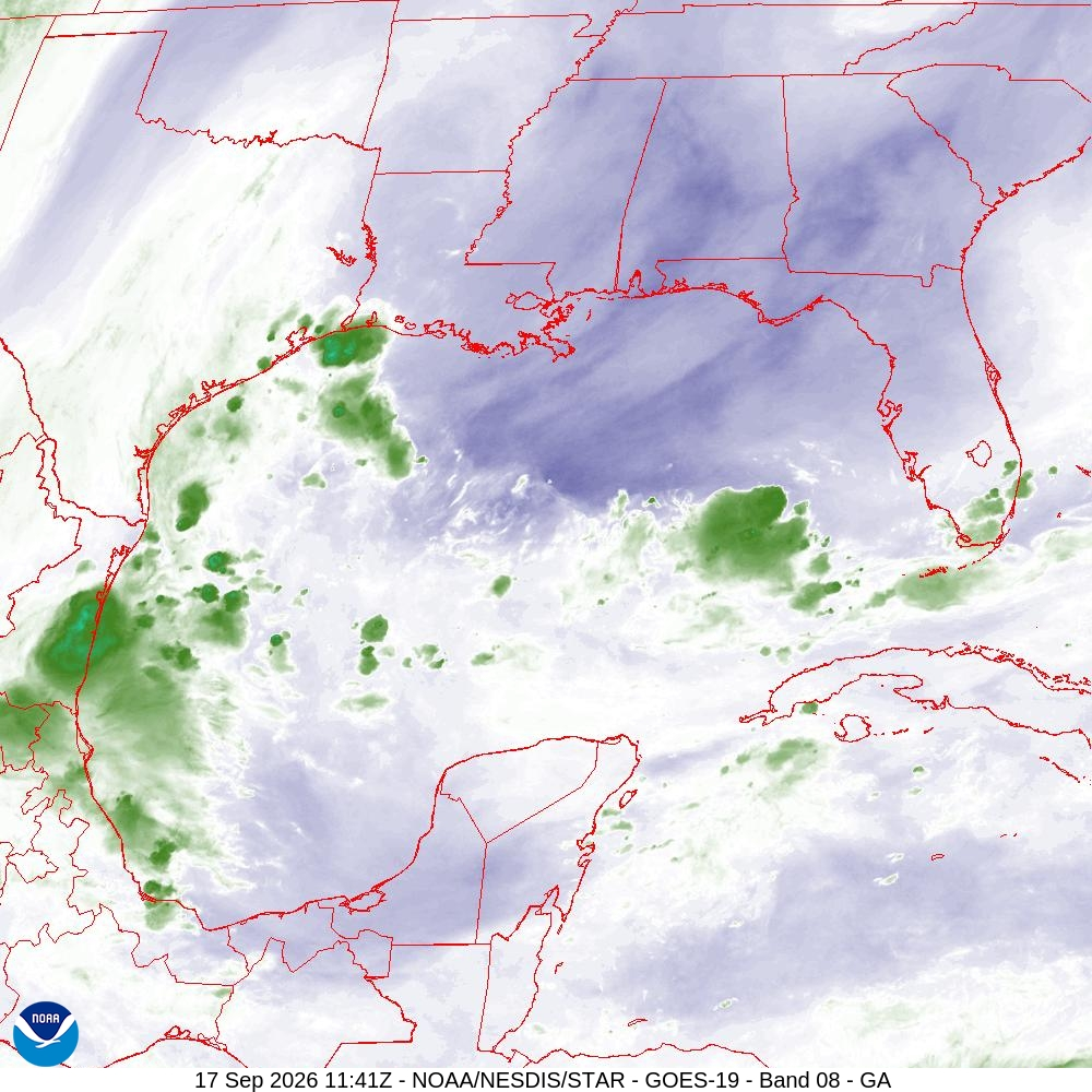
Thus, tropical moisture is capable of producing high rainfall rates. So when we have a tropical storm, it brings not only a surge of tropical moisture, but a very efficient atmospheric machine in terms of wringing that moisture from the atmosphere and generating heavy rainfall. We sometimes see rainfall rates of 3 or 4 inches per hour (or higher!) instead of the more common 0.5 to 2 inches per hours. Higher rainfall rates quickly back up streets.
Anyway, all of that to say we have a surge of tropical moisture headed toward Texas this morning. It presently is over the northwestern Gulf, but will soon move into the Houston region. This will bring some decent rain chances into our area, especially (but probably not exclusively) for areas south of Interstate 10. But since we lack a tropical storm-like environment, the showers will be more scattered and fleeting in nature, so we shouldn’t worry too much about flooding. For most of any rains today would be beneficial.
Thursday
As noted above, we have a healthy chance of showers today, which is notable because it’s probably our last significant chance of rain for several days. Most areas along and south of I-10 could pick up a few tenths of an inch of rain, but there is the potential for higher isolated totals. Coverage and amounts will be less further inland. With increased cloud cover our highs should be around 90 degrees, or perhaps a little warmer inland. We may see some gusty easterly winds. Lows tonight will be in the upper 70s.
Friday, Saturday, and Sunday
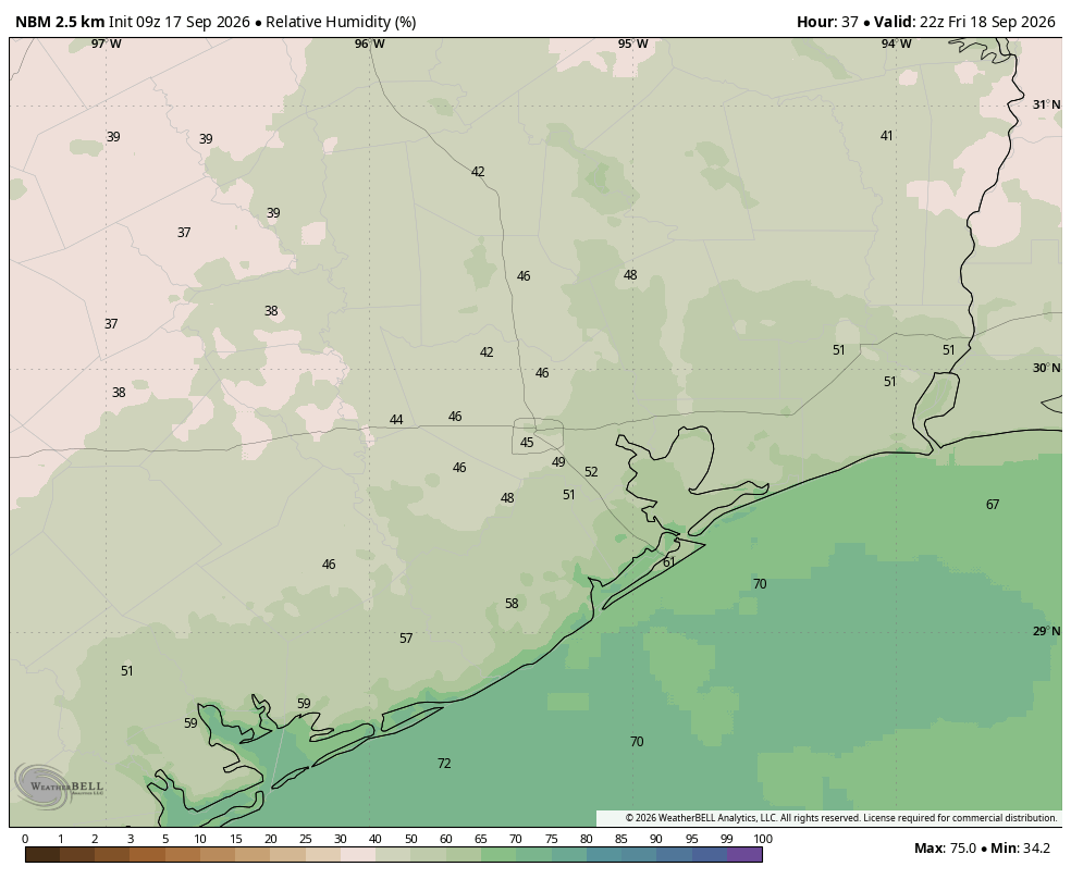
For the weekend we are very unlikely to see any rain, and skies should be sunny. On Friday we should see some slightly drier air, and this will lead to slightly lower humidity during the daytime. It won’t be much, but you may notice it. The effect should fade out on Saturday and Sunday. Highs this weekend will be in the low- to mid-90s with nighttime temperatures generally in the mid- to upper-70s.
Next week
This warm, late summer pattern should persist for most of next week, with mostly sunny skies and highs in the low- to mid-90s. We may start to see some low-end rain chances during the afternoon hours along with the sea breeze, but these are only going to be in the 10- to 20-percent range, probably. Some kind of a pattern change, or possibly a weak front, remains possible during the later stages of next week but again, there are just no guarantees at this point. We are watchful and waiting, but prepared for disappointment. That should probably be this website’s motto for September, no?
