In brief: Rain chances continue today, although coverage should be slightly less than Tuesday, with lower overall intensity. High pressure builds later this week to set up an extended period of hot and sunny weather.
The Woodlands gets whacked
All of the greater Houston region recorded rainfall on Tuesday, but as is often the case totals varied widely. Some locations southwest of the city picked up only a quarter of an inch, with most of the area picking up between 0.5 and 2 inches. However the exception to this came north of the city, in Montgomery County.
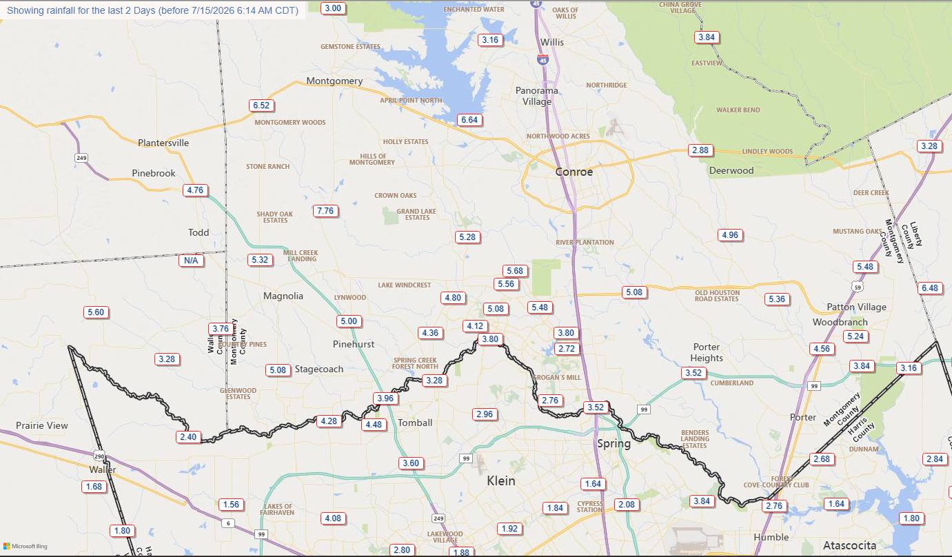
Over the last two days areas from The Woodlands north to Lake Conroe have picked up 5 to 7 inches of rainfall. A check of waterways in the area show that most streams, creeks, and bayous are elevated but generally within their banks. After a quiet night, water elevations are slowly falling. High water remains on a handful of roadways this morning.
As we’ll discuss below, the focus for showers and thunderstorms should shift further south today. So although some rains are possible in areas hardest hit in Montgomery County over the last couple of days, I don’t believe conditions will be problematic for these locations. However, out of an abundance of caution I am going to hold Stage 1 flood conditions in place through this afternoon.
Also, although flooding issues have not been particularly acute for most of the greater Houston region, the story is different in parts of Central and West Texas. We have more information on that situation on The Eyewall.
Wednesday
Conditions are not as favorable for widespread showers and thunderstorms today in Houston as they were on Tuesday, but plenty of moisture remains in the atmosphere. For this reason much of the area is likely to see showers and thunderstorms today, although overall intensity should be lower. Rain chances are probably 50 percent for areas north of Interstate 10, and a bit higher for locations closer to the coast.
Most locations will likely pick up less than 1 inch of rain, but there could be some higher bullseyes south (and particularly further southwest, near El Campo and Matagorda Bay). These rains should end by late afternoon or early evening, leading to quieter conditions. Skies will be mostly cloudy otherwise, with highs generally in the mid-80s.
Thursday and Friday
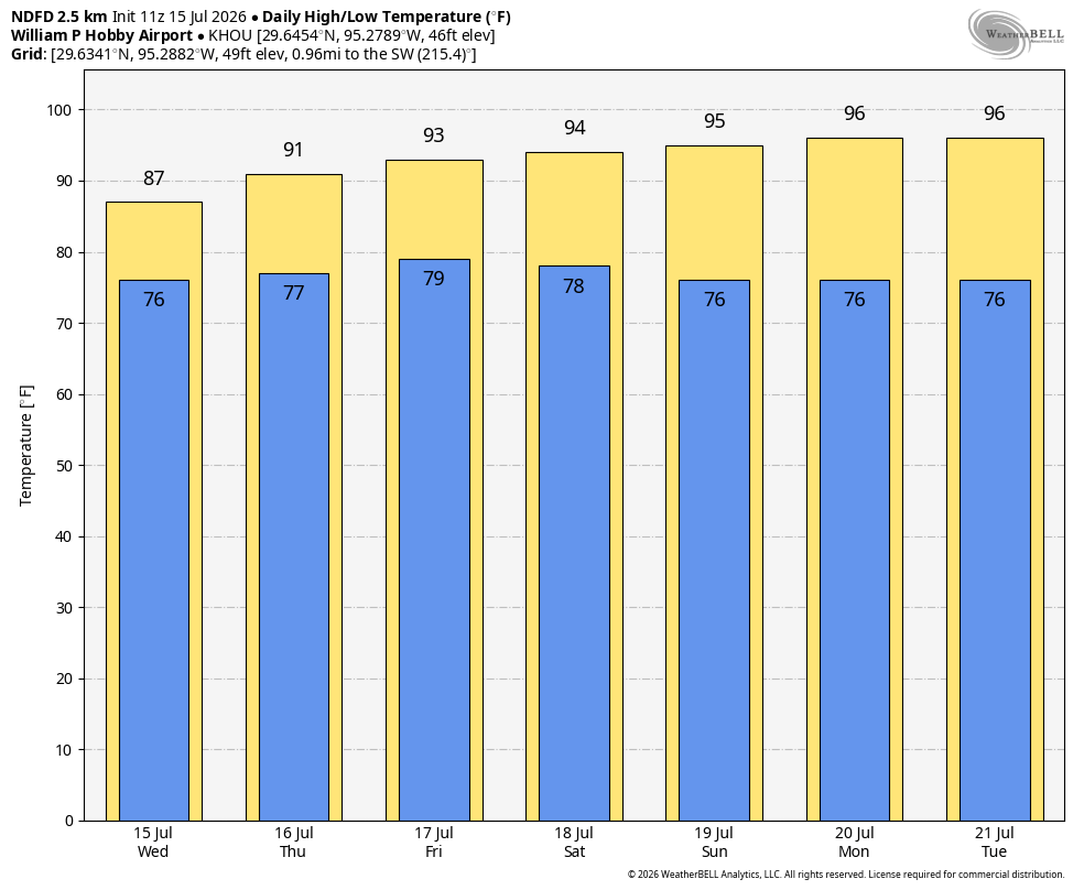
High pressure will begin to build from the east, and this will start to shut down daily rain chances. Still, we probably will see about a 30 percent chance of showers or thunderstorms each day. With a mix of sunshine and clouds, high temperatures on both days will likely be in the vicinity of 90 degrees, or possibly lower 90s if we get more sunshine during the afternoon hours. Humidity will be sky high, of course, and nights only cooling into the upper 70s briefly.
Saturday and Sunday
We continue to expect mostly sunny and hot weather this weekend. For most locations highs will likely get into the mid-90s, although some inland locations could approach the upper 90s. It will be a classic beach and pool weekend in our region of Texas.
Next week
This hot and sunny pattern will persist through the first half of next week. There is some indication that we could possibly see the return of a few, sea breeze-driven showers by the second half of the work week. But mostly I expect we’re going to continue to see sunny skies and highs in the 90s. In other words, get any rains you need now.
