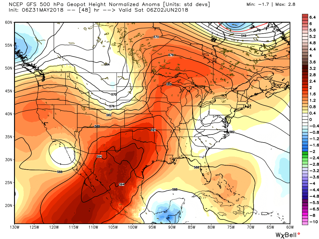
The heat will continue as high pressure remains more or less in control of Houston’s weather. Why? High pressure occurs when air above sinks downward—this increasing the pressure of the atmosphere at the surface. This descending air generally inhibits the formation of clouds, and very often prevents moist air at the surface from rising, and returning as precipitation. So hot, and sunny.
Thursday, Friday, and Saturday
And this is just what we’re going to get for awhile—hot and mostly sunny, with highs in the mid-90s for the most part. Warm nights in the mid- to upper-70s. Not much more to say as high pressure dominates our weather.

Sunday
Hot, with highs in the mid- to upper-90s. We should have an outside chance at the region’s first 100 degree day, but I’d bet against that for now. A weak front arrives later on Sunday, and while this won’t bring any colder air, it could disturb the atmosphere enough to pop out some showers during the afternoon or evening hours. Don’t hold your breath, and consider yourself lucky if you get any rain.
Monday and beyond
High pressure returns next week, although at this point the ridge looks like a weaker sibling to very strong high pressure system currently in control of our weather. This will probably allow high temperatures to back off into the low 90s, with slightly cooler nights. After Sunday, rain chances go back to being extremely low for quite some time, probably at least until around the June 10 time frame.
Part two of our hurricane coverage comes out tomorrow morning at 10 am. If you missed our initial post on hurricane season questions and answers, you can find it here.
Ugh. This makes me wonder (yet again) why I bother living in Houston.
What is the chance of rain for graduation Sunday night@ 7:30??
I’d plan on zero.