In brief: In today’s post we spend some time discussing the slow start to the Atlantic hurricane season, and how we are increasingly late into the game for the first hurricane to form. We also discuss Houston’s brief period of low humidity on Monday, and look ahead to a blazing hot week.
What’s happening in the Atlantic?
It’s really calm out there. Based on recent climatology, the first hurricane forms in the Atlantic basin (which includes the Caribbean and Gulf waters) on August 11, on average. We are now one week past that. Moreover the period of mid-August to mid-October, which we have now reached, is the busiest time for the Atlantic. But right now there are crickets. Can this quietude last?
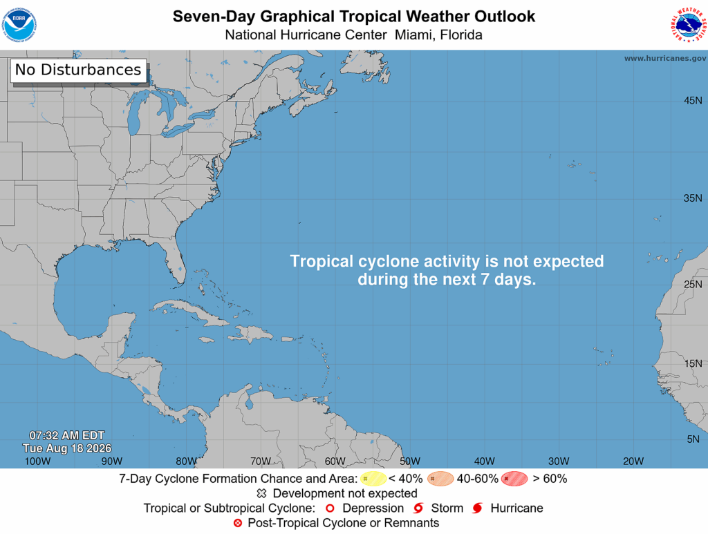
First of all, it would be extremely unusual to not have any Atlantic hurricanes during a season. In the last 50 years, when forecasters have had satellites and other modern detection tools, no season has gone without a hurricane. The latest date for a hurricane formation in any of these seasons is September 11, which happened in 2002 and 2013. So we are almost certainly going to get some hurricanes this year, although I would not necessarily bet on it happening before September 11.
Right now the Atlantic is just hostile to hurricanes, especially with a rapidly strengthening El Niño. We saw two reasonably promising tropical waves last week, both of which the forecast models were at times excited about, vanish into wind shear and dust. In the next 10 days or so we are likely to see a couple of more tropical waves move off of Africa. It is possible that one of these will develop into a tropical depression toward the end of August. But all available evidence suggests these will remain far from not just the Gulf, but the Caribbean as well.
As always, we will keep watching.
Tuesday
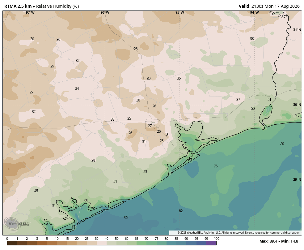
There was a brief period on Monday afternoon, around 3 to 5 pm, when if you stepped outside it didn’t feel that much like Houston. Sure, it was hot, with temperatures in the upper 90s. But we saw enough mixing of some drier air aloft to bring humidity down into the 20s (the map below shows approximate relative humidity at 4:30 pm). It didn’t last long as this drier air was soon swamped by a humid flow off the Gulf, but it was briefly noticeable. I think something similar will happen today and Wednesday, although the effect probably won’t be quite so prominent.
Alas that’s probably the most interesting part of the forecast. Highs today will be in the upper 90s for most of the region, away from the coast, with sunny skies. Winds will be light, perhaps gusting to 10 or 15 mph during the afternoon hours. Lows tonight will only fall to around 80 degrees.
Wednesday through Friday
And not much changes for the remainder of the work week: Inland highs will be in the upper 90s to 100 degrees, with warm and sultry nights. Rain chances are near zero.
Saturday and Sunday
A front will die to the north of Houston, and this will introduce some slight (maybe 10 or 20 percent, at best) rain chances across the region over the weekend. But mostly we expect sunny and hot weather to persist.
Next week
Does anything change next week? Probably not. The rest of August simply looks very hot, very sunny, and very probably rain-free.
