We’re going to have uneven weather this week, mostly warm with some rain showers, before a strong front moves through early next week.
TODAY
Temperatures are a bit cooler this morning, but it won’t last. There are a couple of features that may bring some rain into the region today and tonight.
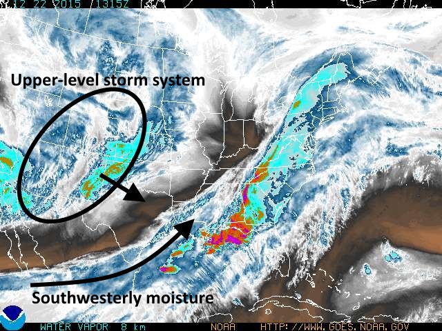
The first feature is moisture streaming up the Texas coast from Mexico, and this will bring a moderate chance of showers into the region this morning, especially for coastal areas.
Tonight an upper-level disturbance will approach the area from the northwest, possibly bringing rain showers into Houston tonight and early Wednesday. It doesn’t appear as though there will be an exceptional amount of energy with this system, although some scattered, severe thunderstorms will be possible to the north of the city of Houston.
WEDNESDAY-THURSDAY
A weak frontal boundary will reach Houston, and likely stall, on Wednesday. This will bring a bit of drier air and perhaps some partly sunny conditions after about the mid-morning hours.
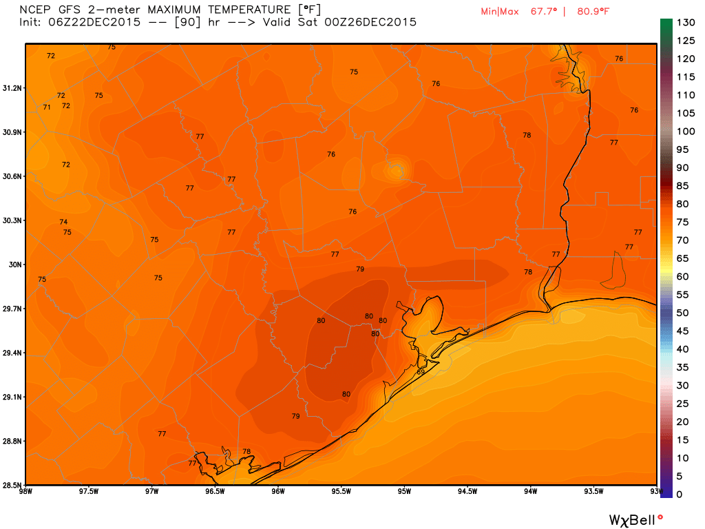
Both days will see very warm weather, with highs near 80 degrees.
CHRISTMAS DAY
The stalled boundary should move back inland on Christmas, making for very messy conditions. We’re talking humidity, highs in the mid- to upper-70s, gray skies and perhaps a few tenths of an inch of rain. Yuck.
WEEKEND
The fun continues next weekend, as additional upper-level systems appear likely to move through the Houston region. This will potentially bring some severe weather chances as well as the possibility of 1 to 2 inches of rain. This hot, wet mess is likely to stick around until Monday or early Tuesday, when a strong cold front should move through.
Eric – the wife and I are taking vacation in New Orleans for Christmas weekend. Looks like warm with rain chances from Thursday – Sunday. Do you see the same?
Eric –
It pains me to say this, but we are simply going to have to put someone else in charge of the Christmas weather next year.
You are still employed the rest of the year, though.
Thanks for keeping us informed, even if the forecast isn’t fantastic. I’ve been missing your Chron.com blog, so thanks for keeping things going here on your website!
Pardon my lack of knowledge but I wish a few terms could be defined; upper level, lower level, disturbance, front. Where does upper begin and lower end?
What does the drought report look like now?
Those who want a white Christmas don’t know what it is like to drive on ice and snow and never know where one’s car will stop, if it stops.
Thank you