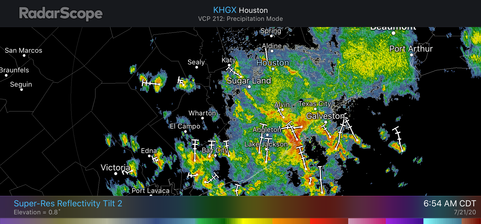
Good morning. For some areas south of town it has been a wild and woolly night, with near-constant thunder and lightning. Some parts of League City and Dickinson received 4 or more inches of rainfall since around 2 a.m., while areas north and west of Houston have received nary a sprinkle. This fairly wet pattern should remain in effect through Saturday, or possibly even Sunday as another tropical wave approaches the coast on Friday. This wave has a pretty decent chance of becoming a tropical depression.
Tuesday
Showers along the coast should move inland and westward later today before fading out this afternoon or early evening. Most of the area probably will receive 0.5 to 1.5 inch of rain, but as we’ve seen in southern parts of the region overnight, some locations may sit under slow-moving storms and receive more. So far rainfall rates have generally been under 1 inch per hour, which has prevented any significant flooding. Cloudy skies and rains should help limit high temperatures today to about 90 degrees. Any storms that develop Tuesday night should be of a more scattered, and less concentrated nature.
Wednesday
The atmosphere on Wednesday should allow for another healthy chance of showers, but we don’t anticipate them being as intense or widespread as storms on Tuesday. Highs will again be limited to about 90 degrees with mostly cloudy skies and rain to help cool surface temperatures.

Thursday
Thursday may provide a bit of a reprieve from rain showers, with only scattered storms developing, and partly to mostly sunny skies. This may allow high temperatures to rise into the low 90s.
Friday and Saturday
As the weekend comes upon us, another tropical system will approach Texas. An increasing number of ensemble members of the European model show this system developing into a tropical depression as it moves westward across the Gulf of Mexico toward Texas, with most ensemble members presently bringing the storm to the Central Texas coast on Saturday. The National Hurricane Center has increased the odds of a depression or tropical storm forming to 40 percent, and I’d say the odds are probably a little better than that.
However, right now none of the forecast models are particularly bullish on rainfall totals, with most bringing an additional 1 to 3 inches of rain to the Houston region on Friday and Saturday. One reason for the lower amounts is that the storm will likely move westward at a fairly high clip, and then keep moving. Even so, this is less rain than one would generally anticipate from being on the wet side of a tropical system.
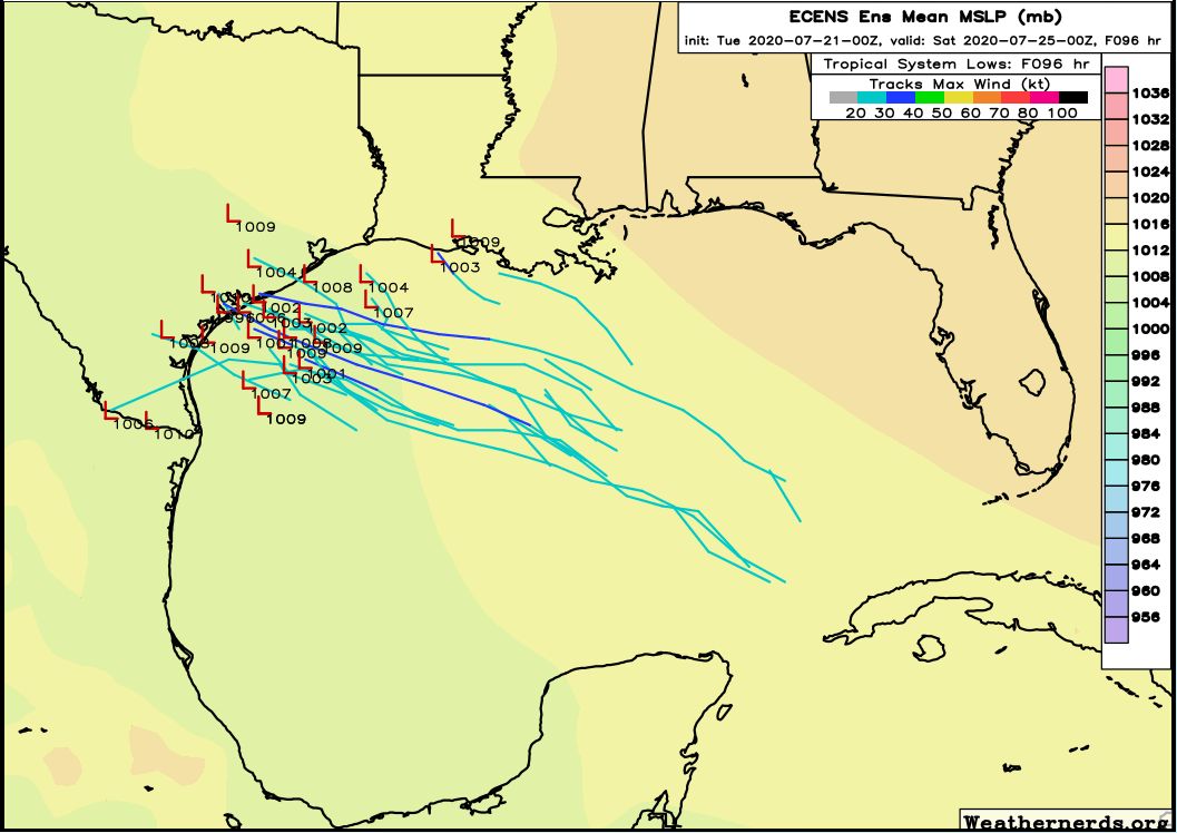
In any case, you never really want to see a low pressure system moving across the open Gulf of Mexico in late July, and we’ll be watching this one for signs of strengthening and potential for making significantly more rainfall. But at this time our overall concerns remain fairly low.
Sunday and beyond
As we get deeper into the weekend and next week highs probably will climb back into the low 90s, with rain chances backing off to normal chances of 20 or 30 percent daily. Overall confidence in this forecast is fairly low, however.
We’re getting a nice general misting for the area so I’m hopeful that the tropical wave this weekend keeps chugging along fast and takes its ball of water to West Texas to give them a drink.
I guess my question would be what are the danger signs we should look out for if it were to become something hazardous? If it stalled out over the gulf?
It’s Really struggling to get rain in The Woodlands so far (0.01 inches as of 9 AM). Looks like just 20 miles south it’s really soaking. I’m hoping it all moves north. Well if not for Saturday’s surprise thunderstorm, I’d be a bit more worried about the yard. At least the forecast for the next week looks great!! I’d say bring it on with the Friday/Saturday system!! It will probably give The Woodlands some really beneficial rainfall.
Temps have been really pleasant lately. mid 80s-low90s with overcast is quite nice and low temps are a bit cooler than they were last week. I like it warm, humid and rainy as opposed to hot, sunny, and humid!!!
We had .25″ yesterday and .07″ so far today at my house in Champions. I like this kind of weather in July, but my son’s baseball game might get rained out tonight.
0.25″ yesterday and 2.6″ so far today around Ellington. Rain woke me up at 2:15 and thunder at 4:30. At least the A/C has not run this morning. When I woke up it was cooler outside the house than inside.