It’s yet another one of these non-winter mornings across Houston, with low temperatures of around 70 degrees. It’s enough to make one wonder whether the region will get through this winter without a prolonged cold spell, and I’m increasingly confident the answer is yes. We might be done with freezes, as well.
For most of central and southern Houston and Harris County, the average last freeze date falls in mid-February. It’s not going to freeze again before then, and by extension I’d be confident in planting from here on forward. For areas north of there, including Montgomery County, the freeze date is generally later, in the latter part of February or early March. Even so, I’d bet the chances of another freeze for the greater Houston metro area this year, including areas like Montgomery County, is now significantly less than 50 percent.
Finally, here’s a tidbit about Dallas’ winter from Victor Murphy, of the National Weather Service—February 5 is date of the earliest last freeze in Dallas-Fort Worth. The average date of the last freeze is March 13. It’s possible this year that the city’s last freeze of winter will have come all the way back on January 8th.
(Space City Weather is sponsored this month by Darrell Lee’s The Gravitational Leap)
Today
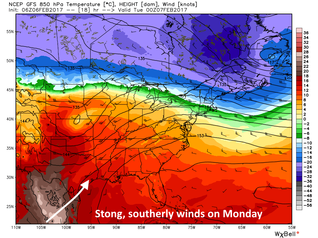
Some areas along the coast are seeing dense fog this morning, but it should burn off by around 9 am. Today will see some gusty southerly winds by the afternoon hours, and warmth and moisture flows into the region from the south. Highs today will reach about 80 degrees, with a slight chance of showers, and we’ll see another warm night.
Tuesday and Wednesday
Hello, warmth. As this warm, southerly flow continues look for temperatures to rise into the low 80s on both days, and the region could set record highs (80, Tuesday, and 82, Wednesday for Bush IAH). Rain chances will be near zero.
Thursday and Friday
A weak cold front will arrive by Wednesday night to provide a bit of a reprieve from our uncharacteristic February warmth. This should knock high temperatures back to about 70 degrees, with sunny days. Lows may be in the low 50s.
This weekend
Warmth returns for the weekend, although it won’t be quite as much as the mid-week heat. Look for highs in the upper 70s, with partly sunny skies. Some scattered rain showers will be possible but I’d bet most of the region remains dry. Another front arrives early next week, in the Monday-ish time frame, and that could bring a decent chance of rain with it.
Posted at 6:45am CT on Monday by Eric
For those who do not believe in Earth warming and climate change, I say welcome to Houston. I love the city but detest the weather.
That and the traffic.
Plus, for me, the lack of a hockey team at any level of play.
Dang, you guys were supposed to bring in a prolonged freeze, sleet, snow, ice storms, while my wife and I were in Hawaii
Grrrrr!
Winter can’t end…. if it never began.
You are so right!
Do you think we can expect this pattern for winters going forward (due to climate change) or is this just an unusually warm year?
I think it’s a bit of both.
So could you do a tomato forecast. When should we plant? If it isn’t going to freeze it might be go time.
The Earth has warmed and cooled since it’s inception. Nothing new
With apologies to the Bard, in Houston “Winter’s lease hath all too short a date.”