Houston’s opportunity to be the proverbial center of the universe has once again arrived, and we can continue to provide mostly good news: No major weather worries will impact the area this weekend. Instead, we have a few minor issues of consequence to monitor.
Today
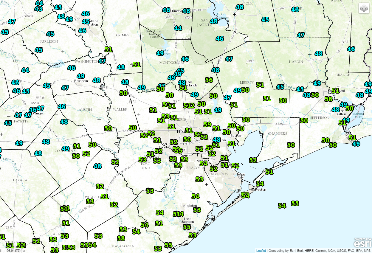
The forecast for the end of this week has evolved quite a bit from where it looked earlier this week. A cold front passed through the region Thursday, and we’re seeing a much cooler start to the day. Temperatures range from the mid to upper 40s north to mid 50s south.
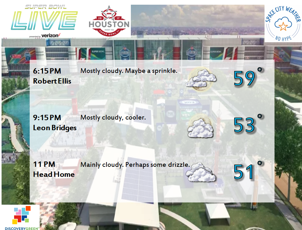
Other than plentiful low clouds and perhaps some drizzle, it should be a quiet day today. Expect temperatures to peak near 60°. If you’re heading out to Super Bowl Live at Discovery Green or any of the myriad of activities going on around town this evening, it looks good, but you will probably want a light jacket.
(Space City Weather is sponsored this month by Darrell Lee’s The Gravitational Leap)
Saturday & Super Sunday
It looks like Houston’s set up for another “okay” day tomorrow. Expect a mix of clouds and maybe a little sun. Light rain or drizzle will again be possible. High temperatures should be similar to Friday, in the upper 50s to perhaps around 60 degrees.
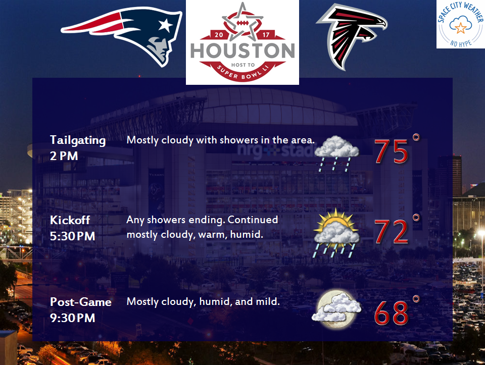
For Sunday, things do get a little trickier. On a normal weekend, this would only have minor implications. But on this weekend, it will have a huge impact on how the main event plays out. Yesterday’s cold front is going to crawl back north through the region as a warm front. That means warmer, more humid air will return to Houston. Expect temps to climb into the 70s Sunday afternoon, along with gradually building humidity. Additionally, we’ll probably have hit and miss showers and perhaps even a rogue thunderstorm along the front as it moves through.
Kickoff is 5:30 Sunday evening. Models are showing showers dissipating around or after 6 PM. It’s going to be a very close call.
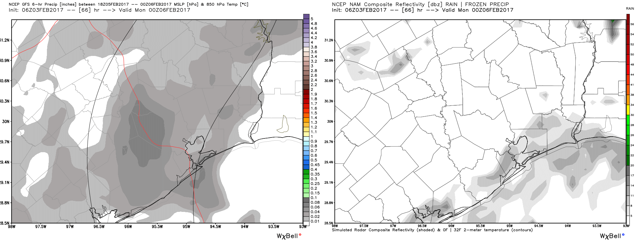
If the game kicked off at 7 or 8 PM, I’d feel good about an open roof. But the reality is that at this point, it’s probably a 50/50 chance at best (still a higher chance than a Texans home game). The NFL will make that determination either tomorrow or even as late as early Sunday, pending the forecast.
Next Week
Texas is in for quite a warm up next week. We should do mid to upper 70s on Monday, with a slight chance of showers and probably a little fog. Tuesday will be interesting. A cold front will approach during the day. If it gets here early and sends the humidity down, we could be in for an extremely warm day, with mid 80s attainable. Regardless, we should be able to test 80° on Tuesday afternoon without a lot of trouble.
Much more pleasant air will filter in behind Tuesday’s front, with mid to perhaps mid to upper 70s at best and low temperatures back in the comfortable 50s. However, another sharp warm up is in store toward next weekend. In fact, warm weather may be the story going forward. A longer range climate model, the CFS (shown below), has been consistently calling for a massive burst of warm temperatures in the U.S. for mid-February.
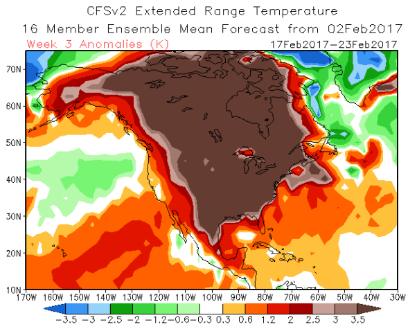
Though the CFS has a somewhat checkered track record, the consistency of the warmth it’s been showing is impressive. Odds seem to favor a mostly prolonged period of warm weather in Texas and/or the Central US. I don’t think Houston’s winter is totally over yet, but we might be left waiting for it to show up again.
Posted at 6:45 AM Friday by Matt
I put the chances of an open roof at zero for Super Bowl.
Any thoughts as to why this winter is so warm?
Think it’s partially an El Nino hangover, partially the fact that La Nina winters tend to be volatile with strong Southeast US ridges. The roller coaster ride early winter was a nice hallmark of that I think. There’s also likely a background climate change signal helping as well. Mild winters aren’t unusual. Mild winters this persistent and intense are.
Is this abysmal lack of winter part of climate change, is it part of a normal cycle that happens every so many years, or is it possibly an “alternative fact” season???!!
Thanks, and as always, I totally appreciate your wonderful information on the weather!
Excellent use of “alternative fact” in this case! It’s likely related to climate change to some extent, though not necessarily driven by it. My reply to Blackhawks fan above basically says that it’s almost certainly related to both last year’s record El Nino (hangover warmth) and this year’s La Nina (favoring a ridge and warm weather in the Southeastern US). But there’s likely a background climate change signal helping to enhance things somewhat. These sort of relationships are always complicated.
The poop color for the heat in mid February is appropriate.
Agreed!
Where’s that polar vortex thing when you need it?
Literally three weeks of temps under 70 this winter. I hear you about El Nino and La Nina, but this is scary.
I am completely bummed that despite a warm winter we had two days in the low 20’s which was hard on my landscaping and that of many others. The copious amount of dead palms and other plants pay tribute to the two coldest nights in 4 years.