As of noon on Saturday the heaviest rains associated with today’s storms have moved through central Houston and are pushing off to the east.
Finally, right?
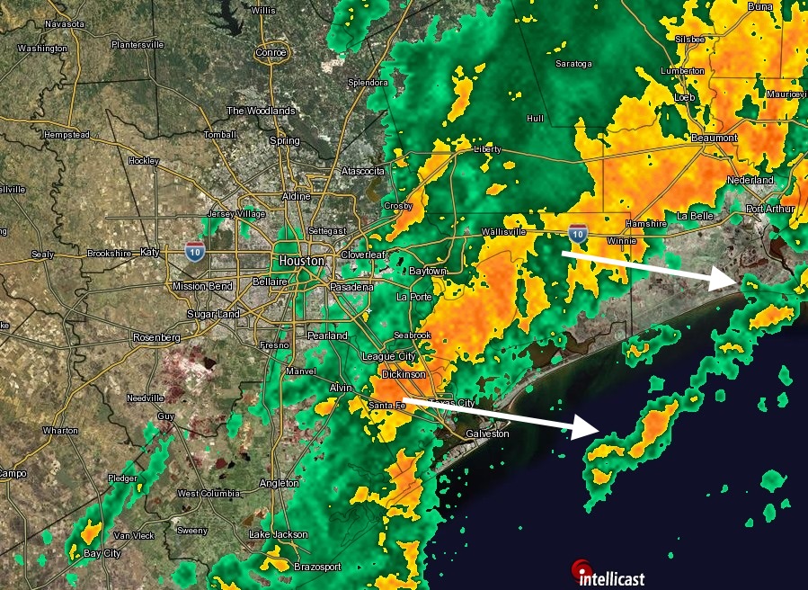
Radar snapshot at 12:05 pm CT. (Intellicast)
Although forecasts for the timing of the heavy rains were accurate — I had pegged midnight Friday to noon on Saturday for the most intense rains — amounts were not. Instead of isolated areas of six or more inches, widespread areas of the metro region received that much. And isolated areas to the east-northeast of Houston, including Crosby, received a staggering 11 inches of rain during the last 24 hours.
A broken line of heavy thunderstorms has reached western Harris County as of 8 a.m. CT and will move through the metro region during the next several hours.
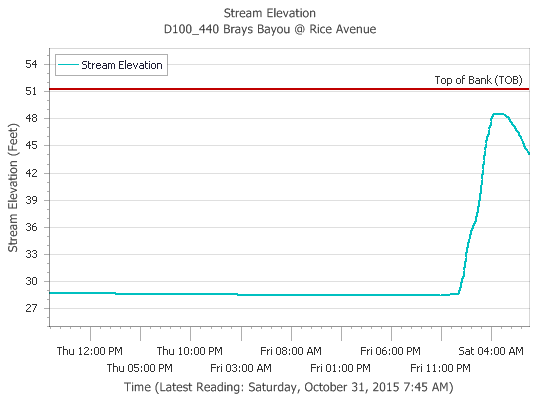
These storms could bring an additional 1 to 3 inches of rain to Houston, but fortunately many of the region’s bayous have had a couple of hours to recede.
Brays Bayou at Rice Avenue has receded 5 feet from its early morning peak. (Harris County FWS)
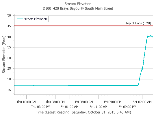
Very strong thunderstorms are moving through Houston this morning, and as of 5:30 a.m. as much as 1 to 6 inches of rain have already fallen. This is producing some street flooding, but so far bayous have largely remained within their banks.
Brays Bayou at South Main has seen a significant rise during the overnight hours but is holding within its banks for now. (Harris County FWS)
The first round of storms has now largely moved off to the east, but another significant line of showers is coming in from the west. They will likely arrive in western Harris County by about 6:30 a.m.
These thunderstorms are capable of producing rainfall rates of 2 to 4 inches per hour, but the good news is that they are generally progressing. This means the heaviest rain should move through before noon. These storms could test some bayous before then, however.
As I have been saying, outdoor activities on Saturday morning are highly discouraged. Many streets are flooding, there have been multiple tornado warnings in the southeast part of the city, and more storms are on the way. According to Harris County sources, there is extensive damage around Danbury and Friendswood, and possible injuries at a mobile home park in Brazoria County. There have also been reports of a tornado in Pasadena. Some 25,000 Reliant customers are without power.
We still should see a clearing pattern throughout the day, with rains ending by afternoon or early evening for most areas.
The radar is mostly quiet across Houston this evening with heavy heavy rain remaining far to our northwest and southeast. I expect showers across the city to stay scattered to non-existent until around midnight or so.
Between midnight and Saturday morning there should be intermittent moderate- to heavy- showers across much of Houston, but for widespread heavier rain we may have to wait until after sunrise.
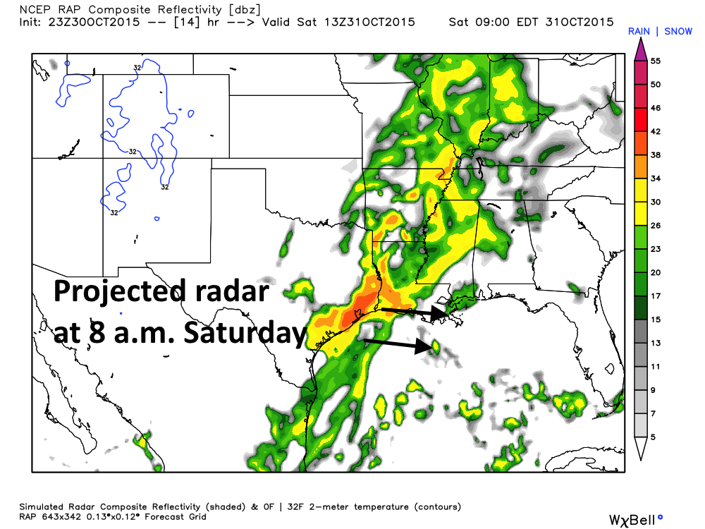
RAP model forecast for radar reflectivity at 8 a.m. CT on Saturday. (Weather Bell)