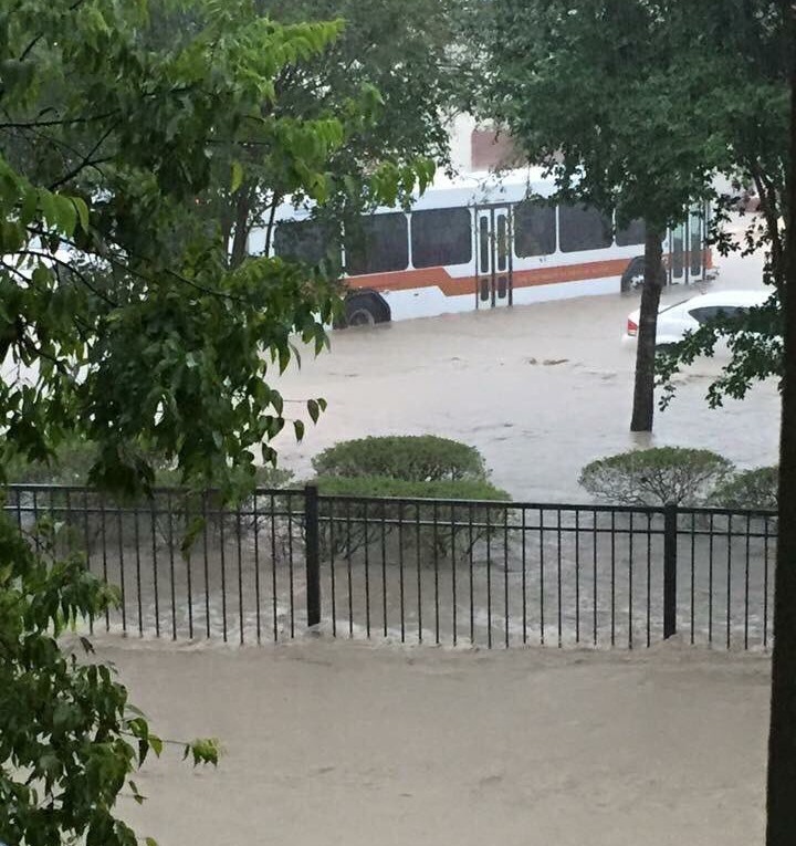
You may have seen the extreme weather in central Texas this morning — some areas near Austin received 10 inches of rain in two hours — and understandably had the concern that similar conditions are coming to the Houston region later today, tonight and on Saturday.
Flooding at the University of Texas on Friday. (Collin Meyers, KEYE-TV)
The short answer is, I don’t think so, at least not so extreme conditions.
The forecast for this weekend remains pretty much the same as I’ve been describing it all week. Please remember this isn’t a guarantee. Nailing the precise timing of rain events like this is an inexact science, but we can have decent confidence in this forecast.
FRIDAY
Breezy conditions, with strong southerly winds. Rains approach Houston from the west, perhaps reaching the western part of the metro sometime during the early afternoon hours, and the rest of the area during the mid- or late afternoon hours.
FRIDAY EVENING
Rains move in from west to east, starting with light rain, building to steadier storms by roughly 7 to 10 p.m. Most areas will begin to see some rain. Additionally the strong southerly winds could push tides 1 to 2 feet above normal. A coastal flood advisory is in effect.
FRIDAY NIGHT
Heavier rains move into central Houston just before or after midnight on Friday. It’s not clear whether the biggest burst will come over inland counties or closer to the coast. 1 to 2 inches are possible. Thunderstorms likely.
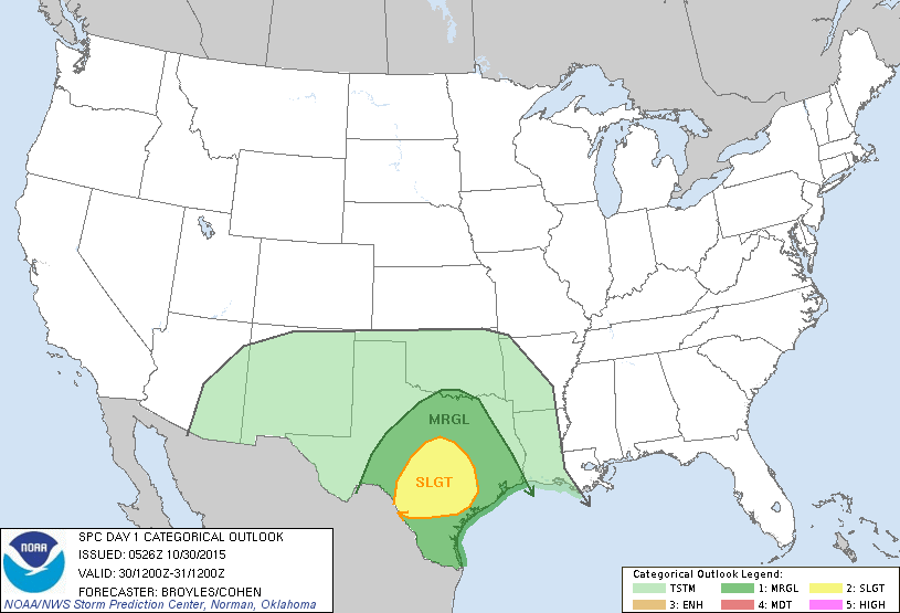
According to NOAA, conditions for damaging winds, hail and isolated tornadoes are highest over central Texas. (NOAA)
Good morning, and welcome to my weekday morning update on conditions ahead for the greater Houston area.
TODAY
It’s one of the coolest fall mornings of the year across Houston, with temperatures generally in the mid-50s across the region. This is courtesy of a front that moved through on Wednesday, and we’ll have a pleasant day with highs only around 80 degrees.
THREE DAYS
Later Thursday and into Friday winds out of the south-southeast will increase, bringing a quick return of humidity to the area, and raising atmospheric moisture levels. This, in combination with a storm moving in from the west, will set the stage for a rainy Friday night and Saturday.
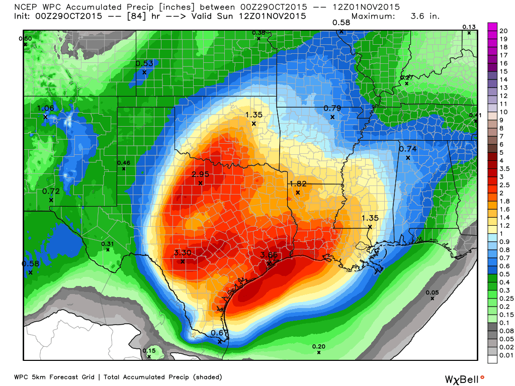
Heavy — but not extreme — rain is likely on Friday night and Saturday in this map of accumulated rainfall. (Weather Bell)
There have been a lot of questions about conditions on Friday night and Saturday so I thought I’d provide a brief update on what the latest forecast models indicate will happen. Please remember this isn’t set in stone. Nailing the precise timing of rain events like this is an inexact science, even two or three days out.
FRIDAY EVENING
Rains move in from west to east, starting with light rain, building to steadier storms by roughly 9 p.m.
FRIDAY NIGHT
Heavier rains move into central Houston just before or after midnight on Friday. It’s not clear whether the biggest burst will come over inland counties or closer to the coast. 1 to 3 inches are possible. Thunderstorms likely.
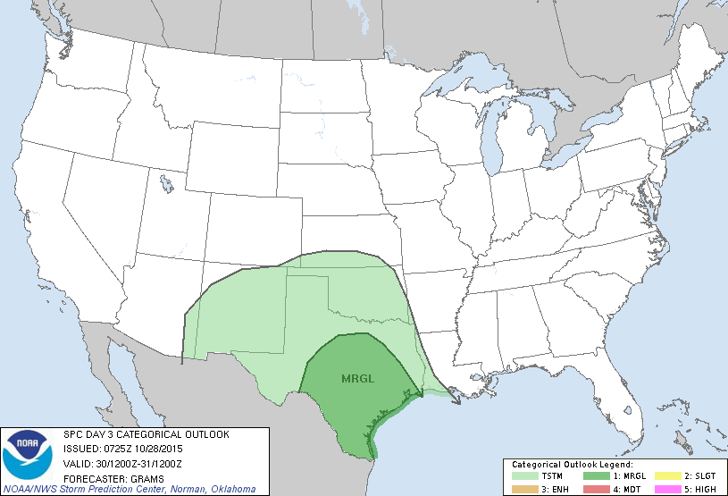
Houston is included in an area that faces a marginal risk of strong winds and isolated tornadoes on Friday night and Saturday morning. (NOAA)