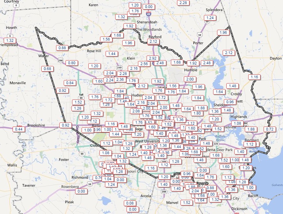
Did the thunderstorms wake you last night? They were a bit stronger and more widespread than anticipated, as the upper-level disturbance in the atmosphere was able to really produce a vigorous upward motion in the lower levels of the atmosphere. As a result most of the Houston area received 1-2 inches of rain during the last 24 hours. Fortunately the heaviest showers came during the overnight hours, as expected, and have now moved along.
24-hour rain totals in the Houston metro area. (HCOEM)
We’re getting close to the point where we can start to look at 10-day forecasts for the marathon, but we’re not there yet. Still, the models remain pretty consistent regarding probable conditions that we’re likely to see for the morning of the run, and the best news is that there’s still no signal whatsoever for very warm conditions.
Right now we’re looking at a strong cold front coming into Houston on Saturday, Jan. 9th, which will keep the region cooler than normal through next Tuesday. The period of next Wednesday through Saturday, Jan. 16th appears to bring near-normal or slightly warmer than normal conditions. However the models appear to be trying to bring a cool front into the region something around Saturday, January 16th. I have to say that trying to time cool fronts 10 days ahead of time is really challenging.
The GFS model forecasts temperatures slightly below normal for Sunday, Jan. 17th. (Weather Bell)
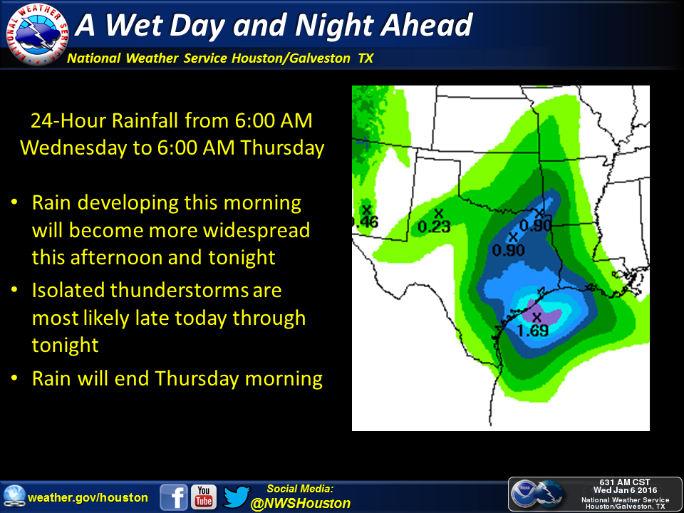
After three sunny days gray skies and rain return to Houston.
TODAY
Dry air is moving off, and being replaced by moist, warmer air. A disturbance in the upper levels of the atmosphere will bring the impetus for rain. Light showers are possible this morning, with heavier stuff later this afternoon and especially tonight across the Houston area. Although I don’t expect any severe weather, much of the region should see a good 0.5 to 1.5 inches of rain.
Not much has changed since yesterday’s forecast. In about a week’s time, give or take, it appears that a large amount of Arctic air will spill into the Midwestern United States. What’s not clear is whether that air will be shunted off to the east, or whether much of it will continue moving southward into Texas. For the marathon’s purposes, it may not matter a whole lot.
After that feature, during the second half of next week, the models bring a somewhat warmer air mass into the eastern United States, including Texas. However by the weekend of the marathon it appears that air, too, has moved on, which would leave conditions cooler than normal.
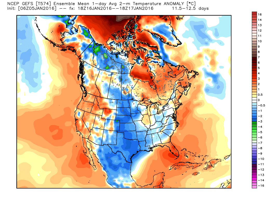
Here’s how the GFS model suggests conditions will be between noon Saturday, January 16th, and Sunday, the 17th. The model is suggesting temperatures 3 to 5 degrees Fahrenheit below normal for Texas, including Houston.
Temperature anomaly for Saturday night and Sunday morning, Jan. 17th. (Weather Bell)