Almost finished with the rain risks

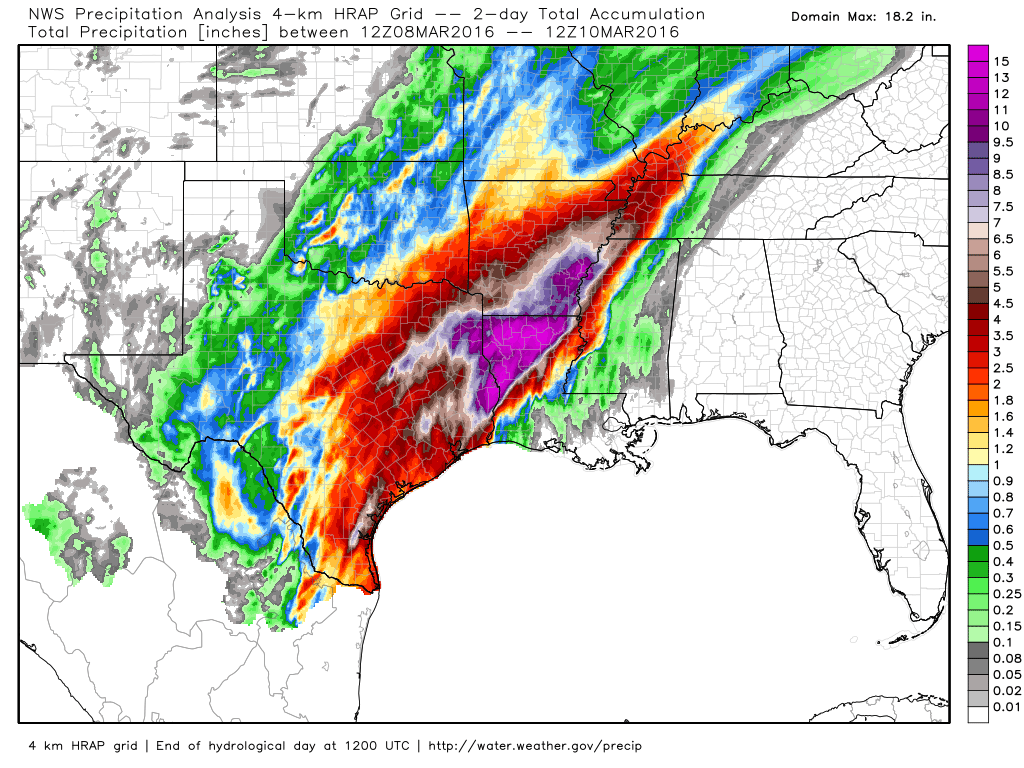
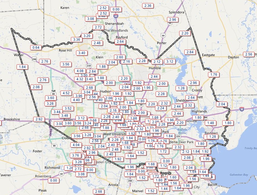
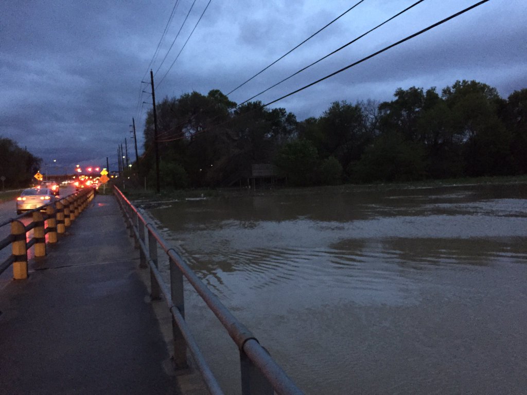
Eric touched on the flooding issues for our friends to the east in the Sabine River basin yesterday. Check that post and visit the NWS Lake Charles website for the latest. Locally, here are the latest flood gauge levels and forecasts around Houston.

We got away with a mostly quiet Thursday. Judging by the weather model trends, today will hopefully have a similar outcome.
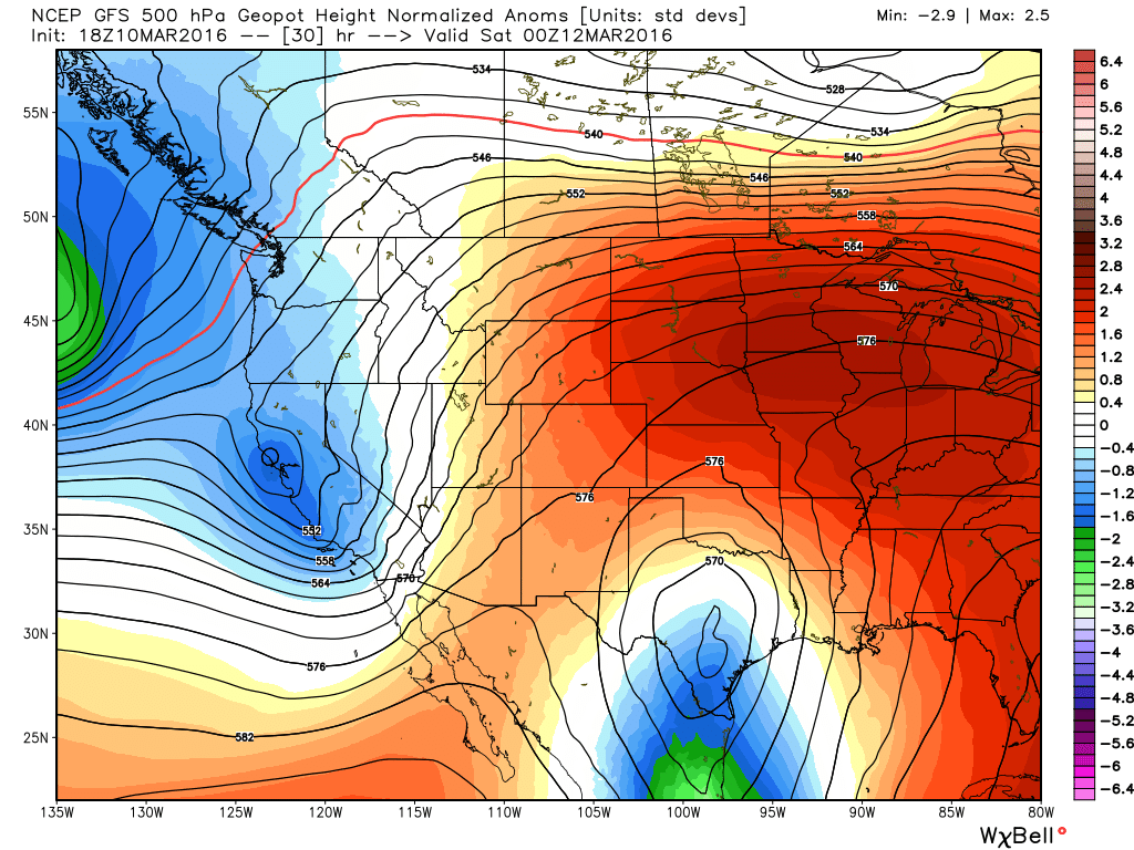
TODAY

The upper low over Mexico the last couple days is projected to end up over South Central Texas this afternoon. That means we are slowly drawing closer to the end of this frustrating weather pattern.

Upper level low moves over South Texas this afternoon and evening. (Weather Bell)


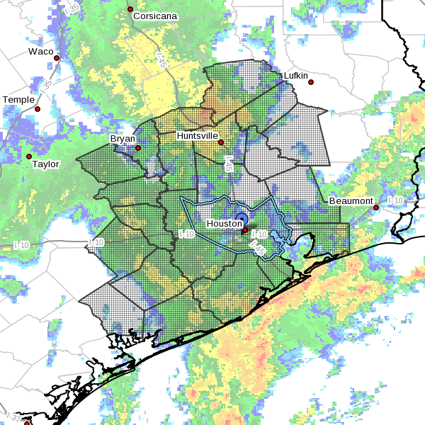
There will still be a few spokes of energy pivoting around the upper low today, so we will still carry a chance of showers or a thunderstorm throughout the day (showers this morning are popping up west of Houston already). But the heaviest storms will be in Eastern Louisiana and Mississippi. There will also likely be areas of showers/storms on the periphery of the upper low in interior Texas (basically north, west, and south of us). That puts us in between. So I’ll put an optimistic spin on things and say, “Yes, a chance of showers or storms through the day today, but I will lean toward the bulk of the day not being too bad.” We’ll see if that works out.

See full post

Houston escapes major flooding, but Sabine River facing historic rises

As expected the rains have moved out of the greater Houston region, and the heaviest storms are now over central Louisiana. Although a flood warning is in effect for Cypress Creek today in Harris County, only minor flooding is expected for portions of Sharp Road and Katy Hockley, which will may become inundated and possibly impassable later today or tonight.

The story is different to our east. Take a look at the total rainfall received in the Texas-Arkansas-Louisiana area during the last 48 hours. Note the very large area of 12 to 15 inches of rainfall in the Barney-colored purples.

Rainfall accumulation during the last 48 hours. (National Weather Service/Weather Bell)

See full post

Heavy rains overnight now moving off to the east

Well, some heavy rain finally came overnight, with 1 to 4 inches generally falling across the Houston area. We were lucky. A region along the Texas-Louisiana border north of Beaumont received 6 to 10 inches overnight, and there are major flooding problems.

Here’s a look at the overnight rain totals in Houston.

Rain totals during the 12 hours preceding 6:40 a.m. CT Thursday. (HCOEM)


According to the Harris County Flood Control District, here are a list of watersheds affected by the rains:

Little Cypress Creek:
Creek is overbanks at Becker Rd with minor flooding in progress. Subdivision on the south side of the creek west of Becker Rd may experience some flooding of the streets as water backs up into the underground system. Creek continues to rise slowly, but looks like it is close to crest.

Upper Spring Creek:
Creek is overbanks from the headwaters to below Hegar Rd. Field Store Rd and Hegar Rd have flooding over the roadways. The creek is continuing a very slow rise.

South Mayde Creek:
Creek is overbanks at Greenhouse Rd. Creek has crested and is starting to fall. Greenhouse Rd is passable.

South Madye Creek at Greenhouse is falling this morning, and passable. (Harris County Flood Control District)
South Mayde Creek at Greenhouse is falling this morning, and passable. (Harris County Flood Control District)


Upper Cypress Creek:
Creek is nearing bankfull at Sharp and Katy Hockley and will likely exceed banks later this morning. Current RFC forecast brings the creek to near 158.5 ft tomorrow morning. Minor flooding is likely along the channel from the headwaters to upstream of US 290. Portions of Sharp Rd and Katy Hockley will likely become inundated and possibly impassable.

Little Mound Creek:
Creek is overbanks and continuing to rise and may be close to impacting Mathis Rd.

West Fork San Jacinto River:
River began a rapid rise overnight. It is forecast to crest at 51.3 feet Friday morning.

Now let’s move on to the forecast.

See full post

Flood watch extended through Thursday morning

The National Weather Service has extended a flash flood watch for the greater Houston area through 6 a.m., and it does appear a fairly broad line of storms is moving in from the south.

Area of flash flood watch in effect until 6 a.m. CT Thursday. (National Weather Service)


These storms could provide heavy rain showers across parts of the Houston area, especially along the coast and to the east of Interstate 45, during the evening hours.