Houston so far today has missed out on heavy rain as the showers have developed mostly to our west and north. Here’s a look at rainfall totals, through 11 a.m. CT, for the last 24 hours.
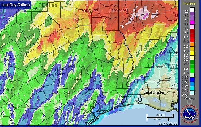
Houston so far today has missed out on heavy rain as the showers have developed mostly to our west and north. Here’s a look at rainfall totals, through 11 a.m. CT, for the last 24 hours.
Well the rain totals so far sure have been underwhelming. Personally, I blame Matt. I go to Seattle for a couple of days and everyone starts busting forecasts around here. (Kidding! Matt’s great. Rain events like this are pretty notorious to try and forecast, in terms of pinpointing the heaviest rain, even though conditions really seemed to line up for this one last night). Anyway, let’s discuss what may be ahead.
TODAY
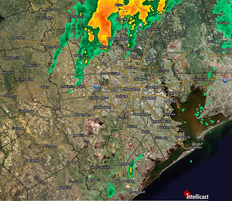
We’re still going to see intermittent periods of heavy rain, even though most of the action so far has been to the north of the Houston metro area. A flash flood watch remains in effect for the entire metro area through 6 p.m. and there’s certainly the potential for an additional 3 to 6 inches of rain between now and Thursday morning. But after this morning’s bust I am in no way calling definitively for that.
This storm has been maddening. You have to walk a very fine line between panicking people and providing actionable information. The balance is between the weather models (screaming 5-10″ of rain), the reality that big rain events aren’t that uncommon here, and the fact that people have a recent disaster (Memorial Day 2015) fresh in mind. It makes it difficult to communicate the information effectively. I know a lot of events and even some schools have been cancelled tonight and tomorrow. And it hasn’t rained much around Houston yet today, so people have to be very confused.
Here’s the scoop.
RECAP OF TODAY
The worst of this event was always supposed to be overnight tonight into tomorrow. Recall this morning, I said that most areas would see 0.5″ or less in all likelihood during the day today. Most have.
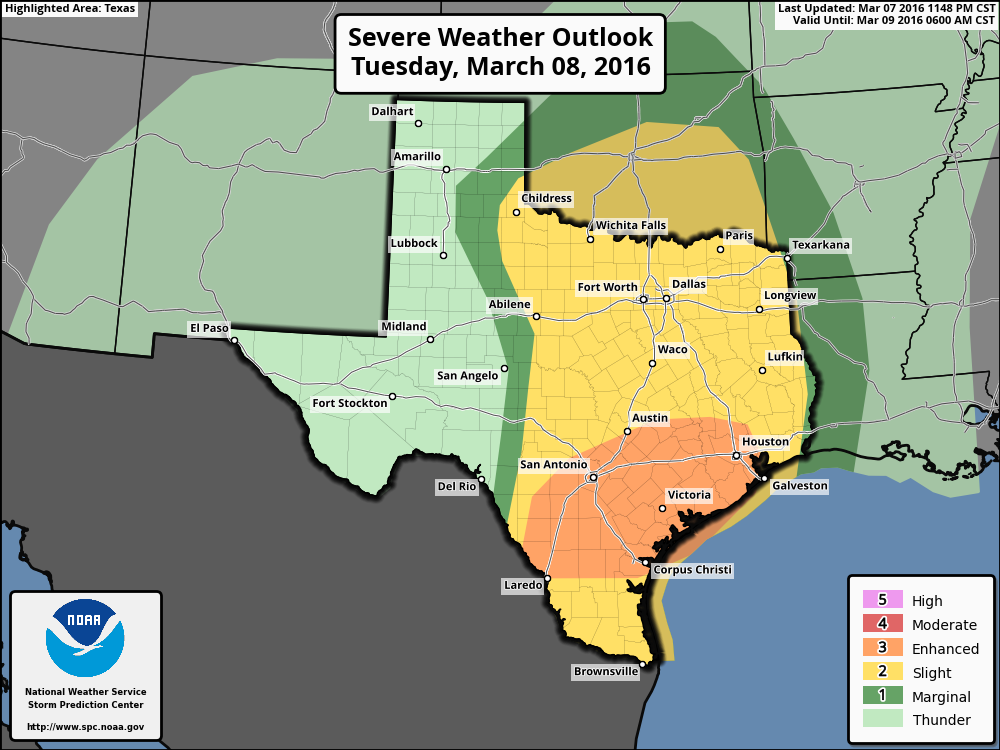
The good news today has been a very distinct lack of severe weather in Southeast Texas. We’ve managed to get through without any serious issues or warnings. The best parameters for severe weather will continue to exit to our east this evening and any tornado threat overnight will likely stay closer to the Golden Triangle than in Houston.
Good morning. It’s going to be a busy day across Southeast Texas, especially as we get deeper into it. I’ll update the Facebook page this afternoon if conditions warrant, and look for another post here this evening, once we get just a little more clarity on how things tonight into Wednesday will unfold.
THIS MORNING & AFTERNOON
There should be no serious issues this morning. A few showers will be around, but severe weather should be absent from our area. A few stronger storms could get going east of I-45 by Midday however.
Houston will be in an interesting spot today. The atmosphere is capped at present (meaning there’s basically a “lid” on things that will suppress storms this morning). As the day goes on, that cap will dissipate, and we’ll be able to start generating thunderstorms. What does all this mean in English? It may take some coaxing to get storms going today. That said, once they do get going, it won’t take a lot for them to become strong or severe, so you’ll want to stay on guard today.
So bottom line: Scattered showers and hit/miss thunderstorms today. Rain totals should be manageable outside of the heaviest activity. Most folks should see 0.5″ or less during the daytime today, with isolated higher totals in any more stubborn storms (where up to 2″ or so will be possible).