An unsettled weather pattern for Houston

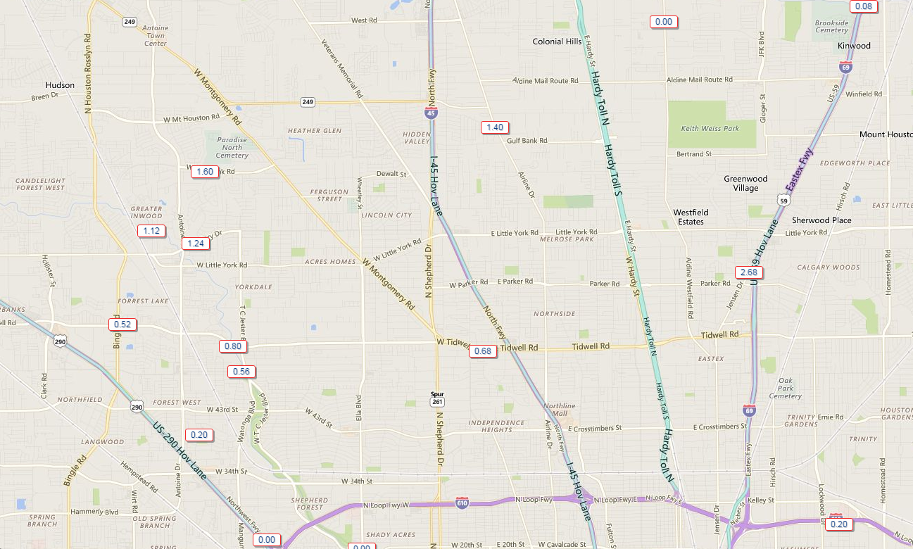
The Houston area has had an interesting couple of days. I think Eric and I have both been surprised by the intensity of some of the sea breeze storms that have fired the last two days. Yesterday saw areas north of Downtown get hammered, with US-59 between Tidwell and Little York especially hard hit by over two and a half inches of rain.

A couple slow moving storms dumped 1-3" of rain north of Downtown yesterday afternoon. (Harris County Flood Control)
A couple slow moving storms dumped 1-3″ of rain north of Downtown yesterday afternoon. (Harris County Flood Control)

So as we go into the weekend, shall we expect more?

Today

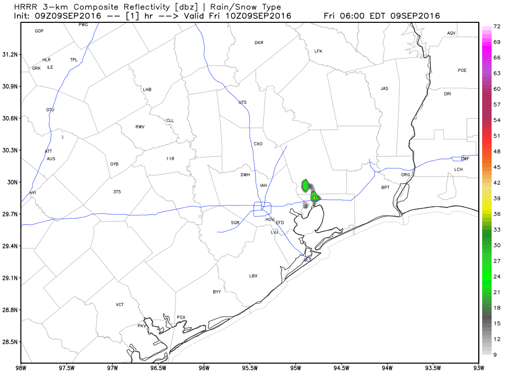
We’re already seeing a few showers this morning, mainly in Northeast Harris and Liberty Counties.

Radar shows just a few showers drifting north and northeast toward Liberty County. (GR Level 3)
Radar at 6:15 AM shows just a few showers drifting north and northeast toward Liberty County. (GR Level 3)

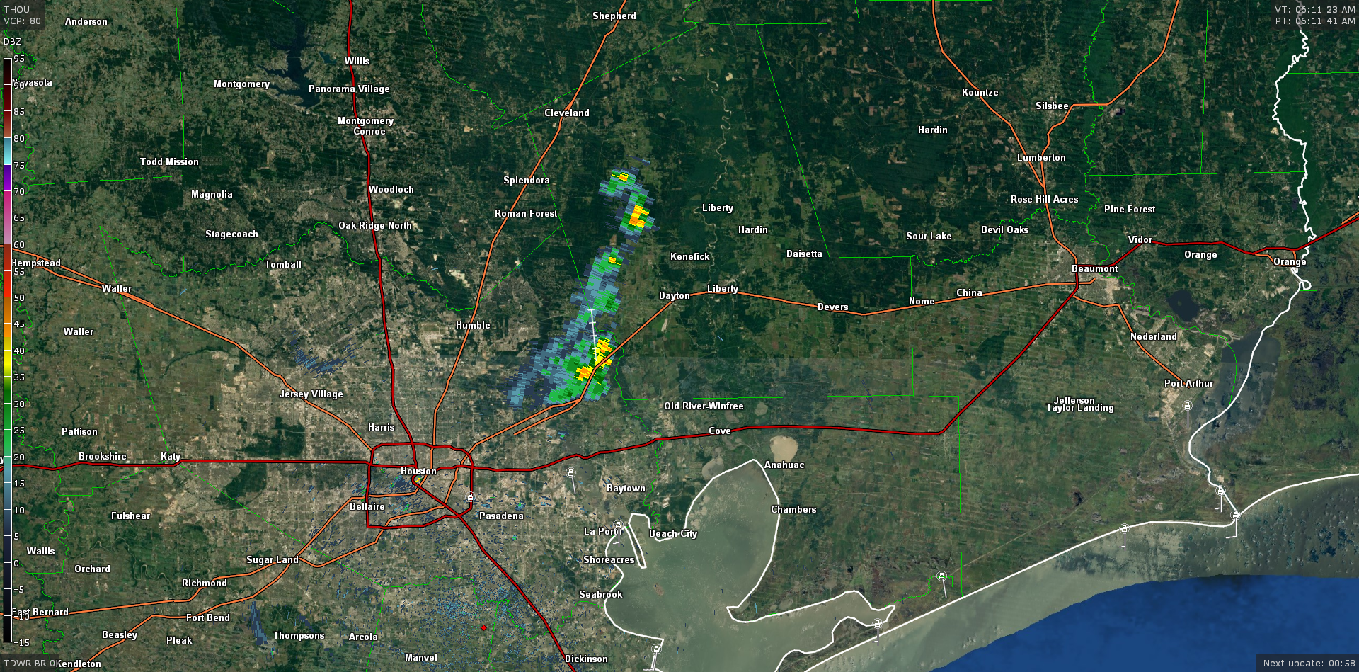
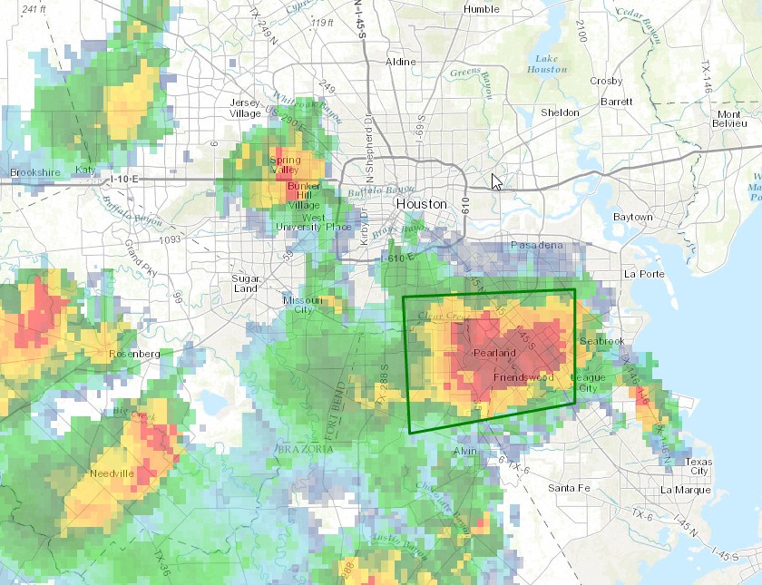
As we head into this afternoon, storms may be a bit more numerous compared to the last couple days, but that won’t mean that everyone sees rain. As is usually the case, sporadic downpours will be capable of producing 1-3″ of rain in a few spots this afternoon. I suspect a good bunch of the area will not see showers though. So it’s a game of luck today, with the most favored areas initially being east of I-45 and south of US-59 as you head southwest of Houston, then spreading north and west.

HRRR model suggests widely scattered showers & storms this afternoon, diminishing in the evening. (Weather Bell)


Temperatures have struck the mid 90s before rain the last few days. We may do that again today, but I’m guessing that with showers getting an earlier start, low 90s may be the best we can do.

See full post

Slightly cooler this weekend, with continued rain chances

The intensity of showers near Sugar Land and Pearland on Wednesday afternoon surprised me somewhat, as isolated areas saw in excess of three inches of rain along the sea breeze boundary.

Thursday

We’re going to see warm conditions again today, with high temperatures likely rising into the low- to mid-90s. We could again see some sea breeze shower activity this afternoon, with some scattered storms. However I would be surprised if the storms were quite so intense as those on Wednesday, which necessitated a flood advisory. In any case, expect any storms to die down in the early evening hours with the loss of heating.

Friday through Sunday

For this weekend, alas, a cold front appears likely to stall out well before reaching the greater Houston metro area. At the same time some lower pressure will move in from the east, into the upper Texas coast, and draw upon moisture from the Gulf of Mexico. The net effect of this for Houston is that high temperatures should be around 90 degrees this weekend, under partly to mostly cloudy skies, with summer-like humidity. There will be periodic, scattered rain showers as well, although most areas will likely see less than 1 inch of rain in total.

Progress of cold front as of next Wednesday morning, according to the GFS model. (Weather Bell)

See full post

Strong thunderstorms south of Houston, may make for a soggy commute

Well, so much for isolated showers this afternoon.

A strong cluster of thunderstorms has developed to the south of Houston this afternoon, near Pearland and the Clear Lake area. The National Weather Service has issued a flood advisory for the regions show below for this afternoon, where some storms are producing 3 inches per hour.

Area of flood advisory. (National Weather Service)

See full post

Houston to see continued “summer lite” conditions for awhile

Houston has settled into a typical late-summer like pattern of very warm days and it’s going to take a little while to break out of this I am afraid. The average high temperature this month has been 94 degrees, and with the humidity that has pushed the heat index to near 100 degrees, or above. Not pleasant.

Wednesday

Warm and humid conditions are going to continue today, with highs likely in the low 90s. We can’t rule out a few scattered showers, but for the most part I’d anticipate partly sunny skies.

Thursday and Friday

As high pressure moves off to the west, and some moisture moves in from the Gulf of Mexico, we could see a slight increase in rain chances toward the end of the week, especially on Friday. I still expect showers to be of a mostly scattered nature, and there should be no problems in terms of accumulations. Highs will likely remain in the low 90s, with warm, humid nights.

Most of the Houston area should see a few tenths of an inch from now through next Monday. (Weather Bell)

Saturday and Sunday

This weekend will see a cold front being pulled down toward Texas. Right now most forecast models suggest the front will stall out north of Houston late Saturday or Sunday. If that happens we can expect highs of around 90 degrees and a continued chance of scattered showers through the weekend, but essentially summer lite. (If the front gets closer to Houston we might see an inch or more of rain, but this possibility seems unlikely at this time).

Next week

Houston will remain in a summer-lite pattern to begin next week, with highs around 90, or in the low 90s. Rain chances will be fairly low as some high pressure builds back over the area.

I’m still watching for the possibility of a cold front, but right now the global models mostly stall the system to the northwest of the Houston metro area, reserving the significantly cooler air for areas west of Interstate 35. It’s still hard to have much confidence in the forecast 7 or 8 days out, so I’d still give the front a moderate (maybe 30 percent) chance of happening. If not we’re going to continue to see highs of around 90 degrees, with not too much of a moderation in overnight lows.

Posted at 6:55am CT on Wednesday by Eric