Houston’s weather whiplash continues

If you’re suffering from weather whiplash in the Houston area, I can’t say I blame you. It’s been a rocky month so far, with a lot of big swings in temperature.

Official temperature readings at IAH have been full of turbulence.

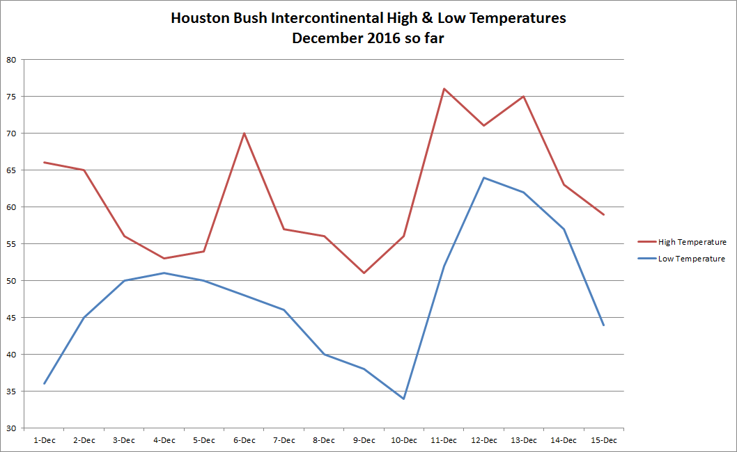
We’re back on the way up today, charting a course that will translate into a wild swing in temperature Sunday.

Today & Saturday

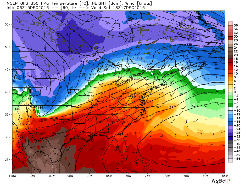
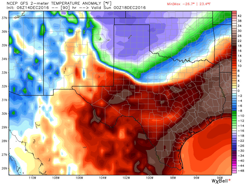
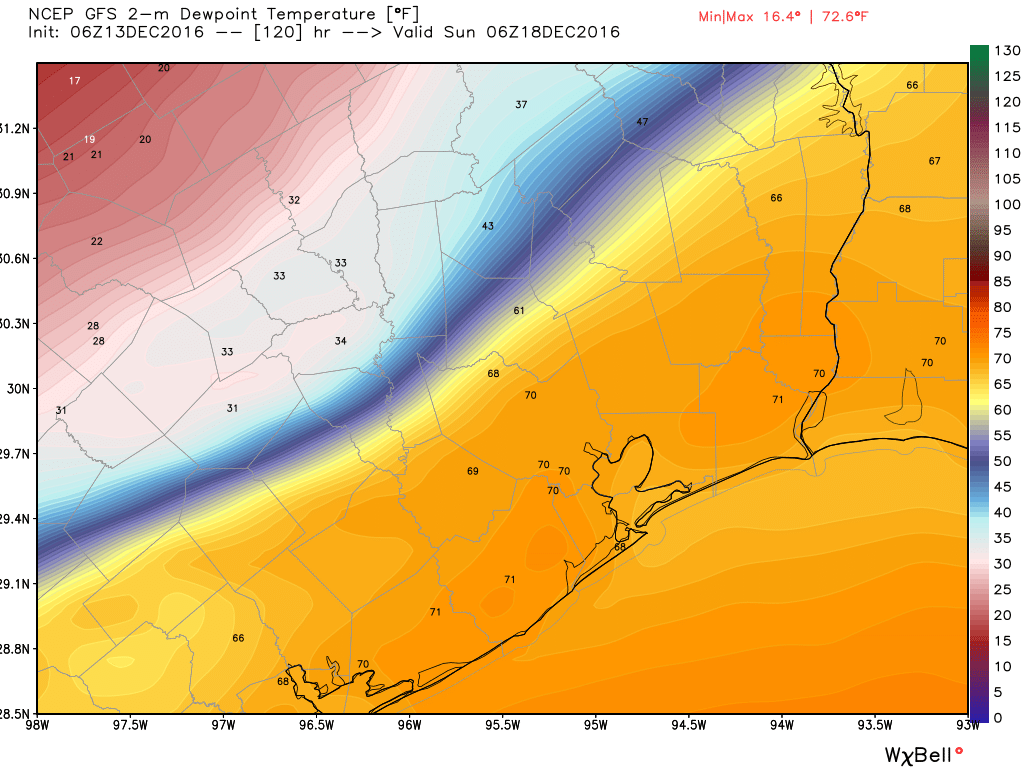
The changes are already underway, as we have begun to slowly pump in humidity off the Gulf this morning. Expect a lot of cloud cover today, and don’t be shocked if you see a few raindrops also in the form of light rain, showers, or drizzle. We’ll peak in the upper 60s to low 70s this afternoon, and as we go into tonight, temperatures may hold steady or continue to slowly rise. In fact into tomorrow, it still looks as though we could push 80°, which would tie the record high for the date set in 1908, 1984, and 1990. December’s all-time record of 85° set on 12/3/1995 should be safe. That said, some model guidance is suggesting we could hit as warm as 83-84° tomorrow; summer-lite for sure.

Saturday’s weather should feature a lot of clouds and a chance for a few showers here or there. The other issue Saturday, especially in the morning and evening, will be dense fog along the coast and bays.

See full post

Houston to go from “almost” summer to deep winter in less than a day

Good morning. Temperatures are quite a bit cooler, with much of the region having fallen to around 50 degrees, or lower. We’ll warm quickly, but a much stronger front looms Saturday night, with a freeze possible in Houston Monday morning as winter returns.

Today

As drier air continues to filter into the Houston region, we should see clearing skies today and cool temperatures. Expect highs generally in the upper 50s with moderate northerly winds, and another cool tonight with temperatures again falling to the upper 40s for inland areas, and lower 50s closer to the coast.

Friday and Saturday

The warmth returns with vengeance. Winds will gradually shift to the east and then from the south beginning Friday morning, and this onshore flow will push temperatures higher quickly. Under mostly cloudy skies look for highs in the mid-70s on Friday, with overnight lows in the upper 60s for inland areas and (unbelievably) lower 70s for coastal areas. This will probably make for cloudy conditions on Saturday morning.

This depiction for winds and temperatures in the lower level of the atmosphere on Saturday at noon is helpful. It shows the very strong southerly winds and warm air advection from Mexico and Texas into the southern United States. Meanwhile, a front advances. (Weather Bell)

See full post

Expect more warm weather before a major cooldown Sunday in Houston

After the city of Galveston broke both its the daily (Dec. 13) and monthly (December) record high temperatures, reaching 81 degrees on Tuesday, the Houston area’s winter “heat” has broken—for now. We’ll have to wait until this weekend for a major cooldown.

Today

A moderate cool front has moved into the Gulf of Mexico, and northerly winds today should finally bring some significantly drier air into the region by this afternoon and evening, clearing skies. Highs today should climb into the upper 60s under mostly cloudy skies.

Thursday

Temperatures should fall into the upper 40s for most of Houston tonight, except for coastal areas, and Thursday should be another cooler day in the wake of last evening’s front. Highs will struggle to reach 60 degrees across much of the metro area. However onshore winds will return sometime later on Thursday, setting the stage for an unusually warm end to the week.

Friday and Saturday

As moisture returns, so will the humidity, and more potential problems from early morning fog. The region will also see some rain chances on Friday and Saturday, but I think we are only looking at fairly scattered, mostly very light rain.

High temperatures should rise into the mid- to upper-70s on both days under partly to mostly cloudy skies, and I think Saturday will probably be quite breezy as a strong wind establishes itself out of the south. Parts of Houston could see gusts around 20 mph. If you don’t like soupy weather in December, change is coming.

Temperatures will be anomalously warm on Saturday evening, 15 to 20 degrees above normal But look at what is coming! (Weather Bell)

See full post

A big cooldown comes Sunday, and our first look at Christmas weather

Good morning. Fog lies across much of the area this Houston morning, and the entire metro region is under a Dense Fog Advisory through 10 a.m. Aside from that conditions are just sticky for mid-December. Will they remain that way through Christmas? I’ll discuss.

Today

Conditions will remain mostly cloudy today, and warm, with highs in the mid-70s before the passage of a cold front sometime this afternoon or evening. Some light, scattered rain showers are possible. The front should allow temperatures to fall into the upper 50s tonight for most inland areas, with slightly warmer temperatures along the coast.

Wednesday and Thursday

As light northerly winds bring in drier air, Wednesday should be partly to mostly cloudy, with highs near 70, and overnight lows around 50 degrees. As cooler air continues to move in Thursday may only reach about 60 degrees under mostly sunny skies. The cold front’s effects will be brief, however, as onshore winds resume sometime later on Thursday.

Friday and Saturday

Warm (for December) and muggy weather returns to Houston to end the week, with highs in the mid- to upper-70s on Friday and Saturday, and warm nights. Both of these days should be mostly cloudy, gray, with a chance of light rain and possibly a few thunderstorms. Rain accumulations don’t look impressive, but there should be enough moisture to put a damper on some outdoor plans.

The GFS model (of dewpoint temperatures) shows the forecast position of the front at midnight, as Saturday becomes Sunday. (Weather Bell)

See full post