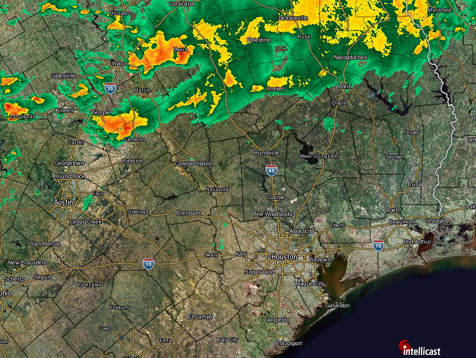
We’ve had a number of really, really nice spring days in recent weeks. And expect us to get another one today. Let’s get to it.
Colorado State Hurricane Outlook
First, I want to just touch on a report released yesterday from the tropical weather research group at Colorado State University. The CSU team produces one of the most widely used and anticipated seasonal hurricane outlooks for the Atlantic. Their forecast for this year calls for below normal activity in the Atlantic basin.
They’re going with 11 storms, four hurricanes, and two major hurricanes for the 2017 season. Recall that last year saw 15 named storms, seven hurricanes, and four major (Category 3 or stronger) hurricanes. Last year’s CSU April forecast called for 12/5/2 in that order. This year will be challenging with risks of another El Nino developing and some uncertainty as to what the ocean temperature profiles in the Atlantic Ocean will look like during the peak of the season. We’ve been in an active period of Atlantic hurricanes since 1995, and there are questions as to how much longer that will last. They will monitor these variables and update their forecast in early June.
Klotzbach’s team also helps put together landfall probabilities by county. You can examine the details yourself, but in the interest of ease, they give a 3.7% probability of one or more named storms making landfall in Galveston County, compared to a 4.3% chance historically in any given year. Texas as a whole has a 38.2% chance using their methodology, compared to a climatological average of 43.3% that a named storm will make landfall. In a nutshell: Slightly lower than normal odds for a landfall than in an average season.
Use hurricane outlooks with caution
There’s a BIG caveat here. Remember, seasonal hurricane outlooks are primarily an academic exercise. Operationally and for most of you, they don’t matter. If we have two storms in the Atlantic all season and one is category 4 that plows into Galveston, it was a below normal season but an awfully bad one for a lot of people. They’ve become a curiosity we need to share, and the group at Colorado State does really good and ultimately important research. But you should ignore this forecast and go ahead and think about preparing for hurricane season anyway.
(Space City Weather is sponsored this month by The Mole, a Jonathon Price novel.)
See full post