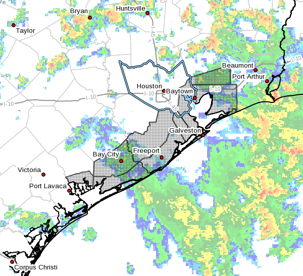
As we’d hoped, the radar has generally been quieter this morning across the Houston area, with showers neither as intense or widespread as they’ve been over the previous two mornings. And while we’re not out of the woods in terms of heavy rain and street flooding potential, we can at least see a period of sunnier weather in the distance.
Thursday
The southern half of the Houston area remains under a flash flood watch through Thursday evening, and this is primarily because of already saturated grounds due to a very wet week for the coast. Generally, we don’t expect coastal areas to pick up more than an additional 0.5 to 2 inches of rain during the next 24 hours as moisture continues to stream inland. This should be manageable, but we’re definitely watching several bands of stronger showers just offshore that could move inland.
Friday and Saturday
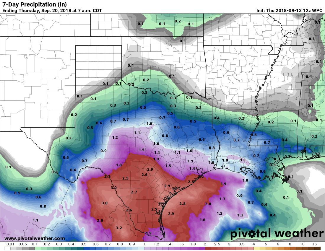
The oft-discussed Invest 95L—and there really has been a lot of sound and fury for a tropical system that never really has appeared all that threatening—will continue to move toward the Texas coast, and should come inland Friday. The threat from this storm will be heavy tropical rainfall, but as the system remains disorganized, it shouldn’t be that potent of a rainmaker. Some areas along the Coastal Bend may see upwards of 3 to 5 inches of rain over the next few days with some higher isolated totals, but in the Houston area I expect the coastal areas to hopefully see less than that, and inland areas perhaps 1 inch of rain through Saturday.