Let the sun SHINE!

When I do Friday posts, I often have a problem where I feel as if I am writing too much about what’s happening with the weather. So I spend a good bit of time editing down some stuff and trying to focus on the important points. Today should be easy, as there is really only one important point: Sunshine!

Today through Sunday

This is the weekend we have been anticipating for months. It will feature mostly clear skies, pleasant temperatures, and pretty comfortable humidity. There are a couple things going on in the background to point out.
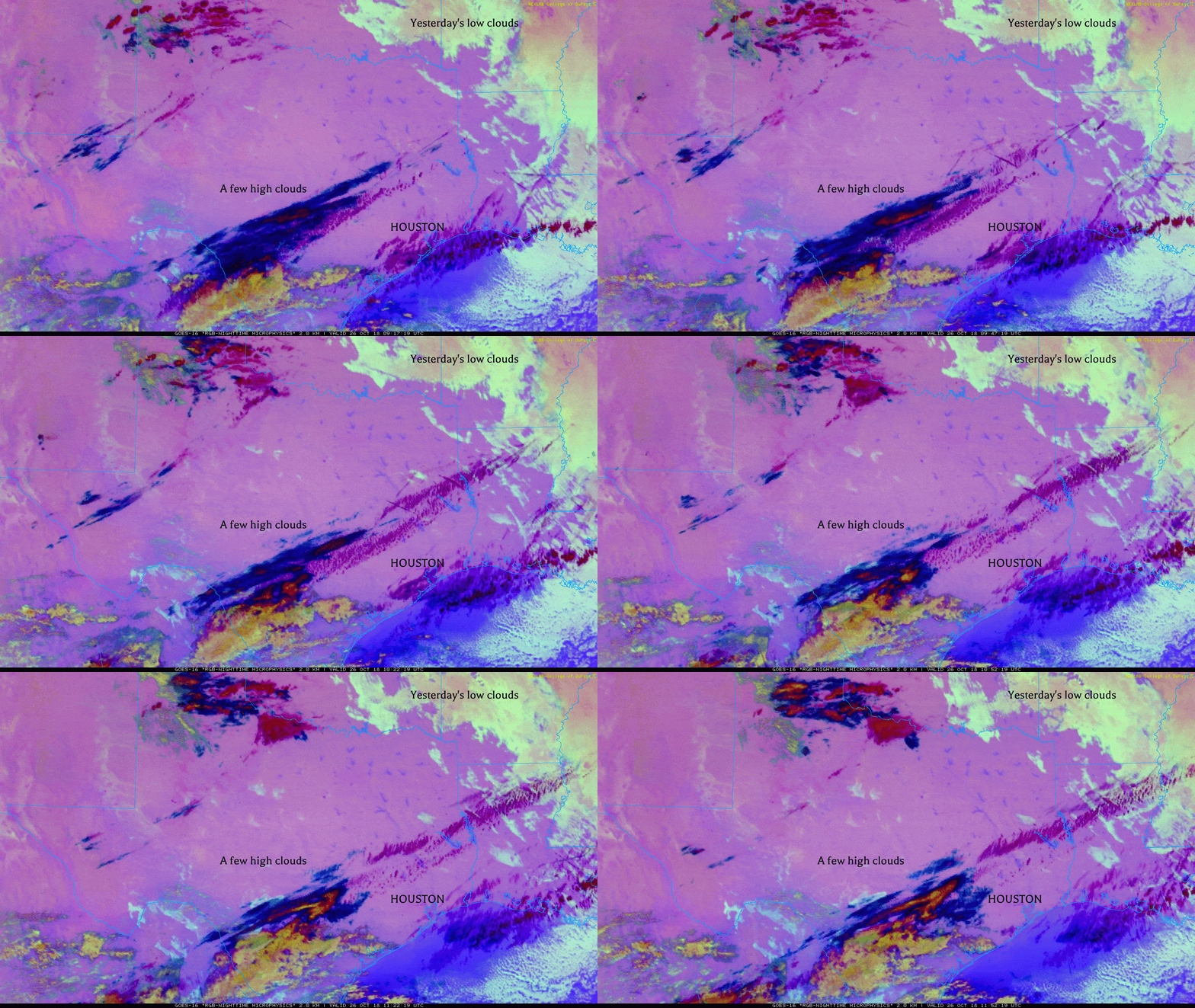
Satellite shows just some high clouds around the area this morning. Yesterday’s low clouds are off to our east. We’re setup for beautiful weather. (College of DuPage)

First, a few high clouds will stream across the region today, but they should not do anything other than add character to an otherwise blue sky. Look for temperatures to warm up into the middle 70s this afternoon.

A weak cool front should pass through the area this evening, but it likely won’t do much. Look for mid-to upper-50s in most spots and near 60 at the beach.

Saturday will be sunny and gorgeous. It will be a touch warm, but the low humidity will counteract that a bit. Expect generally lower 80s for high temperatures. We will be a few degrees warmer Saturday night, so expect around 60 in Houston, lower 60s near the beach and upper-50s northwest.

“Sun”day will live up to its name. It will be a little warmer still, with highs in the middle 80s possible. Again, mostly comfortable, low humidity will help.

See full post

Goodbye rainfall, hello gorgeous fall weather

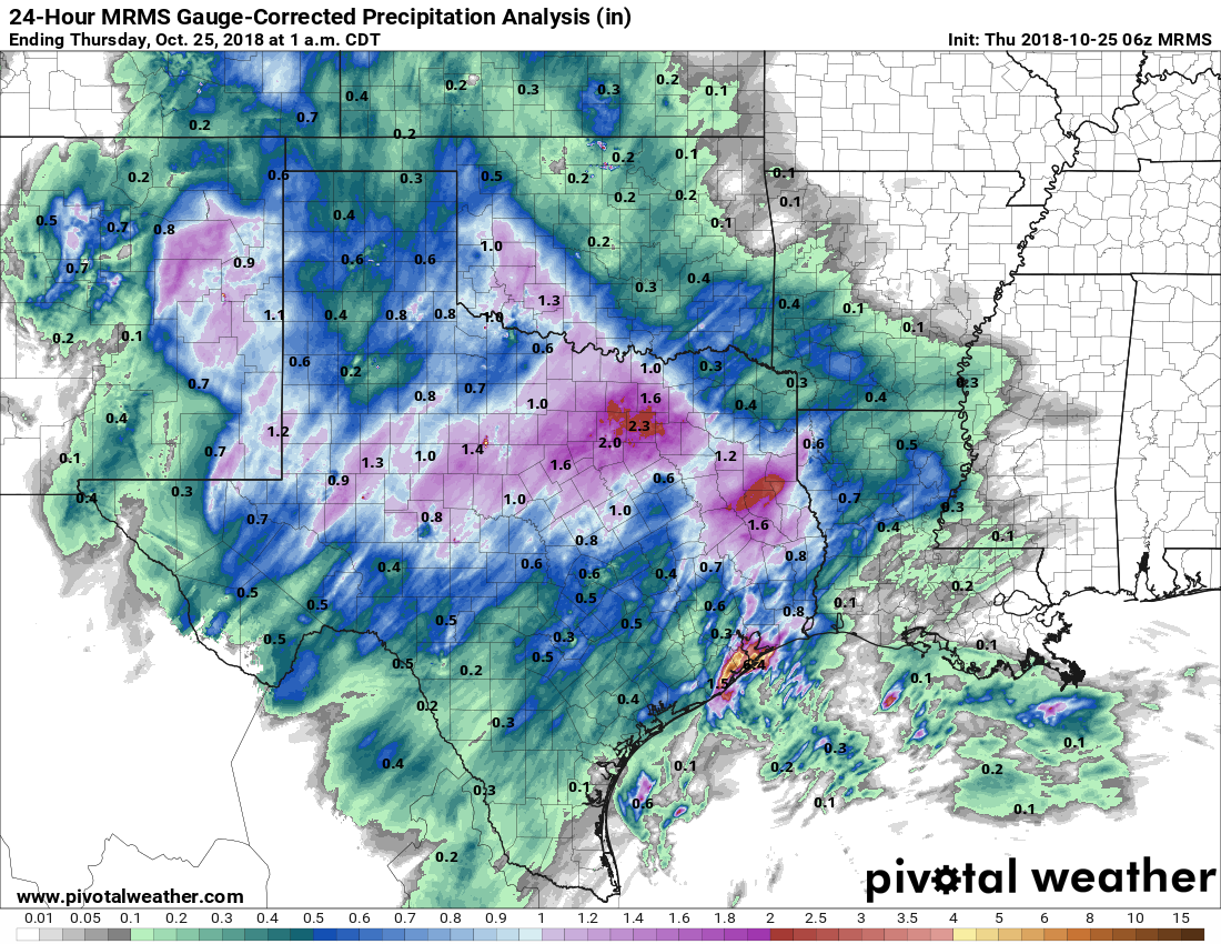
Moisture associated with the remnants of Hurricane Willa produced showers across the Houston area from Wednesday evening through Thursday morning. Most of the region saw less than 1 inch of rain, but southern areas of the metro area were harder hit, with a few parts of Galveston seeing as much as 4 to 5 inches of rainfall. Fortunately, we are all done with that mess now. We’ll now see a heavy dose of sunshine and drier air for the next six or seven days.

24-hour rain totals ending at 1am CT Thursday. The coast near Houston got hit hard. (Pivotal Weather)

Thursday

A few lingering, light showers southeast of Houston will push east by around sunrise. Skies should clear some today, but we’ll still see plenty of clouds, and that should limit high temperatures to about 70 degrees. In the background, northwesterly winds will be ushering drier air into the region, which will set up a really nice weekend.

See full post

After rain showers today and tonight, our weather turns seriously nice

We’re going to have one day, and especially night, of widespread rainfall before the region gets a break from the precipitation. In fact, after early Thursday morning, it would not surprise me to see the region go an entire week without rainfall. So if you’ve been waiting for the region to really dry out, that time now appears to be at hand.

Wednesday

There are a few light showers about this morning, but it looks like the deeper moisture from the remnants of Hurricane Willa won’t push into Houston until later today, or during the overnight hours. Before early afternoon today, we’re likely to see mostly cloudy skies, with scattered light to moderate rain showers, and highs in the upper 60s. Winds will also be breezy, out of the northeast, with gusts up to 20mph.

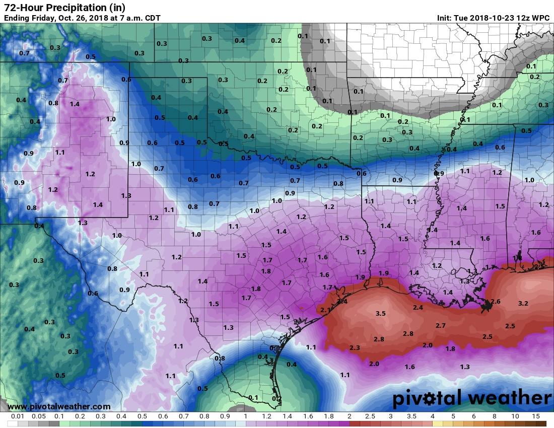
Rain accumulation forecast for now through Thursday. (National Weather Service)

The real action will likely begin this afternoon to our west, or after sunset for eastern Houston. As we’ve been suggesting for a few days now, we don’t expect anything too extreme. Most of the region will likely see 0.5 to 2.0 inches of rain. Some thunderstorms are possible closer to the coast, but most areas will just see rain. Although soils are pretty wet already, these kinds of rainfall amounts should be manageable, and right now we wouldn’t expect anything more than some isolated, brief street flooding—if that.

See full post

After a wet mid-week, Goldilocks weather for Houston this weekend

Good morning. We’ll remain in a wet, gray pattern for the next couple of days before drier air and lovely weather arrive in time for the weekend. In fact, the weather for the upcoming Friday through Sunday period should make for the region’s nicest weekend since about April. We’ll also take an early look at the Halloween forecast.

Tuesday

Light to moderate showers are moving from west to east across the Houston area this morning, and high resolution models suggest this precipitation should come to an end around noon, or a few hours later. Accumulations should be modest, under 1 inch for most. Skies will remain cloudy after the rains end, and highs for the most part should stay in the 60s today—so cool and gray. Rain chances will be lower tonight, but not zero, with little overnight cooling due to thick cloud cover.

Wednesday

Texas will see some moisture from the remnants of Hurricane Willa on Wednesday, but nothing to be particularly concerned about. A few thunderstorms are possible, but for the most part we expect the region to just see 1 to 2 inches of rainfall from Wednesday morning through Thursday morning. Slightly higher amounts are possible along the coast.

Rain accumulation forecast for now through Thursday. (Pivotal Weather)

This shouldn’t be enough rain to cause problems for the Houston metro area, but central Texas certainly doesn’t need the additional rainfall. The City of Austin had to issue a boil water notice for residents on Monday due to problems with flooding at its water treatment facilities.

See full post