A thin, broken line of showers pushed through Houston this morning ahead of a cold front that is now moving through the region. Skies are already clearing on the west side of the region, and should clear out for all of Houston later this morning. We’ll now have a few sunny days before clouds return later Saturday or Saturday evening.
Thursday
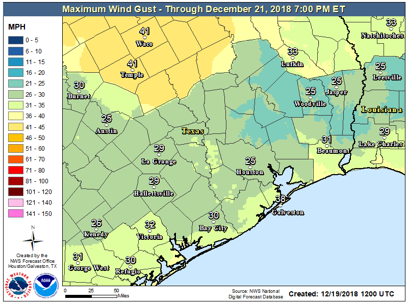
The name of the game today will be winds. Because air pressure will change over a relatively short distance, we’ll see vigorous northwest winds today, and the National Weather Service has issued a wind advisory through 6pm. Conditions won’t be too extreme, but gusts of 30 to 35mph will definitely make for a blustery day as high temperatures struggle to get to 60 degrees. Lows tonight will be clear and cold for the city, although should remain comfortably above freezing.
Friday
Winds should dial back overnight, making for a pleasant day Friday. Look for sunny skies, with highs around 60 degrees. Temperatures Friday night should be a degree or two warmer than Thursday night, but conditions will still be clear and cool.