Enjoy the sunshine for a couple of days before a rainy end to the week

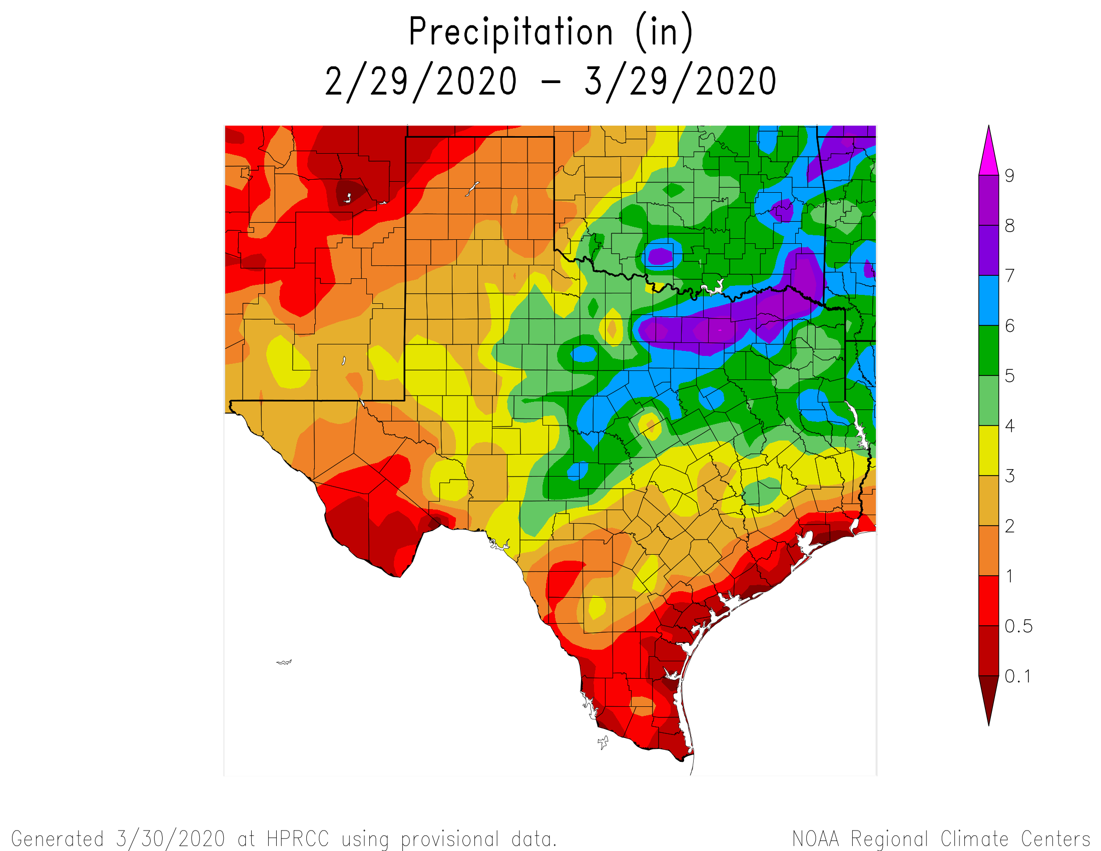
For much of the region over the last month, it has been feast or famine when it comes to rainfall. Some areas northwest of downtown have received 3 or 4 inches of rainfall, whereas some parts of Clear Lake and points south toward Galveston have received less than one-quarter of an inch. The problem is not yet serious, but with warmer weather on the way it would be nice to have some rain.

Texas precipitation during the last 30 days. (UNL.edu)

Fortunately, that appears to be just what’s in the cards for the end of this week. But before we get to the rainfall, we’re going to have a couple of pleasant, spring-like days.

Tuesday

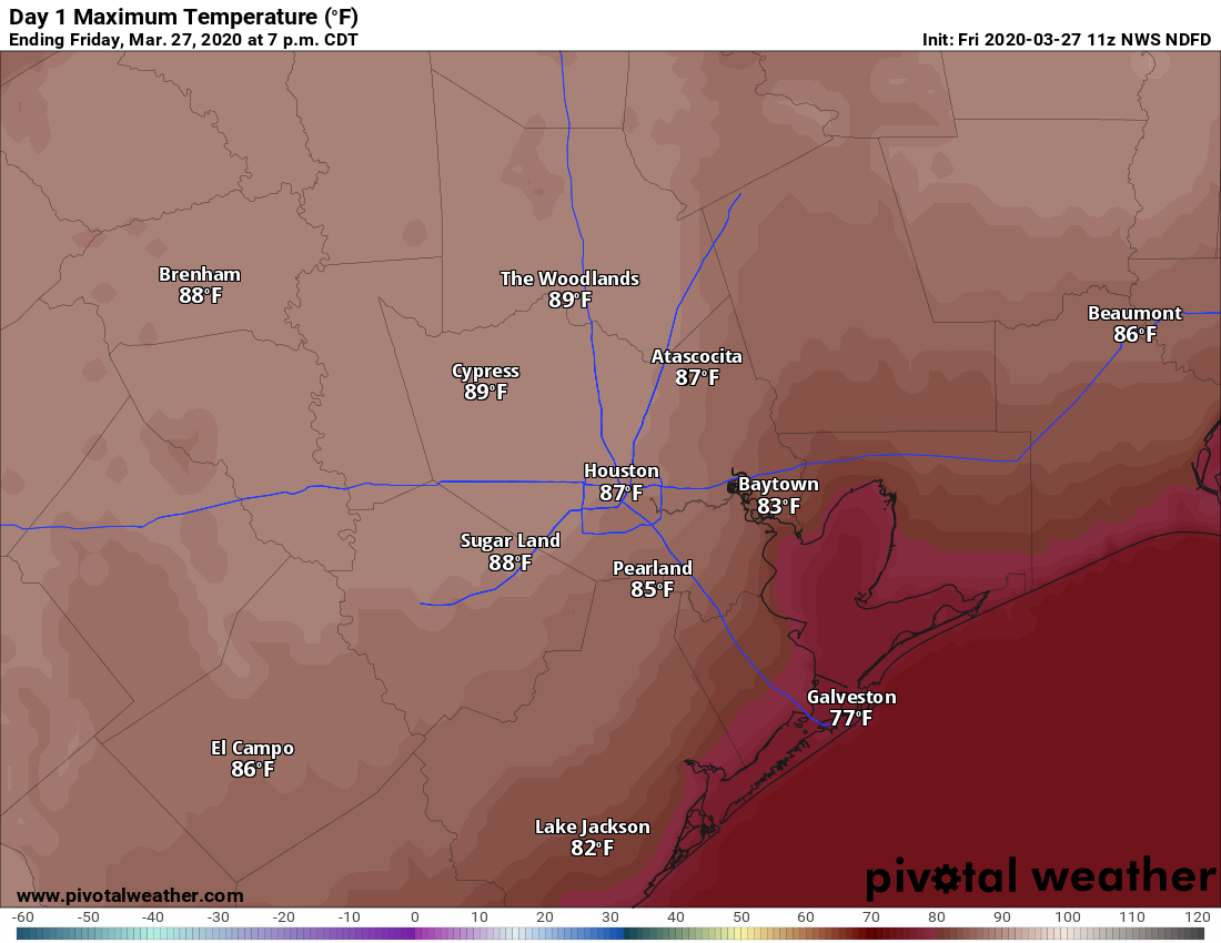
A front is moving into Houston this morning, with winds turning to the west-northwest. Partly to mostly cloudy skies this morning should give way to partly to mostly sunny skies this afternoon and highs generally in the upper 70s. The only downside of today’s weather will be at-times gusty winds, perhaps reaching 20 mph. The weather this evening and during the overnight hours looks splendid, with lows dropping into the mid-50s with partly cloudy skies and dying winds.

Wednesday

This will be another fine day, with at least partly sunny skies, and highs in the mid-70s. However the front will once again wash out pretty quickly, with winds returning from the southeast sometime on Wednesday. This will allow for clouds to begin to develop later in the day and during the overnight hours. Lows Wednesday night probably will only drop to around 60 degrees for most areas.

See full post

Warm March nears its end, with little change in store for April

Good morning and welcome to the end of March. We don’t have the final temperatures yet for the month, but the average temperature through the first 29 days of this March is 71.1 degrees, which is 8.6 Fahrenheit degrees above normal.

  • This ranks as the second warmest March on record in the city.
  • The city’s records date back to 1892. Only March, 1907, finished warmer.
  • During that March more than a century ago, the average temperature was 72.1 degrees.

Matt has done some research on what that unprecedented March was like in Houston, and he’s found some really interesting things. Matt will write a separate post on this for Wednesday, April 1. You’d be a fool not to read it.

Also, if you were wondering what the rest of “spring” looks like for Houston, the NOAA outlook for temperatures during April, May, and June is below:

NOAA outlook for temperatures in April, May, and June.

Monday

Today will be, you guessed it, warm again. The weak front that moved offshore on Saturday pushed back onshore as a warm front Sunday. The combination of that and some nearby low pressure will push rain chances to around 50 percent today, but most of the rain should be in scattered, short-lived showers—any stronger thunderstorms probably will remain north of Highway 105. Overall accumulations should be slight except beneath a stray thunderstorm, with mostly cloudy skies and highs of around 80 degrees. Winds will be light, out of the south or southeast at about 10 mph.

Tuesday

A cool front should slide into the region during the overnight hours Monday, and this will make for a pleasant Tuesday. Expect clearing skies, winds out of the north at around 10 mph, and highs of around 80 degrees. Low temperatures Tuesday night should drop into the upper 50s.

See full post

Changes this weekend after one of Houston’s warmest March stretches in history

Officially, we won’t have a heat wave in Houston. We “only” hit 88° at Bush Airport yesterday, after Wednesday’s 90 degree high. No matter: We are in the midst of one of the hottest stretches of weather this early in the year on record. If you look at the last 4 days in Houston, our average temperature has been a whopping 78.9°. The earliest we’ve ever had a 4 day stretch that warm prior to this year was April 7-10, 1999, when we averaged 79.4° for the four days.

The hottest average temperatures for a 4-day stretch for January, February, and March, with March 23-26, 2020 supplanting the previous record in 1907 by a full degree. (NOAA)

We broke the previous record for earliest hottest 4 day stretch (1907) by a full degree. The heat continues for one more full day before a bit of a respite this weekend.

Today

Look for more of the same today. Any low clouds this morning should eventually give way to sunshine. We’ll have a steady south wind at 10 to 15 mph (Side note: The breeze yesterday afternoon was actually quite lovely, despite the abnormally warm weather). Expect highs in the upper-80s to perhaps near 90° in spots.

Another warm day ahead for the entire region. (Pivotal Weather)

We expect another muggy night ahead tonight, with lows in the upper 60s to low-70s.

Saturday

Tomorrow will start much like every other day in recent memory. But we’ll have a twist via a cold front Saturday afternoon. Expect clouds and some sun with temperatures warming into the lower 80s by late Saturday morning. Thereafter, scattered showers and a few thunderstorms with heavier downpours should begin to move west to east across the area. Any severe weather should be off to the northeast and out of the Houston area. Rain-wise, it wouldn’t be shocking to see some places receive no rainfall with the front. Those would be mainly southwest of Houston. Other areas could see a few tenths of an inch or even more if any heavier storms develop.

Temperatures will drop only a couple degrees behind the front, into the 70s, as it moves across the area between about Noon and 5 PM.

See full post

Will Houston’s heat and humidity help control the spread of Covid-19?

Houston officially reached 90 degrees on Wednesday at Bush Intercontinental Airport, marking the region’s first such day of the year. This milestone has come about six weeks early this year, and we’ll see two more very warm March days before a cool front on Saturday. Speaking of the heat and humidity, we’ll address the idea that this may help to tamp down the local spread of Covid-19 at the end of this post. The short answer is that it’s possible, but the evidence is far from conclusive.

Thursday

This morning will start off mostly cloudy like Wednesday did, but we should see clearing skies by around noon, or shortly thereafter. Highs again should get up to near 90 degrees, with light winds, making for another very warm day. Lows tonight will likely only fall to around 70 degrees.

Expect another warm day Thursday. (Pivotal Weather)

Friday

As high pressure begins to ease off, and some more clouds appear in the afternoon sky, temperatures Friday may hold in the mid- to upper-80s but the humidity will still be there. Winds will start to kick up during the afternoon or evening hours, gusting out of the south up to 20 mph.

Saturday

As we’ve been saying, conditions on Saturday will depend on the timing of the front, which probably will sweep through the area (beginning in the northwest) during the late morning hours and end up off the coast during the evening. Local highs will depend on the timing of the front. As for rain showers, most of the model guidance now shows something akin to a dying line of storms, so areas such as College Station may receive one-half inch of rain or more and a pretty good lightning show, with less as the showers get near Houston and push through the city. Lows Saturday night should drop into the 50s, except for the coast.

See full post