What you need to know about solar energy in Texas as summer heats up

Welcome to the summer solstice. Today is the longest day of the year, and the point at which the sun reaches the highest point in the sky. At 1:23 pm today, the sun will climb to an altitude of 84 degrees, reaching very nearly directly overhead. By contrast, in December, the sun’s peak altitude is as low as 37 percent. This high sun angle is why it is so important to wear sunscreen during the middle of the day in summer, but there is a brighter side of the story.

You may have noticed—it would be hard to miss, really—that it has been hot and sunny outside this summer. While summers are not always like this, when high pressure systems build over the Southern plains states, we see days and days of sunshine. This helps make Texas one of the sunniest states in the nation, with an average of 2,850 hours of sunshine a year.

The good news is that we can actually put that sunshine to use by gathering some of it for solar energy, and it is increasingly easy to do this. In this post, which is created through our partnership with Reliant, I want to talk about some of these ways you can put the Sun to work for you.
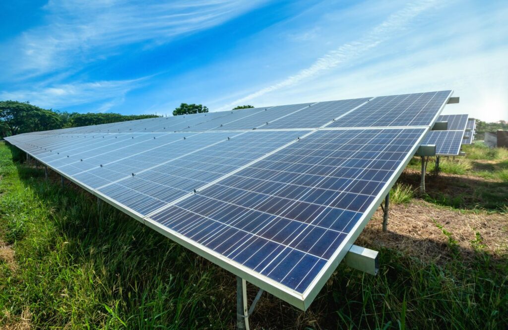
Put the sun to work. (Reliant Energy)

Solar stats

As the state grows, so does its energy needs. And especially during these warmer months, when the sun reaches the highest point in the sky, solar energy is helping to power our life-saving air conditioning units. Last summer, solar energy provided about 4 percent of the state’s electricity needs, and that may nearly double this summer. Let’s start with some basic information about solar power in Texas, sourced from the Solar Energy Industies Association:

  • $16.6 billion: Total solar energy investment in Texas
  • 1.7 million: Number of homes in Texas powered by solar energy
  • 506: Number of solar energy companies in Texas
  • 50 percent: Decrease in price of solar energy during the last decade
  • 4 GW: Amount of new solar energy capacity to be installed in the next five years
  • 1: State ranking in solar power generation in 2021

Understanding solar: utility scale vs. residential

There are two primary ways in which the sun’s energy is collected: residential solar power and utility-scale solar farms. Residential solar is spread around communities, made up of solar panels installed on roofs, or mounted on the ground, and is typically connected to the local utility distribution grid. Utility-scale means a centralized solar farm connected to the grid that sells generated energy back to the local wholesale utility, rather than end-use customers.

Both means of generating solar energy are helping to fuel growth in the state. And depending upon your home, lifestyle, and budget either might be an option for your electricity needs.

Solar hows

There are several ways for electricity consumers to get involved with solar energy, and save money in the process.

Without rooftop Panels

Support solar energy with your existing electricity plan. Reliant offers an easy option for customers to “Make It Solar” to support clean, renewable energy while keeping their existing plan the exact same. No panels required, you can live in a house or apartment that you own or rent. Customers simply add “Make It Solar” to their preferred electricity plan for $9.99/month. Or for those enrolling in any Truly Free electricity plan, it’s an automatic, free upgrade.

Enroll in a Plan Designed to Support Renewable Energy in Texas. Even without the commitment of installing panels, Reliant’s 100% Solar plan supports renewable energy and offers customers a stable fixed rate. When you sign up, 100 percent of your electricity usage will be matched with solar renewable energy certificates, which provide another source of revenue for solar power companies. These certificates signify that renewable energy equal to your usage has been generated and sent to the electric grid—so you’re not required to install solar panels on your roof.

With rooftop panels

Make the Most of Your Panels’ Power

If you already have solar panels, you can earn bill credits to make the most of your power. With the Reliant Solar Payback plan, you’ll receive bill credits up to your monthly usage when your solar panels generate excess energy and return it to the electric grid.

Backup Power Solutions

Harnessing Solar During an Outage

Solar can also provide peace-of-mind and serve as back-up power during an outage. Reliant’s sister company Goal Zero offers a range of solar-powered back-up power options, ranging from portable and mountable panels to portable chargers and generators. I used one of these to power some basic necessities, including a few laptops, during the Valentine’s Day freeze of 2021.

As we make it through this particularly sunny summer, know that the sun is helping create a cleaner, greener Texas. You can learn more about solar power and energy choices from Reliant at reliant.com/solar.
Summer officially begins today, but peak heating is months away

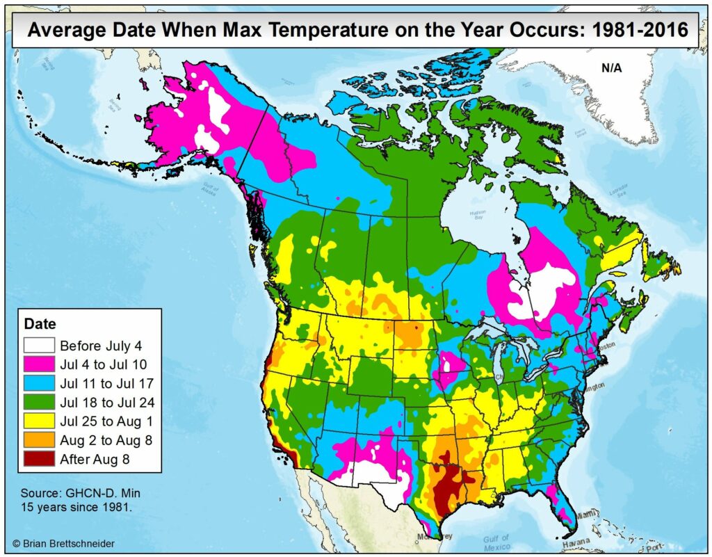
Good morning. Today is the longest day of the year, with a length of 14 hours, 3 minutes, and 30 seconds. For Texas, however, there is typically a considerable lag in peak heating, which does not come until August. This is due both to the fact that July and August are often the region’s sunniest months, as well as warmth moving in from the Gulf of Mexico as it continues to heat up during the next few months. Will July or August be hotter than our torrid June this year? We’ll see.

Date when maximum temperature occurs. (Brian Brettschneider, via Twitter).

Later this morning, look for a sponsored post from Reliant on taking advantage of all this sunshine with solar energy. And tomorrow, thanks in large part to your submissions, we’ll publish a top 10 list of “reasons why this summer heat and drought are just the best.” Yes, there will be some sarcasm in that list.

Tuesday

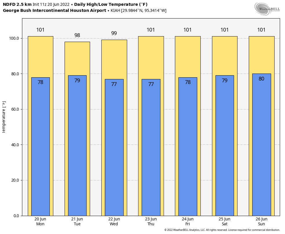
Houston had its warmest day of the year on Monday, when the thermometer at Bush Intercontinental Airport reached 102 degrees. Temperatures today should be a couple of degrees cooler, as there is a chance for a few more clouds to form, and some isolated showers and thunderstorms later this morning and into the early afternoon hours. If you get hit by a quick shower, consider yourself very lucky. Otherwise expect highs in the upper 90s, with light southeast winds.

Wednesday

This will be a day a lot like Tuesday, with isolated showers and highs in the upper 90s.

High temperature forecast for Sunday. (Weather Bell)

Thursday, Friday, Saturday, and Sunday

Our confidence is high that the heat wave will peak toward the end of this week and weekend, as high pressure builds directly over the region. Look for daily highs of 100 degrees or perhaps even a touch higher. Sunday at this point looks to be the hottest day, and hoo-boy is it going to be hot. Bru-tal.

Next week

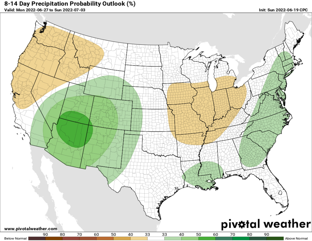
At some point next week, likely on Monday or Tuesday, high pressure will back off some and bring our high temperatures back into the upper 90s, or a bit lower. We should also start to see more clouds and even a moderate chance of rainfall. Do I have great confidence in precipitation next week? I do not. But at least there’s a decent chance. Anything will be better than Sunday.

We’re very, very, very sorry, but this week is going to be even hotter in Houston

We realize that after surviving last week’s extraordinary heat you are probably reading this in hopes of seeing some hope of respite on the horizon. To make a long story short, there’s very little of that of this week. We’re sorry.

As for the heat last week, it truly was quite a bit beyond normal. The average high temperature was 98 degrees across the city, and it now seems certain that we’re going to beat an ugly record. Longtime residents will probably remember the summer of 2011 in Houston. I recall it because, during the month of August, every single day but one recorded a high temperature of 100 degrees or above. Anyway, June of 2011 was extremely hot that year as well, with an average temperature (that’s the daily high and low, divided by two) of 86.2 degrees. Well, my friends, through Sunday we’re averaging 86.5 degrees for this month. And the next 10 days look considerably hotter, so we’re going to smash the temperature record for June in 2011. No, I don’t know if that means this August will be like August 2011. It’s possible, but not a certainty.

If all of this depresses you, we’re here to help. We’re going to create a top 10 list reasons why this year’s heat and drought is actually kind of a good thing. I realize that finding 10 reasons is going to be a struggle, so I’d like your help. If you have suggestions, please leave a comment here, on Facebook, Instagram, Twitter, or send an email.

Monday

High pressure remains the dominant factor in our weather, and high temperatures today should reach 100 degrees for most locations away from the coast. However, there is a slight chance—perhaps 10 to 20 percent—of showers developing along the sea breeze later today. Winds will be light, out of the east-southeast at 5 to 10 mph. Lows tonight may not drop below 80 degrees for most locations.

This week’s forecast calls for pain. (Weather Bell)

Tuesday

Conditions will be a couple of degrees cooler on Tuesday, as there may be a few clouds. Rain chances will probably jump to 20 to 30 percent, and this looks to be the day with the best option for rain for the next week. Look for highs in the mid- to upper-90s.

Wednesday, Thursday, and Friday

Heat really builds over the region, beneath the ridge of high pressure. Wednesday may stay in the upper 90s, but Thursday and Friday should see temperatures reach triple digits beneath sunny skies. Hot, hot, hot.

Saturday and Sunday

The heat wave looks to peak this weekend, with temperature readings between 100 to 105 degrees for most locations. It’s going to be brutal.

Next week could see the return of some slightly better rain chances. (Weather Bell)

Next week

The models are fairly consistent in showing the high pressure ridge breaking down about a week from now, and temperatures dropping back into the mid-90s with some better rain chances by next Tuesday or Wednesday. That is a hopeful sign, but because this is forecast to happen 7 or 8 days from now, it is far from something we can take to the bank, I’m afraid.

Drought expanding around Houston, as our best rain chance for several days arrives today

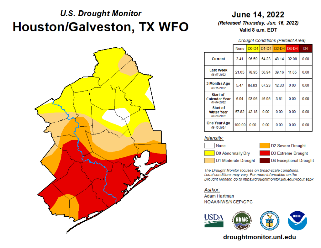
Yesterday’s drought monitor update showed that drought has indeed expanded around the Houston area, rather significantly too.

Almost the entire Houston metro is officially in drought now, with the fewest impacts in Montgomery County (US Drought Monitor)

Coverage of drought increased almost 10 percent, while coverage of extreme drought (Level 3 of 4) in the southern half of the region almost tripled week over week. We are still well behind 2011’s pace. At this point in 2011, the entire metro area was in level 4 of 4 (exceptional drought) compared to 0 percent today. But we are clearly in drought now, and it’s only going to get more extensive from here.

That said, we may get a little relief today!

Today

Today is beginning on a quiet, warm note once again. But there are actually some showers on radar in Louisiana, which indicates a weak little disturbance passing by. As that moves through our area today, we should expect to see at least a handful of showers or downpours develop. Let’s be fair here: Rain chances are only about 20 to 30 percent, but it’s the highest they have been recently and the highest they will be for a while to come.

Expect mid to upper 90s today with at least some showers or storms around, our best chance of rain for a while longer. (NWS Houston)

There’s a better chance you won’t see rain today than you will, but at least there’s a chance. Aside from that, expect mid to upper 90s with sun, clouds, and a touch of Saharan dust still.

Saturday and Sunday

For the weekend, the good news is that if you’re planning anything for Father’s Day or Juneteenth celebrations, you probably won’t get rained on. The better news is that the Saharan dust will be outta’ here as well. So it will look a bit less hazy outside.

Of course, we stand a really good chance at finally breaching the 100 degree mark officially this weekend (yes, many of you already have reached this point but IAH has not), particularly on Sunday. Either way, it looks hot.

Next week

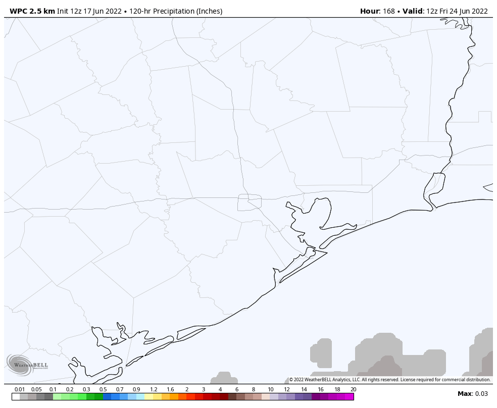
More of the same. 100 degree chances are with us Monday and maybe Tuesday with very slim to no rain chances. Atmospheric moisture levels look rather low most of next week, so I don’t expect much if any rainfall for most of the week.

Next week’s rainfall forecast. Alright. (Weather Bell)

Temperatures may actually bottom out on Tuesday or Wednesday. With a rebuilding ridge toward the end of the week, we may actually see our hottest weather of summer so far. More on that Monday. Whether it’s 98 or 102 next week, it’s just going to be hot.

Nothing out there we need to monitor for the tropics at this time.

I’ll leave on a quick note: If you missed Eric’s post yesterday, version 1.5 of the Space City Weather app is now available, and we encourage you to upgrade and inform us of any bugs you encounter. Thank you as always for your support.