In brief: Houston’s radar has quieted down after Thursday night’s widespread showers west and north of Houston, but our rain chances will continue through the weekend. Also, next week looks sunny, with notably lower humidity.
Thursday night surprise
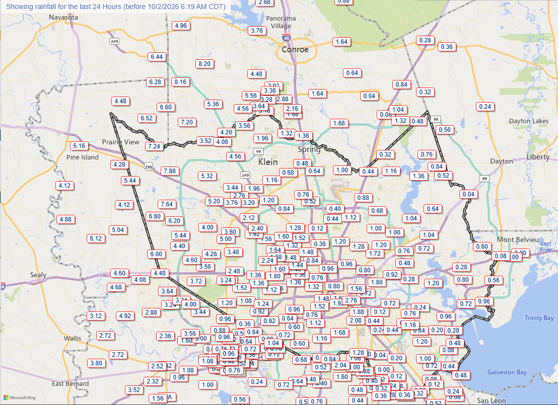
It’s safe to say we did not expect to spend Thursday evening watching a mass of showers continue to creep into the Houston region from the west. Rather than more or less halting in the Brazos Valley as expected, the storms kept coming, bringing 3 to 6 inches of rain to a broad area from south of Katy all the way north into The Woodlands. Some locations in western Montgomery County, near Magnolia, picked up more than 8 inches. It was a wild and wooly night in these areas, but most creeks and bayous have thankfully remained within their bayous. The radar over this region has quieted down overnight, but because the high-resolution models behaved so badly with this system, it diminishes my confidence in the forecast for storms over the remainder of the weekend. Nevertheless, we press on.
Friday
We are seeing a few scattered showers near Galveston Bay this morning, but nothing too serious. In terms of activity today, I think pretty much the entire region faces the possibility of showers and thunderstorms through about 7 to 9 pm today. It is difficult to pin down a specific part of our region at risk, but I don’t think we’ll see the organized mass of storms we saw Thursday night. Rain chances will likely diminish overnight. Highs today, with mostly cloud skies, will range from the upper 80s to about 90 degrees.
Saturday and Sunday
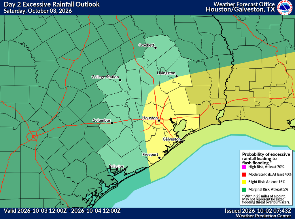
Over the weekend the focus of rainfall will shift closer to the coast, where a low pressure system will bring moisture and other ingredients necessary for heavy rainfall. Everyone will have the potential for showers and thunderstorms this weekend, but the greatest risk will be for coastal areas, and locations generally east of Houston. For these locations rain chances will be in the vicinity of 70 percent each day. Areas hard hit by rains on Thursday night will likely see lesser coverage. In terms of timing, rains appear most likely from Saturday afternoon into Sunday. Highs will be in the mid- to upper-80s. Lows will be in the 70s.
Next week
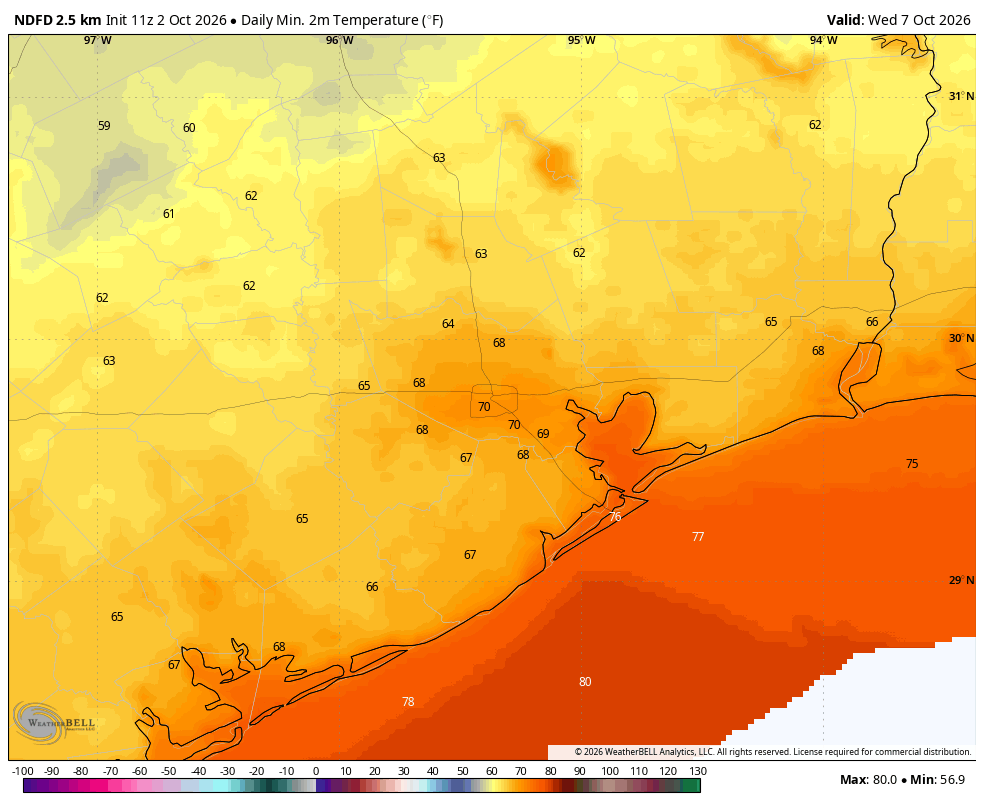
Monday should be partly sunny, with lower rain chances, and highs in the 80s. Some time later on Monday a modest cool front will push some drier air into the region. Don’t set your expectations too high, as this won’t exactly be crisp fall weather. But after a long and humid summer, even a little bit of fall will feel just fine. Look for highs in the mid- to upper 80s for most of next week, with sunny skies. Lows will be in the upper 60s to lower 70s. As for humidity, with dewpoints in the 60s the air will feel more comfortable, but not exactly dry.
We will update the site later today, or this weekend, if needed to cover the threat of showers and street flooding this weekend.
