In brief: Storms have moved further east than anticipated this evening, and we are instituting a Stage 1 flood alert for locations along and to the west of Highway 59/I-69 for Thursday night. We’ll reevaluate the situation early Friday morning.
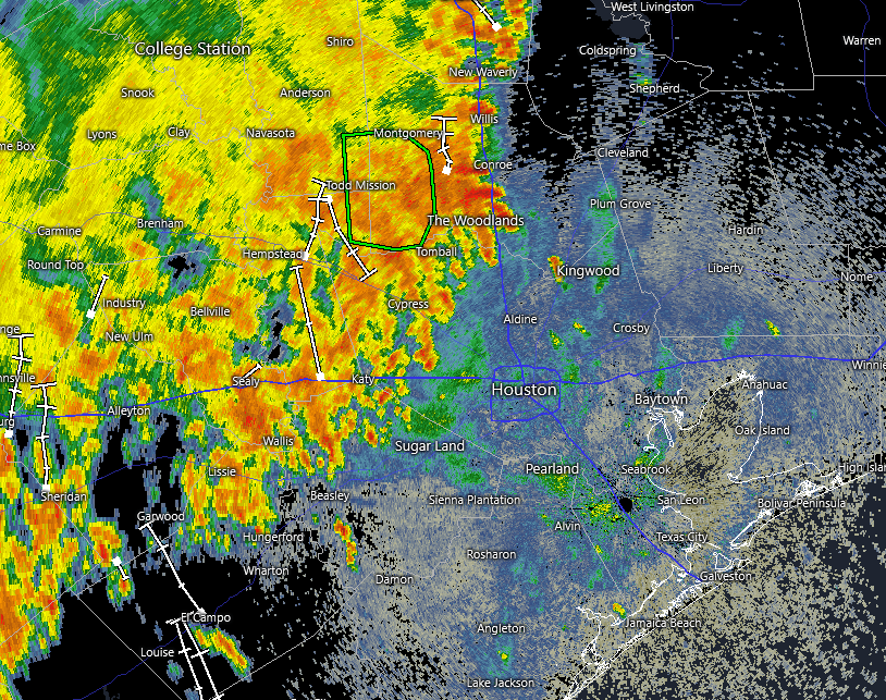
A mass of thunderstorms associated with a slow-moving front has edged further to the east than expected this evening, bringing heavy rains to some locations north and west of the central Houston region. Most totals have been manageable, in the 1 to 2 inch range. But some locations near Cypress and Waller have picked up 4 inches, and parts of western Montgomery County have seen 4 to 6 inches.
As of 8:15 pm these storms have progressed to a line from roughly Katy north to The Woodlands. Our latest high resolution modeling indicates the mass of storms could move a little bit further east, perhaps as far as Highway 59, before petering out this evening by around midnight. For areas currently receiving rainfall another 1 to 2 inches is possible in some locations tonight, with street flooding the principal threat, which is why we’ve put the Stage 1 flood alert into place.
We then expect a quieter period early on Friday and into the morning hours. After that? We will have to see about that in the morning.
