HOUSTON—Humidity Outside, Unbearable. Sweat To-day Or Night

Good morning. You’ll notice that today headline is yet another acrostic, in which the first letter of each word spells out Houston. Because there is not much else to challenge a forecaster when high pressure dominates our weather, I’m going to challenge my creativity with words and acrostics until the heat breaks and we see some more widespread showers. And when will that happen? There is a chance of some small relief by the middle of next week.

On another note, if you’re going to be in the bay area this weekend, and particularly if you live close by Johnson Space Center, please note that they’re conducting a pressure test of a lunar habitat on Saturday. Effectively this means that engineers are going to pump up the pressure in a habitat to see how high it can go until it bursts. The burst test will begin at 8 am, with the culminating boom likely to come between 11 am and noon. Don’t freak out if you hear a loud noise!

Thursday

Conditions today will be similar to Wednesday in that high temperatures will generally reach the mid- to upper-90s beneath mostly sunny skies. Also like on Wednesday, there is the potential for some isolated to scattered thunderstorms. While virtually all of us saw no rain yesterday, a thunderstorm just east of downtown Houston popped out 1 to 2 inches of rain across a couple of miles near Galena Park. There may be a couple of those rainy areas today, as well. Otherwise, winds will be light, out of the south.

High temperatures this weekend may run 5 to 10 degrees above normal. (Weather Bell)

Friday and Saturday

Hot and sunny, with highs near 100 degrees, if not reaching triple digits. Rain chances fall to 10 percent or less. Winds will generally be light.

Sunday and Monday

Temperatures remain about the same, but rain chances may increase slightly to 10 to 20 percent during the afternoon. Skies remain mostly sunny.

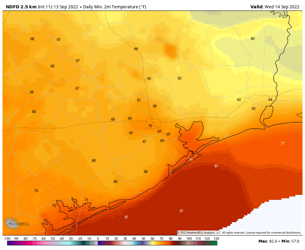
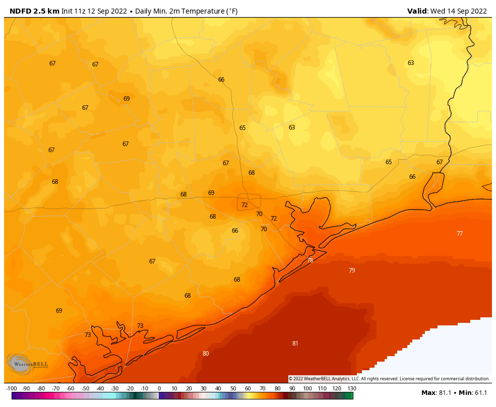
Nighttime temperatures will be 3 to 6 degrees above normal this weekend. (Weather Bell)

Tuesday and beyond

It looks as if the high pressure ridge may start to back off by the early part of next week, and this could allow for temperatures to start to drop into the mid-90s. This may also introduce better daily rain chances along the sea breeze. There are no promises here, but only potential. We’ll see.

HOUSTON—Hot Out, Use Sunscreen Today, Overcast Not

Good morning. Houston’s hotter than normal weather for July will continue for the foreseeable future, as high pressure continues to set the agenda through the weekend and into next week. It looks as though the heat will peak this weekend, with triple-digit conditions for much of the area, before a slight moderation in temperatures next week. As for when we might see widespread rainfall, that is probably at least a week or 10 days off.

By Friday of this week, temperatures will be sizzling outside. (Weather Bell)

Wednesday

Skies will be mostly sunny today, with highs generally in the mid- to upper-90s for central parts of the Houston area, with warmer conditions possible inland, and slightly cooler weather along the coast. Winds will be out of the south at 5 to 10 mph. As an atmospheric disturbance approaches, we may see a few scattered to isolated showers this afternoon, but overall chances are probably about 20 percent for the coast, and 10 percent inland. So, not much. Lows tonight will probably not fall below 80 degrees.

Thursday

A day quite similar to Wednesday.

Friday, Saturday, and Sunday

The heat continues to build into the weekend, with highs of about 100 degrees likely for much of the metro area, to go along with sunny skies. Rain chances are less than 10 percent—unless you count the perspiration falling as you walk outside.

Yep, it’s going to be hot for awhile. (Weather Bell)

Next week

It looks like the high pressure system will retreat a bit to the northwest next week, which should bring highs down a couple of degrees. It won’t be much to start. But I could see the development of more clouds later next week, and that’s when rain chances may start to improve a little bit.

High pressure is back, and will continue to dominate our weather

Good morning. I hope everyone had a safe, healthy, and happy Fourth of July. If you liked the calm and hot conditions on Monday, you’re in luck, because high pressure is more or less here to stay, and that’s the kind of weather we’re going to see for awhile. If you did not like the weather, well, I’m sorry to say the pattern is unlikely to change for at least a week or two.

Tuesday

Skies will again be mostly sunny today, with high temperatures of around 90 degrees right along the coast, to mid-90s in parts of Houston, to around 100 degrees for far inland areas. Winds will also be light, out of the south at 5 to 10 mph, for much of the day. With a persistent onshore flow there will not be much relief overnight, with lows unlikely to drop below 80 degrees for much of the metro area.

Much of Texas has fallen under a ridge of high pressure this week. (Weather Bell)

Wednesday, Thursday, and Friday

Each of these days will generally bring temperatures in the mid- to upper-90s, but the difference is the ridge should back off just slightly. This will allow for a slight chance of showers each afternoon, perhaps on the order of 10 to 20 percent. These will occur as the sea breeze migrates inland, and you should consider yourself lucky if you win the rain lottery each of these days. Nights remain warm and muggy.

Saturday and Sunday

If you’re making plans for the weekend, you can reliably count on hot and sunny conditions, with highs near 100 degrees in the metro area. Prepare to sweat.

High temperatures this weekend will look something like this. (Weather Bell)

Next week

Hey Eric, when is this pattern going to change? Well, as we get deeper into July, the models suggest the next reasonable chance for widespread rain probably won’t come until the weekend after next, in the July 15 to 17 range. Because that is so far out to forecast, overall confidence in this kind of a pattern change is fairly low.

Tropics

They’re fairly quiet, and we’ll have an update from Matt a little later this morning.

Fourth of July signals the return of hot weather for awhile to Houston

After several days of cooler weather, and for some locations fairly wet conditions, high pressure has again started to assert control over our weather. There really is not a whole lot more to say other than that temperatures will be a few degrees warmer than normal for the foreseeable future with lots of sunshine. And because today is a holiday, this post will be short and (not so?) sweet.

Monday

Highs today will range from around 90 degrees along the coast, to mid-90s in the city of Houston, to near 100 degrees for far inland areas such as College Station and Conroe. Skies will be mostly sunny this afternoon. Winds will generally be light, out of the southeast at 5 to 10 mph. Aside from the lingering heat, there are zero concerns for fireworks this evening. However because of dry ground, especially north of Interstate 10 where the recent rains left less of an impact, please take care of any activities that could cause wildfires.

High temperature forecast for Monday, July 4th. (Weather Bell)

Tuesday

A lot like Monday, but without the fireworks.

Wednesday through Friday

Each of these days will bring highs in the mid to upper-90s in Houston, with warmer conditions further inland, and slightly less hot along the coast. It does look like atmospheric moisture levels may tick up a bit during the second half of the week, allowing for a slight 10 to 20 percent chance of a an afternoon shower along the sea breeze. But don’t get your hopes up.

Temperature outlook for this weekend into the middle of next week. (Pivotal Weather)

Saturday, Sunday, and beyond

Temperatures look to rise even a bit further this weekend, with 100-degree weather possible in the city itself. At this point I expect sunny weather to continue, with perhaps 10 percent daily rain chances. Quite honestly there does not seem much chance of a pattern change at least into the early to middle part of next week. Hot, hot, hot.

The good news is that the Atlantic tropics look to be quiet for a while, as the overall pattern favors sinking air over much of the basin. Please have a safe and enjoyable Fourth of July!