After Wednesday evening’s line of storms, the Houston region will see several days of placid weather before another front arrives later on Sunday. This will bring with it a stronger shot of colder air and, for areas just north of Houston, the potential for snow. Cold weather will prevail throughout the period.
Thursday
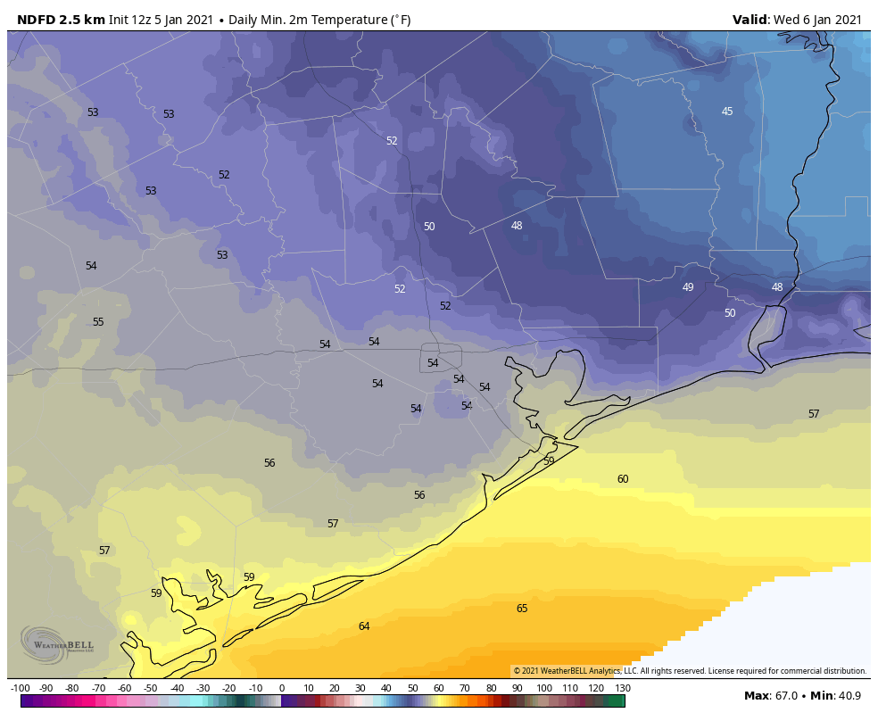
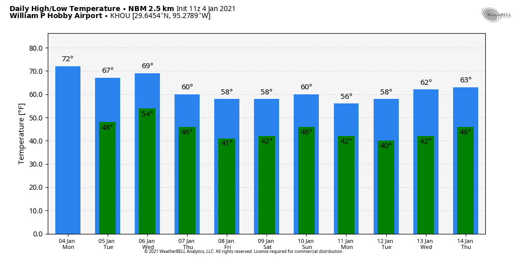
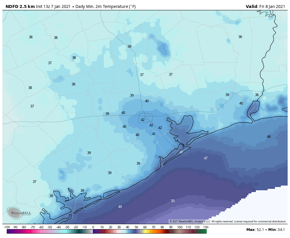
Temperatures have dropped into the 40s across much of the area this morning, and in concert with northwesterly winds it feels brisk outside. Winds should slacken this afternoon, but even with mostly sunny skies our high temperatures are unlikely to climb above the mid- to upper-50s. Lows tonight will drop down to around 40 in the city of Houston with partly cloudy skies and light northerly winds.
Friday
This will be another mostly sunny and cold day, as northerly winds continue to bring dry air into the region. Expect highs generally in the mid-50s, and with clear skies overnight temperatures may be a few degrees cooler on Friday night than Thursday night.
Saturday
This will be our third chilly, sunny day in a row with highs again in the 50s. As winds shift to come from the east clouds may begin to build during the afternoon or overnight hours, but lows should still get down to around 40 in Houston overnight.
Sunday and Sunday night
An approaching front will combine with surface low pressure over the northwestern Gulf of Mexico to produce healthy rain chances on Sunday and Sunday night. We can be pretty confident this will be a cold and gray day, during which highs will struggle to climb above 50 degrees. Rain chances will increase as the day goes on. For now, it appears as though the greater rain accumulations will remain to the south of Houston, where totals could be on the order of 1-2 inches. However, north of a line from Wharton to Alvin to League City will probably see less, perhaps 0.5 to 1 inch of rain with this front. We’ll have to iron out those details in future forecasts.
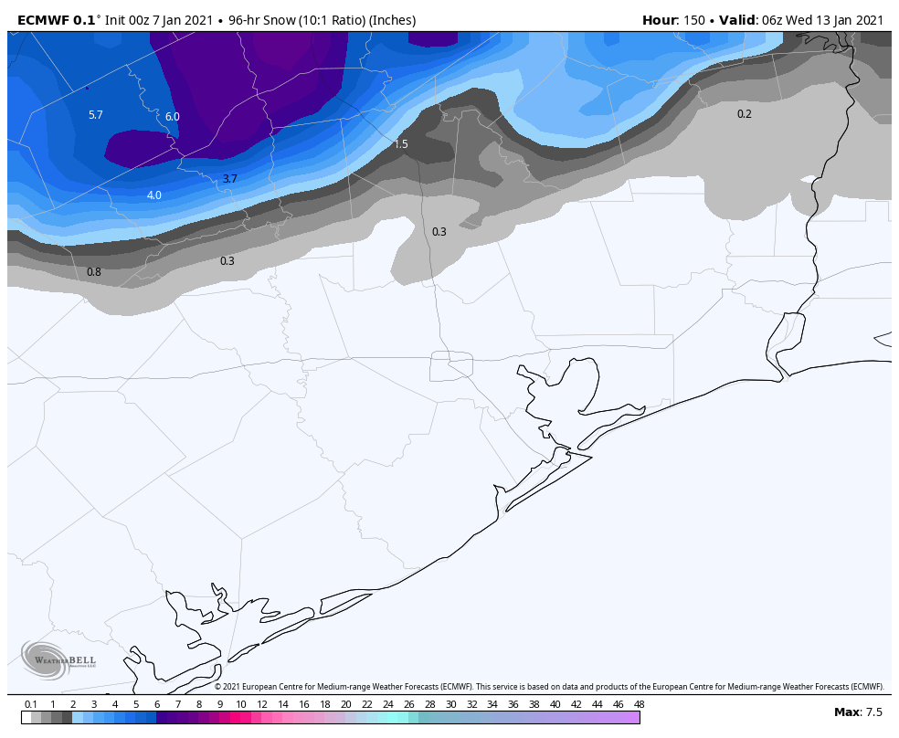
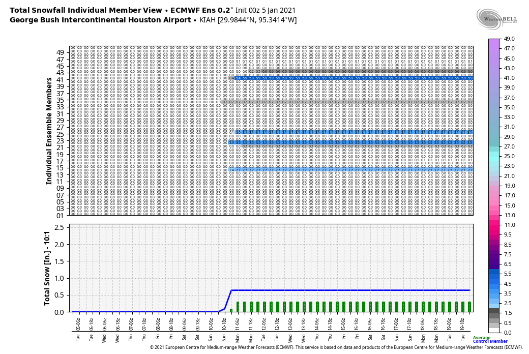
We think things will be warm enough in Houston to keep this precipitation rain throughout the day and overnight hours, but there will be a dividing line—perhaps somewhere in Montgomery County?—where this precipitation turns into snow or sleet on Sunday evening. Matt will provide an update on the region’s snow chances with a post later today.
Next week
Our region will be cold and sunny next week in the wake of the front, with highs generally in the 50s and lows in the 30s. The urban core of Houston may remain above freezing, but there will almost certainly be freezing temperatures in the vicinity of the city, if not the entire metro area itself.
Virtual Houston Marathon
Due to the pandemic, the Houston Marathon is a virtual event this year. So instead of being run as a single event on January 17, participants can run their half and full marathons on any day between Friday, January 8 and Sunday, January 17. If you have some flexibility in your schedule, you will have options for weather. (My ideal conditions are temperatures in the 40s, clouds, and light winds, but we’re all different!) Both this Saturday and Sunday look chilly, and if you complete your run before noon on Sunday you should miss the rain. The absolute coldest temperatures in the week ahead should come on Tuesday morning, January 12, when I expect a freeze for most of Houston.
Then we’ll see a slight warming trend through Friday, with mostly sunny skies throughout. Next weekend looks a bit warmer, but basically every morning during the virtual marathon period is likely to see lows in the 30s or 40s for Houston. If you prefer warmer weather, then the coming Friday, Saturday, or Sunday afternoons—January 15-17—may be your best bet as highs get into the upper 60s, perhaps. Rain chances seem fairly low throughout the running period, aside from the Sunday, January 10th mess described in the forecast above.