Good morning. Houston will continue to enjoy relatively dry and cool weather for another day or two, before the air mass begins to moisten with the onshore flow. Then, beginning Saturday night, the region will likely enter into a period with healthy daily rain chances.
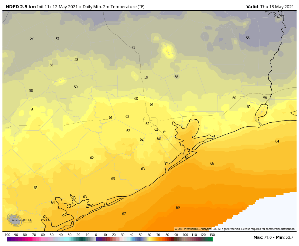
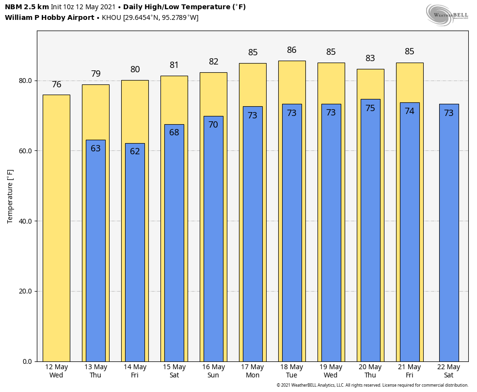
Thursday
The air is dry at the surface, but at an altitude about 1 mile above there’s still plenty of moisture. As a result, skies today should remain partly to mostly cloudy, and this should help to limit highs to around the upper 70s for most. Winds will continue out of the north, and perhaps gust as high as 20 mph. Lows tonight will again drop into the low to mid-60s for most of the region.
Friday
Another pleasant, late spring day for Houston. Look for partly sunny skies, with highs around 80 degrees, and moderate northeast winds to start. Lows Friday night will be a few degrees warmer.
Saturday
The first half of the weekend looks good-to-go for outdoor activities, with partly sunny skies and highs in the low 80s. With southeasterly winds we’ll start to feel the humidity rise, however. There will be some very slight rain chances during the afternoon hours, with somewhat better chances overnight.
Sunday
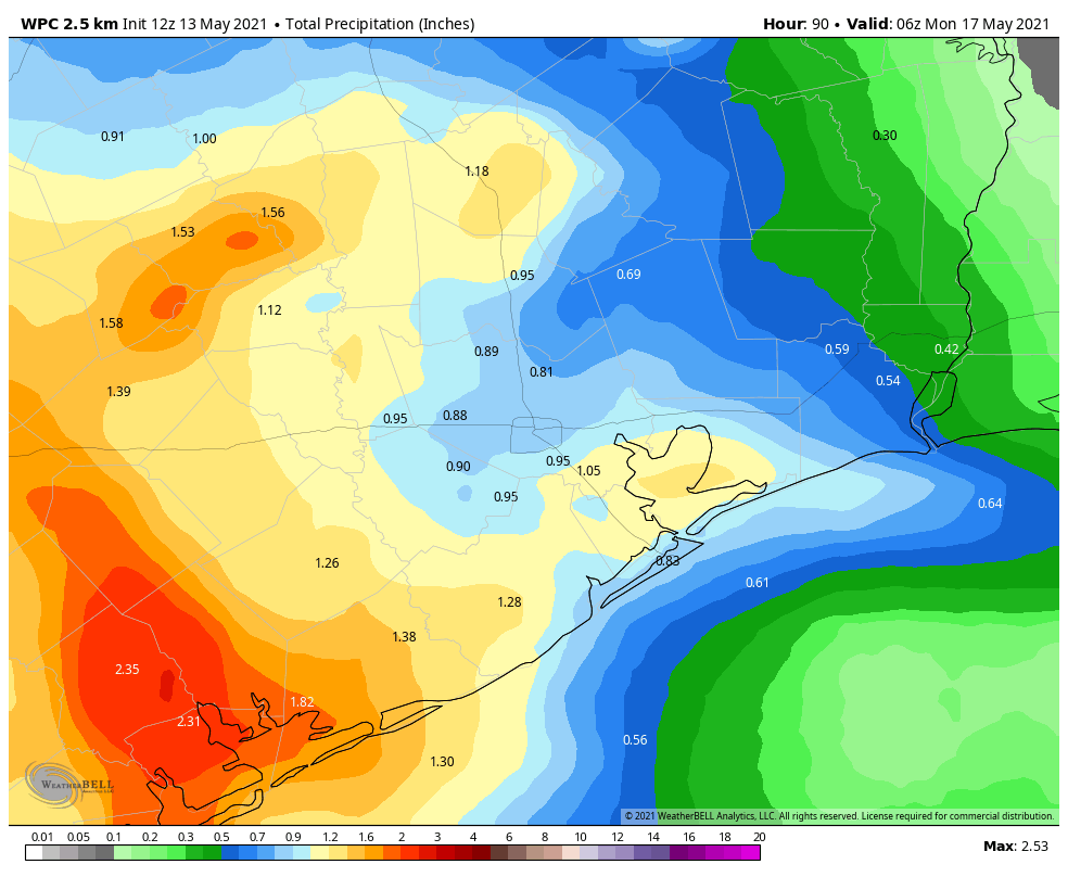
An upper-level low pressure system will begin to impact our region Sunday, and this will drive a healthy chance of showers during the daytime. Most of the region will see rain, but I’m not overly confident in the details. I’d guess that much of the area sees about 1 inch or so, with the better chances for more rain to the west of Houston. Highs will likely reach the low 80s with mostly cloudy skies.
Next week
The atmosphere should remain perturbed next week, and this will contribute to daily rain chances. Overall, I’m not expecting any sort of washout, but the region could pick up a few inches of rain next week, with mostly cloudy skies holding highs in the low 80s, and keeping nights in the low 70s. As always, details about individual, daily rain chances will come in due course.