May has started out fairly warm for Houston. The city recorded its first 90-degree day May 3, and although the region recorded a few cooler nights, most days have seen highs in the upper 80s. This is the time of year when cool fronts start to become really scarce, and the heat and humidity of summer in Houston begin to assert themselves. However, I’m happy to report that the region will experience at least one more decent front this spring.
Monday
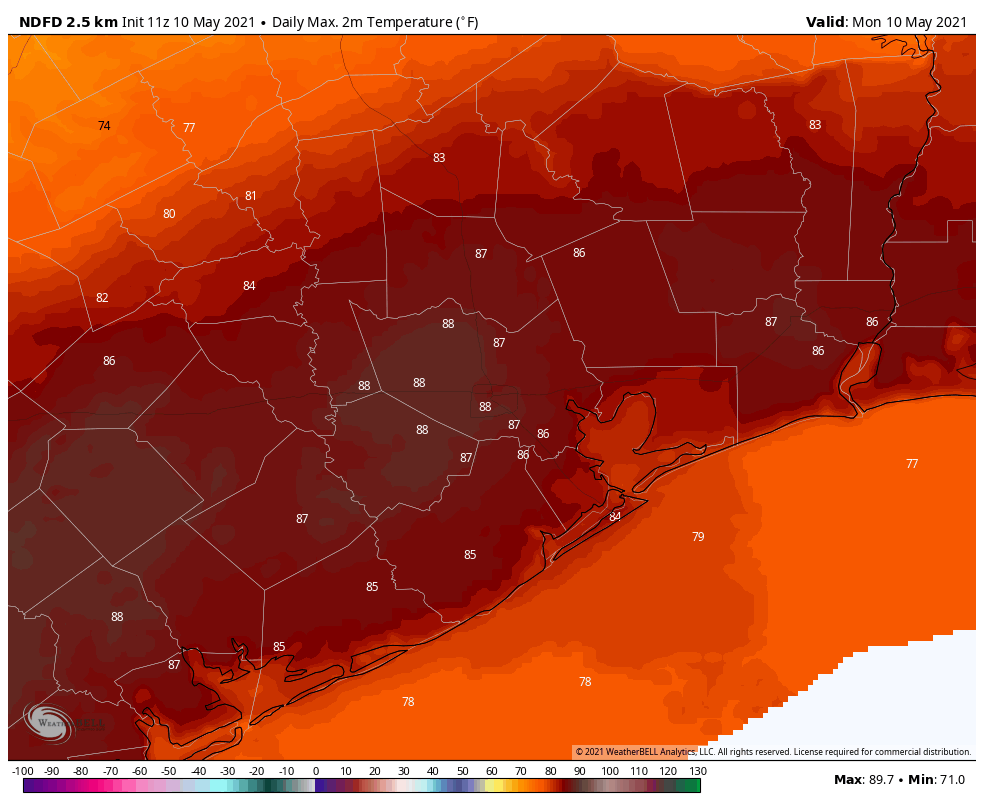
Skies are mostly cloudy this morning across much of the region as a cold front remains stalled out north of the Houston metro area. The front won’t move much today, so most of Houston will continue to see partly to mostly cloudy skies and warm temperatures in the upper 80s to low 90s. A few scattered showers and thunderstorms will be possible across the region, with slightly higher chances north of Interstate 10. But for the most part, a capping inversion should limit activity. Overnight temperatures will drop into the mid-70s for most.
Tuesday
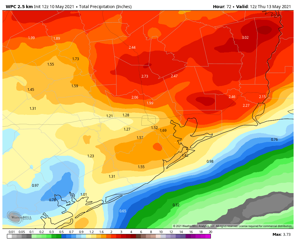
The front may slide a little closer to the Houston area on Tuesday, and this will trigger somewhat better rain chances. Most parts of Houston probably will see at least a sprinkle on Tuesday, with some areas getting perhaps a couple of tenths of an inch of rain. There is a slight chance for some heavier rainfall for areas north of Houston, such as College Station or Huntsville. Skies will otherwise be cloudy, with highs in the mid-80s. Overnight lows will depend upon the progression of the front, which will begin pushing toward the coast on Tuesday night.
Wednesday
The region will see widespread showers and some thunderstorms on Tuesday night and Wednesday as the front slogs its way through the region. I don’t feel overly confident in the rain accumulation forecast, but it seems likely that much of Houston and surrounding areas will see 1 to 2 inches of rainfall, with showers likely ending on Wednesday afternoon. Highs on Wednesday will be around 80 degrees, and lows Wednesday night should drop into the lower 60s.
Thursday and Friday
The end of the week looks glorious, with drier air likely filtering in behind the front. Look for high temperatures in the upper 70s to around 80 degrees, sunny skies, and overnight lows in the 60s. This is very fine weather for mid-May.
Saturday and Sunday
The weekend forecast is not yet locked in. I think we’ll continue to see partly to mostly sunny skies in the wake of the front, with highs in the low 80s on Saturday, and mid-80s on Sunday. Dewpoints will rise as the onshore flow resumes. We can’t entirely rule out rain showers, but overall chances look fairly low at this point.
Very satisfying to hear that Thursday and Friday will be one more glorious period to enjoy. The summer slog will soon be upon us so I’ll gladly take the respite.