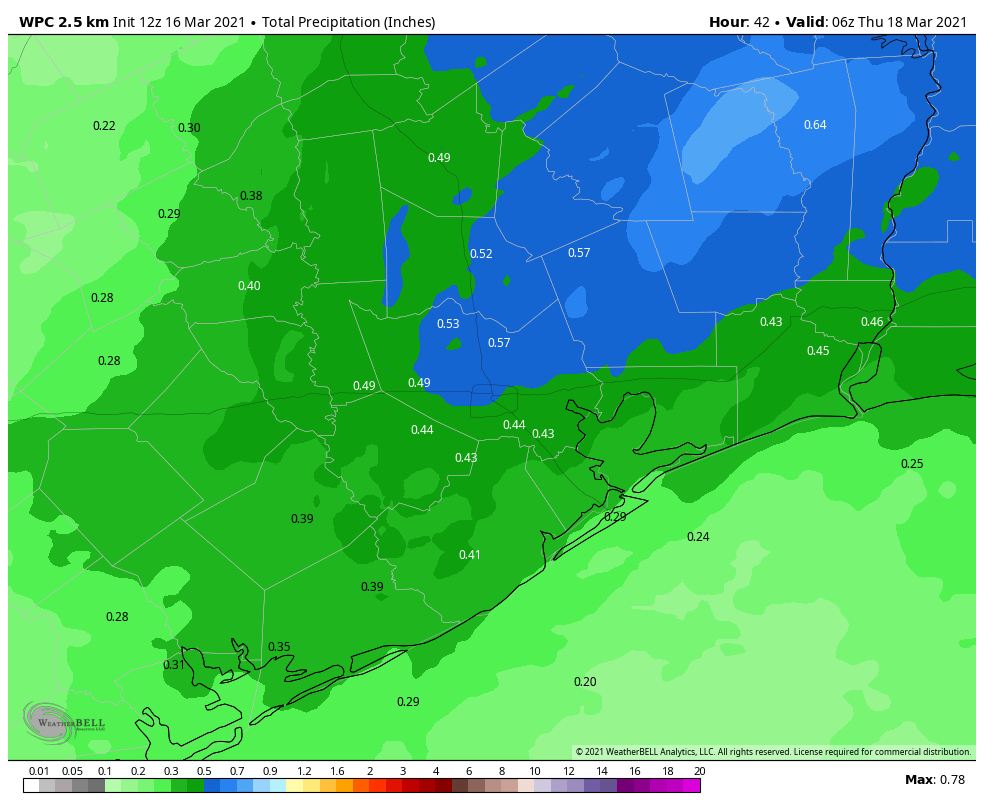
Just a quick Saturday update to say the latest forecast modeling suggests rainfall later today could be a bit stronger than anticipated. At this point we think much of the region may see 1 to 2 inches of rainfall, with the possibility of 3 inches for areas south and east of Harris County. Some minor street flooding may briefly occur.
Updated rainfall outlook for Saturday. (Weather Bell)
In terms of timing, we expect rainfall chances to increase as the morning progresses, with a band of storms forming west of Houston shortly before noon and moving eastward. This band of storms should be near or off the coast by around 4pm this afternoon. A cold front will sweep through behind this band, rapidly bringing an end to the storm activity. We still anticipate mostly sunny conditions on Sunday, with highs in the mid-60s.
Looking further ahead, Christmas Day still looks quite cold. We will of course have a comprehensive update for you on Monday morning.
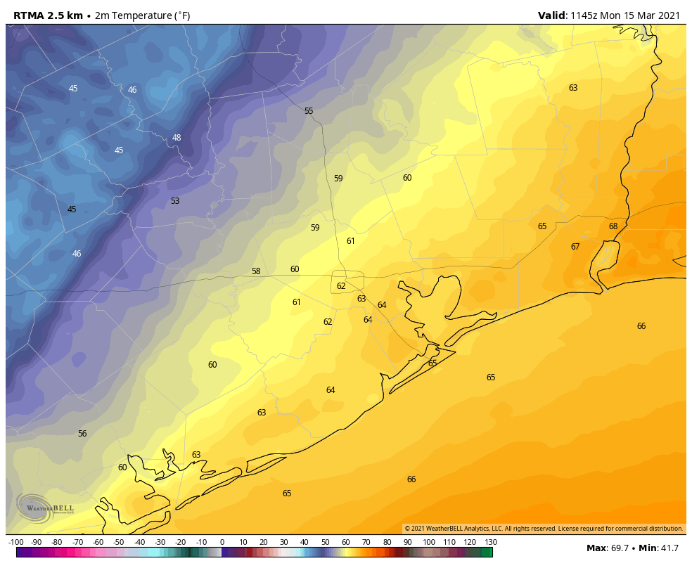
Good morning—and is definitely a cold one, especially for those of you in areas like Conroe and Cleveland who are experiencing temperatures in the 20s. We’ll now see a warming trend through Saturday, before another front arrives to keep our weather on the cool and sunny side. Our forecast for Christmas Day continues to call for a cold start and a cool day, although there remains a fair bit of wiggle room in the details.
Conditions are freezing for much of Houston this morning. (Weather Bell)
Thursday
Sunny skies and light winds will allow temperatures to rise this morning, and highs should get into the mid- to upper-50s by this afternoon. Our skies will remain clear heading into this evening, although a light wind shift from the east should make for a slightly more moderate night. Expect lows in Houston to drop to around 40 degrees, with warmer conditions along the coast, and cooler weather inland.
Friday
As winds become more southeasterly on Friday, we’ll start to see the development of a few clouds in the morning. As highs reach into the mid-60s or so during the afternoon hours, we should start to see partly to mostly cloudy skies. We may see some light rain chances during the evening hours, but the better opportunities for rain will come after midnight.
Saturday
An approaching cold front will help generate widespread light to moderate showers, and possibly a few thunderstorms, on Saturday. For now, I expect accumulations will be 0.25 to 0.75 inch for most areas, and rains should end by the afternoon or early evening hours as a front pushes through the metro area. Highs Saturday night should reach about 70 degrees ahead of the front, dropping fairly quickly after the front’s passage. Overnight lows on Saturday night should generally drop into the 40s.
NOAA rain accumulation forecast for now through Sunday morning. (Pivotal Weather)
Sunday
If you have outdoor plans for the weekend, Sunday should be the pick of the litter, with clearing skies and highs in the mid-60s. Winds will generally be light, but could remain at about 15 mph just along the coast as cool, dry air moves into the region. Lows Sunday night will again drop into the 40s.
The week of Christmas
We’ll see a warming trend beginning on Tuesday as the onshore flow becomes more pronounced, and temperatures probably will reach 70 degrees by Wednesday. Some light rain showers will be possible mid-week with the increased moisture. All eyes will then turn toward our next cold front, which will set the stage for conditions on Christmas Eve and Day.
Right now there seems to be general agreement in the models that this front will push into Houston late on Wednesday evening, or early Thursday morning—but with nearly seven days until that time frame I’m hesitant to lend too much credence to precise timing. However, under this scenario Christmas Eve may see clearing skies, and Christmas morning would be quite cold. I think temperatures could be in the 30s for much of the area. Alas, the atmosphere would be dry, so don’t expect a White Christmas in Houston this year.
Good morning. Skies are clearing across the metro area, and the region will now see a few days of sunshine before the arrival of yet another front brings the chance of showers and thunderstorms this weekend. But mostly, we’re just going to see cool, December-like weather in the days ahead.
It is a chilly start across the Houston area this morning. (Weather Bell)
Wednesday
Winds are blowing out of the northwest this morning at 10 to 15 mph across the area, and this influx of colder and drier air will make for a cool day. High temperatures are unlikely to rise further than the mid-50s, despite the ample sunshine. Mostly clear skies and light winds will make for a cold night, with a light freeze possible north and west of Houston, with the urban center likely remaining several degrees above freezing.
Thursday
We can expect another splendidly sunny day, with temperatures a few degrees warmer as highs climb to around 60 degrees for much of the area. Winds will shift to come from the south later in the day on Thursday, and this will make for a warmer night, with lows likely only falling into the 40s for most areas.
Friday
We’ll start to see some clouds on Friday, and high temperatures should push into the mid- to upper 60s in response to the onshore flow. At this point I think skies will remain mostly sunny throughout the day, with any rain holding off until the evening or more likely overnight hours. Lows on Friday night may not drop below 60 degrees for some areas.
Saturday
The best chances for rain will come between midnight on Friday and Saturday before noon. Most areas will probably see only a few tenths of an inch of rain before a front arrives during the afternoon hours to dry the atmosphere out. We may end up seeing at least partly sunny skies on Saturday, in addition to the rain. Highs will probably reach 70 degrees ahead of the front before a chilly night.
Sunday
Expect mostly sunny skies, with highs perhaps in the low 60s. Sunday night may see temperatures drop into the low 40s for much of the area except for the coast.
For now, the European model forecasts a cold Christmas morning. (Weather Bell)
Next week, and Christmas Day
The region should warm up back to near 70 degrees by Tuesday or Wednesday of next week, and then it becomes a waiting game to determine the timing and strength of the next front that will determine our weather for Christmas Day. Right now, I think this front may arrive any time between next Wednesday, Wednesday night, or Christmas Eve. At this point, the bulk of the model guidance shows the coldest morning coming on Christmas morning, with the potential for lows in the low 40s, or even upper 30s, but it’s difficult to have much confidence at this point in precise temperatures. Some rainfall may well accompany this front, but it likely will end before temperatures get cold enough to produce any chance of wintry precipitation—sorry kids.
On a recent Sunday evening my family and I visited Galaxy Lights, presented by Reliant, at Space Center Houston. It was a near perfect night, with cool, crisp air to help make for a festive time outside, and the evening combined rockets and the holidays—two things I love. (Note: Reliant is also the sponsor of Space City Weather.)
This is the second year of Galaxy Lights, and the exhibition has been reimagined from last year’s experience to allow for social distancing. Now, the majority of Galaxy Lights involves an outside walking trail. Overall, it felt like a superior, more fulfilling experience, and given that we’re living in a pandemic, walking outside with everyone wearing masks felt perfectly safe.
For me, the highlight of Galaxy Lights was the “Lights Around the World” display that marks the 20th anniversary of the International Space Station being continually inhabited, as well as a flown SpaceX Falcon 9 rocket. As part of the display you can walk around and under the rocket with its engine section, massive landing legs, and the grid fins used to steer its return through the atmosphere. I also really liked walking through the 200-foot-long tunnel of LED lights – a favorite for the Instagram enthusiasts. There are many other experiences too, including kinetic light displays, 3-D lighted décor and interactive activities for kids and shows about science and space. Check them out here.
We arrived at about 6:30 p.m. on Sunday evening and there was a fairly long (socially distanced) line to get into the display. However, the show runs from 6 to 10 p.m. each evening, and by the time we left at 8 p.m. there was no line. So if you want a less crowded experience, it probably is better to go later. It takes about 90 minutes to enjoy the full experience and it is recommended that tickets to the exhibition be purchased online, to schedule the day and time you’ll attend. Also, because so much of the show is outdoors, you should definitely check the forecast before making plans.
Thanks to our friends at Reliant for partnering with Space Center Houston on this fun experience and keeping holiday traditions alive in a safe way!