Good morning. The Houston region saw its first real taste of rainfall in two weeks early on Monday as a line of storms pushed from north to south through the area. It was hit or miss in the metro area, with some parts of the region picking up as much as 1.5 inches, and others seeing lightning, but no real rainfall. The storms heralded the arrival of a front that will eventually bring some drier air into the region—which we’ll feel this in the morning and evening.
Monday
Some rain chances will linger into this morning, but as drier air moves in we should see gradually diminished precipitation throughout the day. By this afternoon skies should be partly to mostly sunny, and we can expect highs to reach the upper 90s. Winds will be light, but out of the north at 5 to 10 mph. Low temperatures will be a degree or two cooler tonight, but the real effect will be in the “feels like” department, not the actual mercury. This effect will be more pronounced north of I-10 than along the coast.
Tuesday
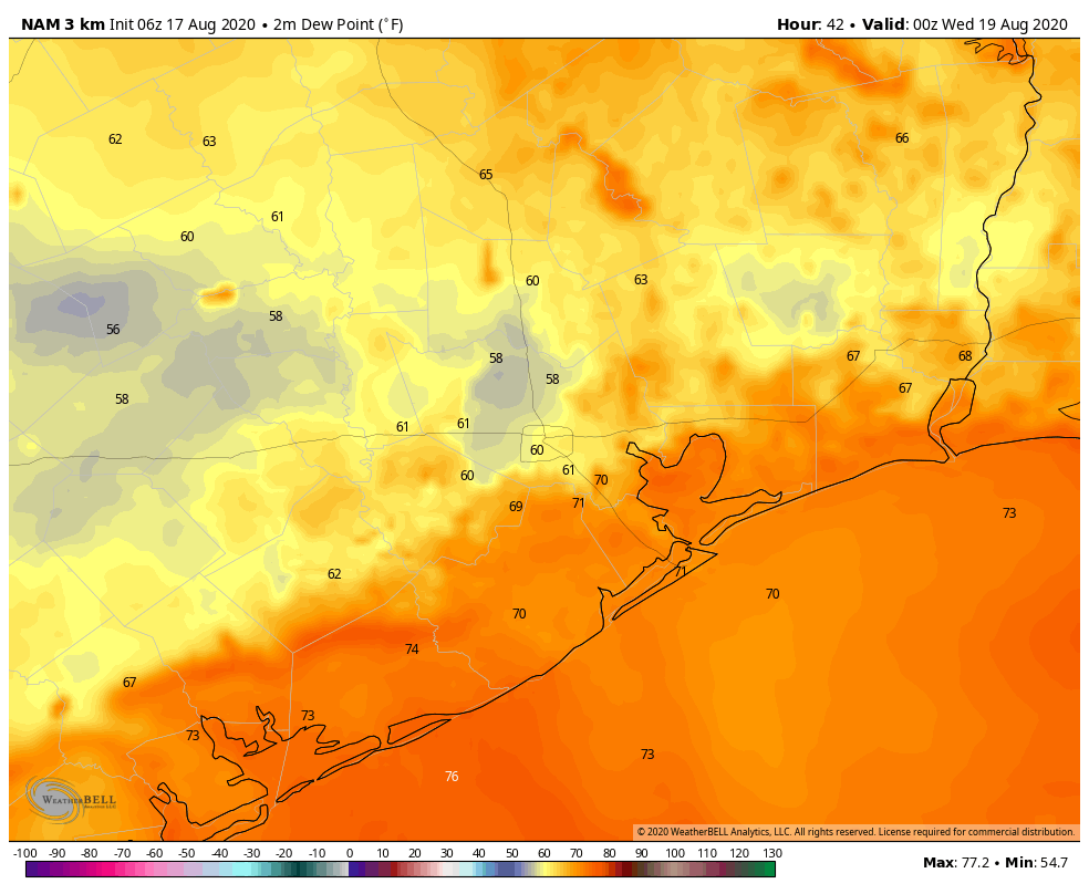
As more dry air filters into the region we’ll see a hot and sunny day. Temperatures will push into the upper 90s, and probably touch 100 degrees for inland areas. If you’re thinking, this sure doesn’t feel like a front, well, you’re right. But this is how cool fronts in August go. There won’t be much impact to temperatures, but evenings and mornings should feel somewhat drier. Instead of dew points of around 70 degrees, which is very sticky and muggy, dew points around sunrise and around sunset may be be about 10 degrees lower away from the immediate coast. A dew point of 60 degrees is definitely not fall-like, but it’s also definitely not “dog’s breath” weather like we normally get in the summer, either. Small victories, people.


