Houston will see the threat of severe weather this afternoon and early evening as a storm system moves through the region, ahead of a cool front. After this we expect several days of dry, sunny weather to dominate the region. It will be warm, but not too warm for late spring, with some reasonably cool nights this weekend.
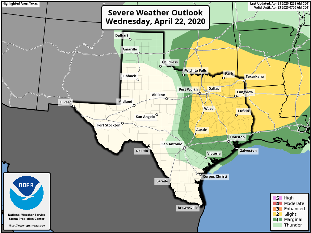
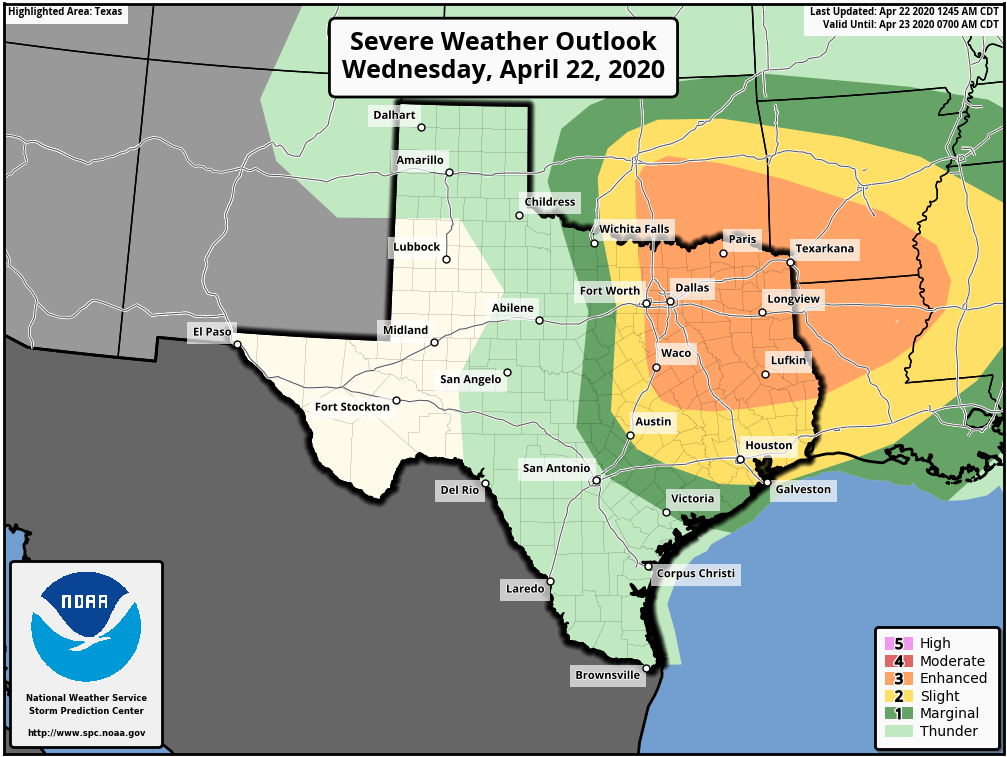
Wednesday
Temperatures this morning are in the mid-70s, with cloudy skies. Unlike Monday and Tuesday, however, we won’t experience much if any clearing skies later today. Instead, the region will see an increasing chance of storms. The bigger threat lies north of the metro area, over areas such as Lufkin and Waco, but almost the entire Houston region faces a “slight” chance of hail and damaging winds. The rain chances with this storm system are pretty meager for Houston, especially areas south of Interstate 10, as the capping inversion may prove unbreakable. That’s unfortunate, because there are a lot of dry areas such as Brazoria County that could use some precipitation and probably won’t get much, if any with this system.
Thursday
A secondary, thin and broken line of showers may pass through the area early Thursday before sunrise along with the cool front itself. In its wake, we should see clearing skies and highs in the mid-80s on Thursday. Lows will drop into the mid-60s.