Good morning. As I walked outside last night it seemed like I could feel the last dry parcel of air leaving the region. I’m not sure whether Houston has experienced its last front of the spring of 2020, but we’re now in a pattern where humidity will rule the day, as it does in summer in Houston. We’ll have a couple of warm, partly sunny days before clouds and then rain chances return for Memorial Day Weekend. If you’re heading to the beach, Saturday may be your best bet.
Wednesday
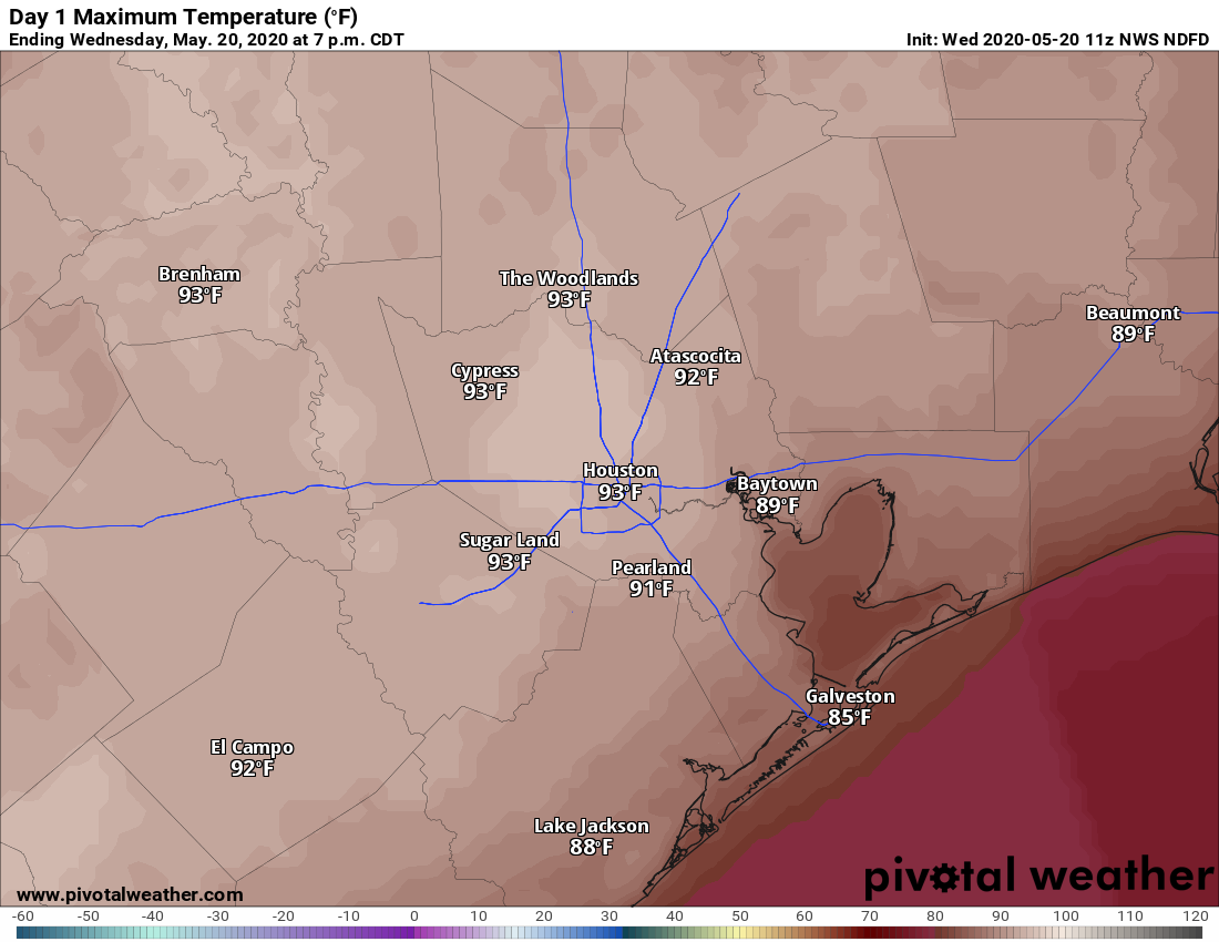
Some clouds have developed this morning across the region as moisture pools beneath a capping inversion, but skies should still clear out by around noon or shortly thereafter. This, combined with light southerly winds, should allow temperatures to reach up into the low- to mid-90s. Cloud cover will increase again overnight, preventing lows from dropping below the mid-70s for most of the Houston region.
Thursday
As high pressure moves away from the region, our weather will begin to slowly change on Thursday. This will likely mean partly sunny instead of mostly sunny skies, and high temperatures should back off slightly to perhaps around 90 degrees. We can’t entirely preclude the possibility of light showers to the northwest of Houston, but it seems unlikely to me. Clouds build again Thursday evening, making for another warm and humid night.