The good news is that if you enjoyed Monday’s weather we have plenty more days like that this week—warm, but not too warm, with lots of sunshine. Wednesday will be the only real exception to that. Our weekend weather also looks pretty fine if you’re looking for sunshine and drier air.
Tuesday
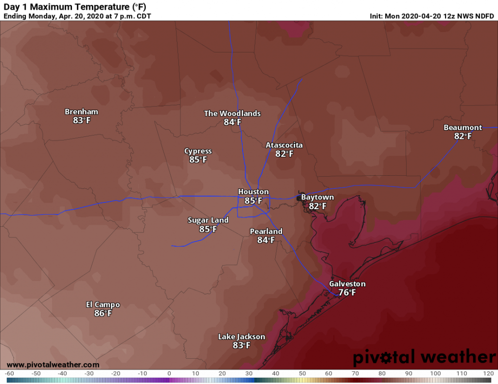
Any patchy fog this morning should burn off quickly, and like on Monday we should see a transition to partly to mostly sunny skies this afternoon. However, with winds turning to come from the southeast later today we expect clouds to return pretty quickly this evening to make for mostly cloudy skies. Highs today should reach the low 80s for most people, with low temperatures Tuesday night falling to around 70 in the city—lower inland, and warmer along the coast.
Wednesday
This is the one day this week the potential for some dynamic weather. An upper-level storm system will drop down toward Texas on Wednesday, but the effects look to be most pronounced for north and east Texas, with the Houston metro area on the southern periphery of the action. Models suggest that a mass of showers and thunderstorms will move through Houston during the afternoon or early evening hours on Wednesday, with the better organization north of Interstate 10. Areas such as Montgomery County and points north may see 0.5 to 1.5 inches of rain, while much of the rest of the region sees a few tenths of an inch or less. Highs Wednesday will be around 80 degrees with mostly cloudy skies.