On this Christmas Eve morning, I want to take a moment to thank all the people who work in retail, at restaurants, deliver packages and perform other services during the long holiday hours. This is hard work, especially at this very hectic time. Thank you.
Monday
Our clear skies—that Moon has been something else the last few nights—will now give way to partly to mostly cloudy skies for most of this week. The culprit is the weak cold front that eased through Houston early on Sunday. After moving offshore it stalled, and it is now moving back onshore as “warm” front. This will help set the stage for warmer, and more humid weather until later Thursday.
We should still see some sunshine today, and highs probably will get up into the mid- to upper-60s with easterly winds. But by this afternoon or evening, skies should turn mostly cloudy, and I only expect areas well away from the coast to fall below 60 degrees.
Christmas Day
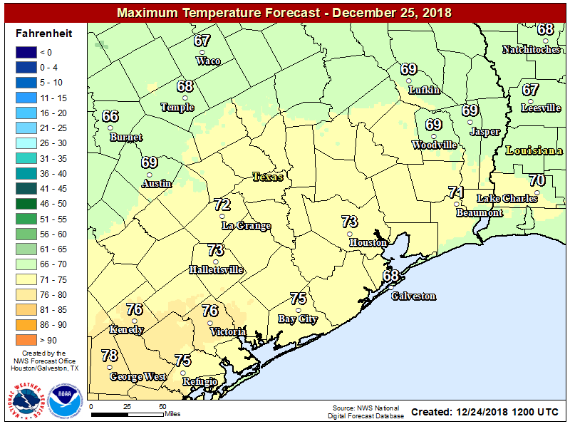
The holiday will dawn warm and gray, with some fog possible as warm air moves over the ground. The day may be fairly dreary, with light, spotty showers possible and 99 to 100 percent cloud cover. Highs probably will get into the low 70s, despite the clouds, which is really quite warm for a December day without direct sunshine. Is there any good news? The only real good news is that stormy weather will hold off until at least Wednesday.