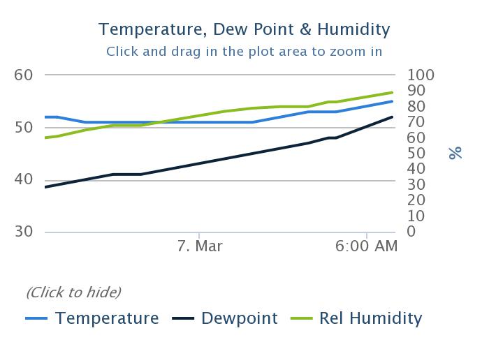
Instead of our normal diurnal pattern, temperatures have risen across the area since midnight for Houston, generally from the lower 50s to the upper 50s. This is indicative of the much warmer airmass that has begun moving into the area, and which may lead to some potentially unsettled weather over the next few days, especially on Saturday. Unfortunately, the weekend weather doesn’t look exactly ace, although Sunday has some potential.
Thursday
Today will be a gray affair, with intermittent drizzle, especially closer to the coast. Some light rain showers will be possible, but for the most part any rain today will be misty. Dewpoints will continue to rise today, leading to much higher humidity, as temperatures rise up to around 70 degrees today. Low temperatures tonight will not fall much, probably only into the mid-60s.
Rodeo weather
 Temperatures will be in the upper 60s at the Houston Livestock Show and Rodeo this evening, with cloudy skies, and light winds. There’s about a 40 percent chance of a light, misty rain, which likely will end before the show ends. Temperatures after the concert will be about the same, as will the 100 percent cloud cover.
Friday
Friday should be similar to Thursday, although 5-7 degrees warmer, and with a healthy chance of morning fog as warmer air moves over cooler waters. Highs will be in the upper 70s, with more light rain showers. Again, accumulations should, at most, be measured in a tenth or two of an inch of rainfall.