Rising moisture levels have combined with rising air to form some moderate-to-strong showers and thunderstorms this afternoon, primarily to the north and west of Houston. The National Weather Service has issued a flood advisory for some of these areas where up to 5 inches of rain have fallen. The advisory (shown below) is in effect through this evening for Houston.
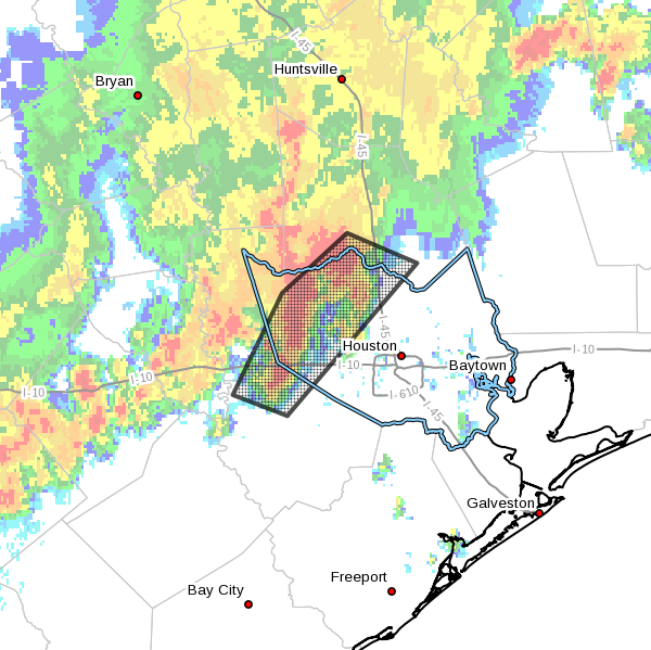
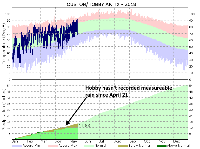
These storms are associated with an outflow boundary, and this complex should slowly move to the southeast this evening. As it does so, rain showers should move into the central and perhaps southern Houston areas, but the storms should also weaken as this happens because atmospheric conditions are less favorable closer to the coast. This is somewhat unfortunate, because the southern half of Houston has not seen significant rainfall in a month. Overall, I would expect showers to die out late this evening, or by around midnight.
Some street flooding is already occurring in areas of the flood advisory, but because the region has been so dry for so long, bayous and creeks should remain within their banks.