Long-time readers of this site will know that we don’t place a whole lot of confidence in seasonal forecasting. Trying to predict weather (note that’s “weather” not “climate”) conditions months in advance is not exactly an exact science. Case-in-point: Much of the Houston area has not gotten a drop of rain in the month of May, and the next week or so looks dry. And yet here’s NOAA’s monthly outlook for precipitation for the month of May, issued on April 30th:
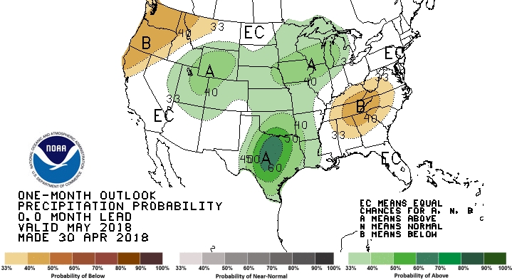
This forecast, quite clearly, will likely bust. And it was issued the day before the month of May began. So while I do think there is some value in seasonal forecasting, you should not take it to the bank.